Hwasong concentration camp
| Hwasong concentration camp | |
| Chosŏn'gŭl | 화성 제16호 관리소 |
|---|---|
| Hancha | 化城第十六號管理所 |
| Revised Romanization | Hwaseong Je16ho Gwalliso |
| McCune–Reischauer | Hwasŏng Che16ho Kwalliso |
| Chosŏn'gŭl | 화성 정치범수용소 |
| Hancha | 化城政治犯收容所 |
| Revised Romanization | Hwaseong Jeongchibeom Suyongso |
| McCune–Reischauer | Hwasŏng Chŏngch'ibŏm Suyongso |
| Part of a series on |
| Human rights in North Korea |
|---|
 |
|
International reactions |
Hwasong concentration camp (Chosŏn'gŭl: 화성 제16호 관리소, also spelled Hwasŏng or Hwaseong) is a labor camp in North Korea for political prisoners. The official name is Kwan-li-so (Penal-labor colony) No. 16.
Location
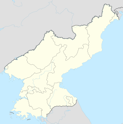
The camp is located in Hwasong County (Myonggan County), North Hamgyong Province in North Korea. It is situated along the upper reaches of the Hwasong River in a secluded mountain valley. The western border is Mantapsan, a 2,205-metre-high (7,234 ft) mountain. On the north and east sides, the camp reaches the Orangchon River valley. The entrance gate is right on the Hwasong River and on the road from Hwasong, 8 km (5.0 mi) west of Hwasong-up (Myonggan-up).[1] The camp is not included in maps,[2] but the entrance gate and the ring fence with watchtowers can be recognized on satellite images.[3]
Description
Hwasong camp is a penal-labor colony in which detainees are imprisoned for life with no chance to be released.[4] With around 549 km2 (212 sq mi) in area[5] it is the largest prison camp in North Korea. Puhwa-ri (Chosŏn'gŭl: 부화리), 4 km (2.5 mi) north of the entrance gate, is the camp headquarters.[6] The number of prisoners is estimated at 20,000.[7] They are classified as "anti-revolutionary and anti-party elements" and held on charges such as opposing the succession of Kim Jong-il.[4] Many of the prisoners are merely family members of suspected wrong-doers, who are held captive in a “guilt-by-association” punishment.[8] It is believed that the camp was founded in the 1990s.[9]
Working conditions
Prisoners are exploited for hard, dangerous, and deadly labor in mining, logging and agriculture.[8] According to Mr. Lee, a former security officer in Hwasong camp, the inmates were overworked and had very little time to rest. Prisoners had to work all day until they fulfilled their quotas and attend self-criticism meetings afterwards. Often they were allowed to sleep only four hours in the night. Mr. Lee witnessed many fatal accidents in the workplace.[10]
The North Korean nuclear tests made in 2006, 2009, 2013 and 2016 at Punggye-ri Nuclear Test Site is just 2 km (1.2 mi) to the west of the camp border. Several defectors reported that political prisoners were forced to dig tunnels and build underground facilities in areas exposed to nuclear radiation.[11]
Human rights situation
Information is extremely limited, as the camp has always been a maximum security camp under strict control and surveillance.[9] An unidentified teenager reported how he was sent to the camp with his entire family at age 13. He witnessed his father being beaten cruelly and his mother and sisters being raped by security officers.[12][13] Residents from nearby villages heard about the horrific conditions inside the camp, but were never allowed to get near the camp.[12]
Security officer Lee explained the methods to execute prisoners in an interview with Amnesty International. He witnessed prisoners forced to dig their own graves and being killed with hammer blows to their necks. He also witnessed prison officers strangling detainees and then beating them to death with wooden sticks. According to him several women were raped by the officials and executed secretly thereafter.[8]
Camp expansion
Analysis of satellite images by Amnesty International in October 2013 shows that the prisoner population of Hwasong camp has slightly increased compared to 2008.[14] In several prisoner villages new housing structures and new administrative buildings can be identified.[15] Some of the new prisoners may have been relocated from Hoeryong concentration camp to Hwasong.[16]
Former prisoners/guards (witnesses)
- Besides the unidentified teenager, no former prisoner was found to provide a direct testimony, probably for fear of retribution.[12]
- Mr. Lee (full name withheld for his safety; 1980s - mid-1990s in Hwasong) was a security officer in the camp.[8]
See also
- Human rights in North Korea
- Prisons in North Korea
- Yodok concentration camp
- Kaechon internment camp
- Mantapsan
References
- ↑ "Army barracs and prison camp entrance". Wikimapia. Retrieved February 7, 2013.
- ↑ "북한지리: 화성군(化成郡) HWASONGGUN". Joongang Ilbo, 1997. Retrieved February 7, 2013.
- ↑ "Nordkoreas Geheimnisse: Google Earth sieht alles (Satellite image of prison camp 16)". Der Spiegel (in German). May 25, 2009. Retrieved February 7, 2013.
- 1 2 "The Hidden Gulag – Exposing Crimes against Humanity in North Korea's Vast Prison System (pp. 78-79)" (PDF). The Committee for Human Rights in North Korea. Retrieved February 7, 2013.
- ↑ Harden, Blaine (July 20, 2009). "North Korea's Hard Labor Camps with interactive map". Washington Post, July 20, 2009. Retrieved February 7, 2013.
- ↑ "Hwasong concentration camp headquarters". Wikimapia. Retrieved February 8, 2013.
- ↑ "North Korea: Political Prison Camps" (PDF). Amnesty International. May 4, 2011. Archived from the original (PDF) on March 9, 2012. Retrieved November 24, 2011.
- 1 2 3 4 "New satellite images show scale of North Korea's repressive prison camps". Amnesty International. December 5, 2013. Retrieved December 10, 2013.
- 1 2 "Political Prison Camps in North Korea Today" (PDF), Database Center for North Korean Human Rights, July 15, 2011, retrieved February 7, 2013
|chapter=ignored (help) - ↑ "North Korea: New satellite images show continued investment in the infrastructure of repression" (PDF), Amnesty International, December 5, 2013, archived from the original (PDF) on January 7, 2014, retrieved December 10, 2013
|chapter=ignored (help) - ↑ "The Terrible Secrets of N. Korea's Mount Mantap". Chosun Ilbo. June 3, 2009. Retrieved February 7, 2013.
- 1 2 3 "Political Prison Camps in North Korea Today" (PDF), Database Center for North Korean Human Rights, July 15, 2011, retrieved February 7, 2013
|chapter=ignored (help) - ↑ 지난 주 탈북 13세 소년이 남조선에 보내는 편지 전문. Korea Unity Press TV, 13.04.2004 (in Korean). April 13, 2004. Retrieved February 7, 2013.
- ↑ "North Korea: New satellite images show continued investment in the infrastructure of repression" (PDF), Amnesty International, December 5, 2013, archived from the original (PDF) on January 7, 2014, retrieved December 10, 2013
|chapter=ignored (help) - ↑ "North Korea: New satellite images show continued investment in the infrastructure of repression" (PDF), Amnesty International, December 5, 2013, archived from the original (PDF) on January 7, 2014, retrieved December 10, 2013
|chapter=ignored (help) - ↑ "From Prison Camp to Coal Hub". Radio Free Asia. November 6, 2012. Retrieved January 14, 2013.
External links
- "The Hidden Gulag" (PDF). Committee for Human Rights in North Korea. – Overview of North Korean prison camps with testimonies and satellite photographs.
- "Political Prison Camps in North Korea Today" (PDF). Database Center for North Korean Human Rights. – Comprehensive analysis of various aspects of life in political prison camps.
- "North Korea: New satellite images show continued investment in the infrastructure of repression" (PDF). Amnesty International. Archived from the original (PDF) on January 7, 2014. – Analysis of satellite images of Hwasong camp and Yodok camp.
- "North Korea: New satellite images show scale of forced labour in prison camps". Amnesty International UK. – Video with testimonies about Hwasong camp and Yodok camp.
- One Free Korea – Camp 16 and Mt. Mantap Nuclear Test Site (satellite images with explanations).
- The Daily NK: The Hub of North Korean News – News about North Korea and human rights.
Coordinates: 41°16′07″N 129°23′28″E / 41.268505°N 129.391211°E
| Political prison camps (Kwalliso) | ||
|---|---|---|
| Reeducation camps (Kyohwaso) | ||