Huslia River
| Huslia River | |
| Country | United States |
|---|---|
| State | Alaska |
| Census Area | Yukon–Koyukuk |
| Source | confluence of the river's north and south forks |
| - location | Koyukuk National Wildlife Refuge |
| - elevation | 162 ft (49 m) [1] |
| - coordinates | 65°56′42″N 156°40′38″W / 65.94500°N 156.67722°W [2] |
| Mouth | Koyukuk River [2] |
| - location | 5 miles (8 km) northwest of Huslia |
| - elevation | 151 ft (46 m) [2] |
| - coordinates | 65°44′18″N 156°32′21″W / 65.73833°N 156.53917°WCoordinates: 65°44′18″N 156°32′21″W / 65.73833°N 156.53917°W [2] |
| Length | 100 mi (161 km) [2] |
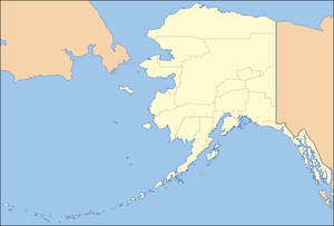 Location of the mouth of the Huslia River in Alaska
| |
The Huslia River is a 100-mile (160 km) tributary of the Koyukuk River in the U.S. state of Alaska.[2] The river begins at the confluence of its north and south forks and flows generally southeast across the Koyukuk National Wildlife Refuge to meet the larger river near the community of Huslia.[3]
See also
References
External links
- Koyukuk National Wildlife Refuge – U.S. Fish and Wildlife Service
This article is issued from Wikipedia - version of the 9/10/2016. The text is available under the Creative Commons Attribution/Share Alike but additional terms may apply for the media files.