Hurricane Humberto (1995)
| Category 2 hurricane (SSHWS/NWS) | |
.gif) Hurricane Humberto just after interaction with Iris on August 27, 1995 | |
| Formed | August 22, 1995 |
|---|---|
| Dissipated | September 1, 1995 |
| Highest winds |
1-minute sustained: 110 mph (175 km/h) |
| Lowest pressure | 968 mbar (hPa); 28.59 inHg |
| Fatalities | None reported |
| Damage | None |
| Areas affected | No land areas |
| Part of the 1995 Atlantic hurricane season | |
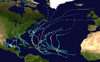
Hurricane Humberto was the eighth named storm and the fourth hurricane of the busy 1995 Atlantic hurricane season. It was the first time that the name "Humberto" had been used, replacing the name Hugo, which was retired in 1989. It was a Cape Verde-type hurricane that never approached land as it tracked across the central Atlantic Ocean.
The storm developed west of the Cape Verde islands on August 21. It was upgraded to a tropical storm on August 22 and to a hurricane on August 23. For the first few days, it followed the wave that became Iris until a Fuji wharf interaction took place about midway between Cape Verde and the Lesser Antilles on August 25. Humberto peaked as a strong Category 2 hurricane and remained a hurricane until just before being absorbed by an extratropical cyclone on September 1.
Meteorological history

The system originated out of one of several powerful tropical waves that moved off the west coast of Africa in the second half of August. When the wave came off the African coast, it already had a cyclonic rotation, although it was fairly disorganized. As the wave moved westward into open waters, it developed rapidly. Late on August 21, it had developed a low-level circulation and was declared Tropical Depression Nine.[1] The system quickly organized itself and was quickly upgraded to Tropical Storm Humberto early on August 22. Beginning on a west-northwest track, it was clear from the outset that Humberto would not affect land, due to a weakness in the subtropical ridge to the north which would eventually turn the storm northward.[2] An impressive outflow pattern and solid banding quickly formed in a very favorable environment with warm sea surface temperatures and low wind shear. Humberto quickly developed and intensified into a high-end tropical storm on the afternoon and evening of August 22.[3] Early on August 23, the storm was upgraded to Hurricane Humberto.[1]
Humberto continued to intensify on the morning of the 23rd as the central dense overcast became well defined, despite the lack of a well-defined eye feature.[4] However, the intensification was slowed somewhat by the presence of Iris to the west, whose outflow intercepted with Humberto's outflow somewhat.[5] Early on August 24, Humberto strengthened into a Category 2 hurricane, finally forming a well-defined eye, as it slowed down as it entered a Fujiwhara interaction with Iris.[6] That afternoon, while still moving west-northwest, Humberto reached its peak intensity of 110 mph (175 km/h), just under Category 3 intensity.[1]
The Fujiwhara interaction had a profound impact on the track of Humberto, which made a quick turn to the northwest, and then to the north-northwest, early on August 25.[1] The interaction came to an end that afternoon as Humberto completed the northerly turn, while remaining a Category 2 hurricane in the tropical waters of the central Atlantic.[7] It began to gradually weaken on August 26 due to an increase in southwesterly shear from a nearby upper-level low as it maintained a north-northwest track.[8] The slow weakening trend continued into August 27 as the eye became intermittent in the moderate-shear environment, which was once again impacted by the outflow of Iris to the southwest.[9] That evening, it dropped to a minimal hurricane with 75 mph (120 km/h) winds, which was later confirmed to have been the low point.[1] Operationally, Humberto was downgraded to a tropical storm for a while on August 28, which was later confirmed to have been underestimated.[10] As it tracked away from Iris and into a more open environment, it turned more to the north-northeast and slowly re-intensified again on August 29.[1] Its movement was now affected by an incoming mid-latitude trough that turned Humberto northeast early on August 30.[11] Humberto reached its second intensity peak of 90 mph (145 km/h) at that time.[1]
However, cooler waters eventually caught up to Humberto and it began to weaken once again early on August 31 as it tracked into the north Atlantic.[12] That afternoon, Humberto weakened to a tropical storm as its circulation became embedded into a circulation of a nearby extratropical low in a high-shear environment.[13] It continued to weaken that evening, and early on September 1, the tropical storm was absorbed by the larger system.[1]
Impact, naming, and records
Humberto remained in the open Atlantic, and no damage or fatalities were reported. Several ships came in contact with Humberto while it roamed the open waters. The strongest winds came from call sign DVRUK4, which reported peak winds of 70 mph (112 km/h) in the central Atlantic on August 30. Three other ships reported tropical storm-force winds.[1]

Humberto was the second of four tropical waves in quick succession in the tropical Atlantic that all eventually became tropical storms or hurricanes; it was preceded by the wave that became Iris, and followed by the waves that became Karen and Luis. It was also the first of three tropical cyclones to form within a 24-hour period on August 21 and 22; Iris formed 12 hours later and Jerry formed 18 hours later. It was also the first of five named storms to form within a seven-day period; Karen formed on August 26 and Luis on August 27.[14]
See also
References
- 1 2 3 4 5 6 7 8 9 National Hurricane Center (1995). "Preliminary Report: Hurricane Humberto" (PDF). NOAA. Retrieved 2016-11-29.
- ↑ National Hurricane Center (1995). "Tropical Depression Nine Discussion #1". NOAA. Retrieved 2006-12-17.
- ↑ National Hurricane Center (1995). "Tropical Storm Humberto Discussion #3". NOAA. Retrieved 2006-12-17.
- ↑ National Hurricane Center (1995). "Hurricane Humberto Discussion #6". NOAA. Retrieved 2006-12-17.
- ↑ National Hurricane Center (1995). "Hurricane Humberto Discussion #7". NOAA. Retrieved 2006-12-17.
- ↑ National Hurricane Center (1995). "Hurricane Humberto Discussion #10". NOAA. Retrieved 2006-12-17.
- ↑ National Hurricane Center (1995). "Hurricane Humberto Discussion #14". NOAA. Retrieved 2006-12-17.
- ↑ National Hurricane Center (1995). "Hurricane Humberto Discussion #15". NOAA. Retrieved 2006-12-17.
- ↑ National Hurricane Center (1995). "Hurricane Humberto Discussion #23". NOAA. Retrieved 2006-12-17.
- ↑ National Hurricane Center (1995). "Hurricane Humberto Discussion #25". NOAA. Retrieved 2006-12-17.
- ↑ National Hurricane Center (1995). "Hurricane Humberto Discussion #33". NOAA. Retrieved 2006-12-17.
- ↑ National Hurricane Center (1995). "Hurricane Humberto Discussion #37". NOAA. Retrieved 2006-12-17.
- ↑ National Hurricane Center (1995). "Hurricane Humberto Discussion #39". NOAA. Retrieved 2006-12-17.
- ↑ Atlantic Oceanography and Meteorological Laboratory (2006). "Re-Analysis Project". NOAA. Retrieved 2006-12-17.
External links
| Wikimedia Commons has media related to Hurricane Humberto (1995). |
- NHC's Preliminary Report on Hurricane Humberto
Tropical cyclones of the 1995 Atlantic hurricane season | ||
|---|---|---|
 | ||
| ||