Huntingdon, Tennessee
| Huntingdon, Tennessee | |
|---|---|
| Town | |
|
Huntingdon Court Square as seen from Main Street | |
| Motto: "Honoring Our Heritage – Shaping Our Future" | |
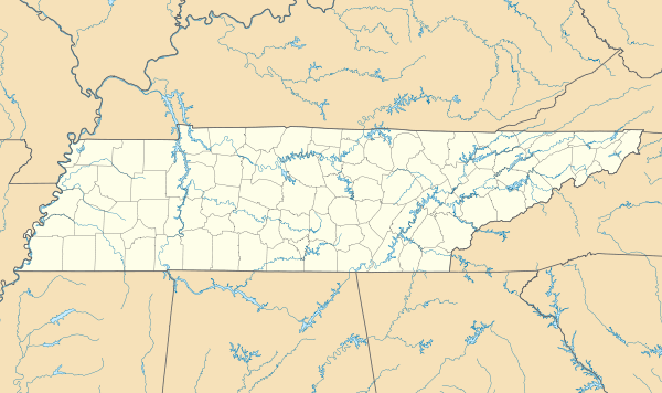 Huntingdon, Tennessee Location of Huntingdon, Tennessee | |
| Coordinates: 36°0′26″N 88°25′14″W / 36.00722°N 88.42056°WCoordinates: 36°0′26″N 88°25′14″W / 36.00722°N 88.42056°W | |
| Country | United States |
| State | Tennessee |
| County | Carroll |
| Area | |
| • Total | 11.9 sq mi (30.9 km2) |
| • Land | 11.9 sq mi (30.8 km2) |
| • Water | 0.04 sq mi (0.1 km2) |
| Elevation | 410 ft (120 m) |
| Population (2010) | |
| • Total | 3,985 |
| • Density | 335/sq mi (129.4/km2) |
| Time zone | Central (CST) (UTC-6) |
| • Summer (DST) | CDT (UTC-5) |
| ZIP code | 38344 |
| Area code(s) | 731 |
| FIPS code | 47-36580[1] |
| GNIS feature ID | 1288761[2] |
| Website |
www |

Huntingdon is a town in Carroll County, Tennessee, United States. The population was 4,349 at the 2000 census and 3,985 in 2010.[3] It is the county seat of Carroll County.[4]
History
Huntingdon was named for Memucan Hunt, the original owner of the town site.[5]
Geography
Huntingdon is located slightly east of the center of Carroll County at 36°0′26″N 88°25′14″W / 36.00722°N 88.42056°W (36.007154, -88.420683).[6]
According to the United States Census Bureau, the town has a total area of 11.9 square miles (30.9 km2), of which 11.9 square miles (30.8 km2) is land and 0.04 square miles (0.1 km2), or 0.42%, is water.[3]
Demographics
| Historical population | |||
|---|---|---|---|
| Census | Pop. | %± | |
| 1850 | 245 | — | |
| 1870 | 609 | — | |
| 1880 | 646 | 6.1% | |
| 1890 | 707 | 9.4% | |
| 1900 | 1,332 | 88.4% | |
| 1910 | 1,112 | −16.5% | |
| 1920 | 1,121 | 0.8% | |
| 1930 | 1,286 | 14.7% | |
| 1940 | 1,432 | 11.4% | |
| 1950 | 2,043 | 42.7% | |
| 1960 | 2,119 | 3.7% | |
| 1970 | 3,661 | 72.8% | |
| 1980 | 3,962 | 8.2% | |
| 1990 | 4,180 | 5.5% | |
| 2000 | 4,349 | 4.0% | |
| 2010 | 3,985 | −8.4% | |
| Est. 2015 | 3,926 | [7] | −1.5% |
| Sources:[8][9] | |||
As of the census [1] of July 2010, there were 3,985 people residing in the town.
As of the census [1] of 2000, the population density was 387.8 people per square mile (149.7/km²). There were 1,950 housing units at an average density of 173.9 per square mile (67.1/km²). The racial makeup of the town was 80.52% White, 17.87% African American, 0.14% Native American, 0.11% Asian, 0.02% Pacific Islander, 0.11% from other races, and 1.22% from two or more races. Hispanic or Latino of any race were 0.62% of the population.
There were 1,752 households out of which 30.1% had children under the age of 18 living with them, 51.4% were married couples living together, 14.4% had a female householder with no husband present, and 32.1% were non-families. 29.5% of all households were made up of individuals and 16.0% had someone living alone who was 65 years of age or older. The average household size was 2.34 and the average family size was 2.88.
In the town the population was spread out with 23.3% under the age of 18, 7.2% from 18 to 24, 25.3% from 25 to 44, 23.2% from 45 to 64, and 21.0% who were 65 years of age or older. The median age was 41 years. For every 100 females there were 84.1 males. For every 100 females age 18 and over, there were 79.4 males.
The median income for a household in the town was $27,625, and the median income for a family was $41,438. Males had a median income of $31,506 versus $20,081 for females. The per capita income for the town was $17,296. About 9.3% of families and 14.3% of the population were below the poverty line, including 19.2% of those under age 18 and 14.5% of those age 65 or over.
Media
Radio stations:
- WAKQ-FM 105.5 "Today's Best Music with Ace & TJ in the Morning"
- WTPR-AM 710 "The Greatest Hits of All Time"
- WEIO 100.9 The Farm Home of the Country hits of Today and Yesterday
Newspapers:
Recreation, sports, and entertainment
It is the home to the Dixie Carter Performing Arts and Academic Enrichment Center[12] which serves as a premiere venue for the performing, literary, visual and media arts and named for Carroll County native Dixie Carter.
It is the home of the New Carroll County Thousand Acre Recreation Lake located on Hwy 70 West out of Huntingdon [13]
Notable people
- Jessica Andrews, country music singer
- Gordon Browning, governor of Tennessee from 1937 to 1939
- Dixie Carter, film, television, and stage actress, best known for her role as Julia Sugarbaker in the CBS sitcom Designing Women
- Carl Mann, rockabilly singer
- Tim Priest, former Tennessee football player and Vol Network color commentator
References
- 1 2 3 "American FactFinder". United States Census Bureau. Archived from the original on September 11, 2013. Retrieved 2008-01-31.
- ↑ "US Board on Geographic Names". United States Geological Survey. 2007-10-25. Retrieved 2008-01-31.
- 1 2 "Geographic Identifiers: 2010 Census Summary File 1 (G001): Huntingdon town, Tennessee". U.S. Census Bureau, American Factfinder. Retrieved July 2, 2015.
- ↑ "Find a County". National Association of Counties. Archived from the original on May 31, 2011. Retrieved 2011-06-07.
- ↑ Gannett, Henry (1905). The Origin of Certain Place Names in the United States. Govt. Print. Off. p. 163.
- ↑ "US Gazetteer files: 2010, 2000, and 1990". United States Census Bureau. 2011-02-12. Retrieved 2011-04-23.
- ↑ "Annual Estimates of the Resident Population for Incorporated Places: April 1, 2010 to July 1, 2015". Retrieved July 2, 2016.
- ↑ "Census of Population and Housing: Decennial Censuses". United States Census Bureau. Retrieved 2012-03-04.
- ↑ "Incorporated Places and Minor Civil Divisions Datasets: Subcounty Resident Population Estimates: April 1, 2010 to July 1, 2012". Population Estimates. U.S. Census Bureau. Archived from the original on June 17, 2013. Retrieved 11 December 2013.
- ↑ http://news.mywebpal.com/index.cfm?pnpid=343
- ↑ http://www.mckenziebanner.com
- ↑ http://dixiepac.net/
- ↑ http://cctarl.com/
External links
- Town of Huntingdon official website
- Huntingdon page at City-Data.com
Municipalities and communities of Carroll County, Tennessee, United States | ||
|---|---|---|
| City | ||
| Towns | ||
| Unincorporated communities | ||
| Footnotes | ‡This populated place also has portions in an adjacent county or counties | |