Huila Department
For other uses, see Huila (disambiguation).
| Department of Huila Departamento del Huila | |||
|---|---|---|---|
| Department | |||
| |||
| Anthem: Alma del Huila (Huila's soul) | |||
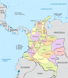
 Huila shown in red | |||
 Topography of the department | |||
| Coordinates: 2°59′55″N 75°18′16″W / 2.99861°N 75.30444°WCoordinates: 2°59′55″N 75°18′16″W / 2.99861°N 75.30444°W | |||
| Country |
| ||
| Region | Andes Region | ||
| Established | 1905 | ||
| Capital | Neiva | ||
| Government | |||
| • Governor | Carlos Julio Gonzalez Villa (2016-2019) | ||
| Area | |||
| • Total | 19,890 km2 (7,680 sq mi) | ||
| Area rank | 26th | ||
| Population (2013)[1] | |||
| • Total | 1,126,314 | ||
| • Rank | 15th | ||
| • Density | 57/km2 (150/sq mi) | ||
| Time zone | UTC-05 | ||
| ISO 3166 code | CO-HUI | ||
| Provinces | 4 | ||
| Municipalities | 37 | ||
| Website | www.gobhuila.gov.co | ||


Huila (Spanish pronunciation: [ˈwila]) is one of the departments of Colombia. It is located in the southwest of the country, and its capital is Neiva.[2]
Geography
The south of the department is located in the Colombian Massif. The Cordillera Oriental is born in this place.
Colombia's second highest peak, the Nevado del Huila volcano, is located in Huila department.
The Magdalena River (also called Yuma River) is Colombia's largest river, rises in Huila department. Some of Huila's most important towns are placed in the Magdalena River Valley. Betania is a dam located in the Magdalena river. A bigger dam, El Quimbo, is planned for the same river.
Administrative divisions
Municipalities
- Acevedo
- Agrado
- Aipe
- Algeciras
- Altamira
- Baraya
- Campoalegre
- Colombia
- Elias
- Garzón
- Gigante
- Guadalupe
- Hobo
- Iquira
- Isnos
- La Argentina
- La Plata
- Nataga
- Neiva
- Oporapa
- Paicol
- Palermo
- Palestina
- Pital
- Pitalito
- Rivera
- Saladoblanco
- San Agustín
- Santa María
- Suaza
- Tarqui
- Tello
- Teruel
- Tesalia
- Timaná
- Villavieja
- Yaguara
References
- ↑ "DANE". Retrieved February 13, 2013.
- ↑ "Generalidades del departamento". Gobernación del Huila. Retrieved 26 April 2013.
External links
- (Spanish) Government of Huila official website
 | ||
This article is issued from Wikipedia - version of the 7/13/2016. The text is available under the Creative Commons Attribution/Share Alike but additional terms may apply for the media files.