Homelake, Colorado
| Homelake, Colorado | |
|---|---|
| Unincorporated community | |
 Homelake, Colorado Location within the state of Colorado | |
| Coordinates: 37°34′28″N 106°05′45″W / 37.57444°N 106.09583°WCoordinates: 37°34′28″N 106°05′45″W / 37.57444°N 106.09583°W | |
| Country |
|
| State |
|
| Counties | Rio Grande[1] |
| Elevation[1] | 7,635 ft (2,327 m) |
| Time zone | MST (UTC-7) |
| • Summer (DST) | MDT (UTC-6) |
| ZIP code[2] | 81135 |
Homelake is an unincorporated community and a U.S. Post Office located in Rio Grande County, Colorado, United States. The Homelake Post Office has the ZIP Code 81135.[2]
History
Homelake is the former location of the Colorado Soldiers' and Sailors' Home and is the location of the Homelake Civil War Cemetery.
Geography
Homelake is located at 37°34′28″N 106°05′45″W / 37.57444°N 106.09583°W (37.574515,-106.095829).
Homelake is north of combined US Route 160 and US Route 285 on State Highway 6.
References
- 1 2 "US Board on Geographic Names". United States Geological Survey. 2007-10-25. Retrieved 2008-01-31.
- 1 2 "ZIP Code Lookup" (JavaScript/HTML). United States Postal Service. December 28, 2006. Retrieved December 28, 2006.
External links
Municipalities and communities of Rio Grande County, Colorado, United States | ||
|---|---|---|
| City | 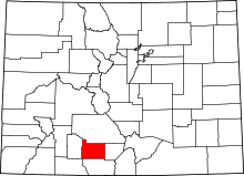 | |
| Towns | ||
| CDPs | ||
| Unincorporated community | ||
| Footnotes | ‡This populated place also has portions in an adjacent county or counties | |
This article is issued from Wikipedia - version of the 7/29/2014. The text is available under the Creative Commons Attribution/Share Alike but additional terms may apply for the media files.