Hill City, Kansas
| Hill City, Kansas | |
|---|---|
| City | |
 Location within Graham County and Kansas | |
 KDOT map of Graham County (legend) | |
| Coordinates: 39°22′2″N 99°50′44″W / 39.36722°N 99.84556°WCoordinates: 39°22′2″N 99°50′44″W / 39.36722°N 99.84556°W | |
| Country | United States |
| State | Kansas |
| County | Graham |
| Area[1] | |
| • Total | 1.00 sq mi (2.59 km2) |
| • Land | 1.00 sq mi (2.59 km2) |
| • Water | 0 sq mi (0 km2) |
| Elevation | 2,185 ft (666 m) |
| Population (2010)[2] | |
| • Total | 1,474 |
| • Estimate (2015)[3] | 1,467 |
| • Density | 1,500/sq mi (570/km2) |
| Time zone | Central (CST) (UTC-6) |
| • Summer (DST) | CDT (UTC-5) |
| ZIP code | 67642 |
| Area code(s) | 785 |
| FIPS code | 20-32175 [4] |
| GNIS feature ID | 0472209 [5] |
| Website | City Website |
Hill City is a city in and the county seat of Graham County, Kansas, United States.[6] As of the 2010 census, the city population was 1,474.[7]
History
Hill City was founded in 1876, making it the oldest town in Graham County.[8] It was named for its founder, W. R. Hill.[9] Hill City was located on the Union Pacific Railway.[10]
The first post office in Hill City was established in September 1878.[11] Hill City was designated county seat in 1880.[8]
Geography
Hill City is located at 39°22′02″N 99°50′44″W / 39.367319°N 99.845558°W (39.367319, -99.845558).[12] According to the United States Census Bureau, the city has a total area of 1.00 square mile (2.59 km2), all land.[1]
Climate
On June 9, 2005 a large tornado passed 1 mile south of Hill City.[13] And again hit by a large tornado just north of the city on June 20, 2011.
On June 26, 2012 the temperature reached 115 °F, breaking the June record tied just 2 days earlier and during the Dust Bowl on June 30, 1933. The town was the hottest city in the United States for four days in a row with temperatures of 114°, 111°, 115°, and 115°.[14][15]
Demographics
| Historical population | |||
|---|---|---|---|
| Census | Pop. | %± | |
| 1890 | 545 | — | |
| 1900 | 468 | −14.1% | |
| 1910 | 983 | 110.0% | |
| 1920 | 732 | −25.5% | |
| 1930 | 1,027 | 40.3% | |
| 1940 | 1,115 | 8.6% | |
| 1950 | 1,432 | 28.4% | |
| 1960 | 2,421 | 69.1% | |
| 1970 | 2,071 | −14.5% | |
| 1980 | 2,028 | −2.1% | |
| 1990 | 1,835 | −9.5% | |
| 2000 | 1,604 | −12.6% | |
| 2010 | 1,474 | −8.1% | |
| Est. 2015 | 1,467 | [3] | −0.5% |
| U.S. Decennial Census | |||
2010 census
As of the census[2] of 2010, there were 1,474 people, 669 households, and 404 families residing in the city. The population density was 1,474.0 inhabitants per square mile (569.1/km2). There were 783 housing units at an average density of 783.0 per square mile (302.3/km2). The racial makeup of the city was 91.2% White, 4.5% African American, 0.8% Native American, 0.3% Asian, 0.3% from other races, and 2.8% from two or more races. Hispanic or Latino of any race were 2.5% of the population.
There were 669 households of which 24.2% had children under the age of 18 living with them, 49.8% were married couples living together, 6.9% had a female householder with no husband present, 3.7% had a male householder with no wife present, and 39.6% were non-families. 35.4% of all households were made up of individuals and 19.6% had someone living alone who was 65 years of age or older. The average household size was 2.14 and the average family size was 2.76.
The median age in the city was 48 years. 20.8% of residents were under the age of 18; 6.2% were between the ages of 18 and 24; 19% were from 25 to 44; 29.9% were from 45 to 64; and 23.9% were 65 years of age or older. The gender makeup of the city was 46.9% male and 53.1% female.
2000 census
As of the census[4] of 2000, there were 1,604 people, 696 households, and 448 families residing in the city. The population density was 1,716.3 people per square mile (665.9/km2). There were 795 housing units at an average density of 850.7 per square mile (330.1/km2). The racial makeup of the city was 94.33% White, 3.43% African American, 0.19% Native American, 0.44% Asian, 0.06% Pacific Islander, 0.69% from other races, and 0.87% from two or more races. Hispanic or Latino of any race were 1.12% of the population.
There were 696 households out of which 26.9% had children under the age of 18 living with them, 54.9% were married couples living together, 7.9% had a female householder with no husband present, and 35.5% were non-families. 32.6% of all households were made up of individuals and 18.0% had someone living alone who was 65 years of age or older. The average household size was 2.21 and the average family size was 2.80.
In the city the population was spread out with 21.3% under the age of 18, 6.0% from 18 to 24, 21.6% from 25 to 44, 25.9% from 45 to 64, and 25.2% who were 65 years of age or older. The median age was 46 years. For every 100 females there were 86.1 males. For every 100 females age 18 and over, there were 82.6 males.
The median income for a household in the city was $30,236, and the median income for a family was $36,500. Males had a median income of $26,207 versus $18,295 for females. The per capita income for the city was $16,989. About 6.2% of families and 11.1% of the population were below the poverty line, including 13.5% of those under age 18 and 11.5% of those age 65 or over.
Notable people
- Charles V. Park (1885–1982), noted librarian for whom the Charles V. Park Library at Central Michigan University is named, was born in town.
See also
- Hillsboro, Kansas, original name was Hill City
References
- 1 2 "US Gazetteer files 2010". United States Census Bureau. Archived from the original on January 24, 2012. Retrieved 2012-07-06.
- 1 2 "American FactFinder". United States Census Bureau. Retrieved 2012-07-06.
- 1 2 "Annual Estimates of the Resident Population for Incorporated Places: April 1, 2010 to July 1, 2015". Retrieved July 2, 2016.
- 1 2 "American FactFinder". United States Census Bureau. Archived from the original on 2013-09-11. Retrieved 2008-01-31.
- ↑ "US Board on Geographic Names". United States Geological Survey. 2007-10-25. Retrieved 2008-01-31.
- ↑ "Find a County". National Association of Counties. Archived from the original on May 31, 2011. Retrieved 2011-06-07.
- ↑ "2010 City Population and Housing Occupancy Status". U.S. Census Bureau. Archived from the original on July 21, 2011. Retrieved March 27, 2011.
- 1 2 Blackmar, Frank Wilson (1912). Kansas: A Cyclopedia of State History, Embracing Events, Institutions, Industries, Counties, Cities, Towns, Prominent Persons, Etc. Standard Publishing Company. p. 844.
- ↑ Gannett, Henry (1905). The Origin of Certain Place Names in the United States. Govt. Print. Off. p. 156.
- ↑ Kansas State Historical Society (1916). Biennial Report of the Board of Directors of the Kansas State Historical Society. Kansas State Printing Plant. p. 196.
- ↑ "Kansas Post Offices, 1828-1961 (archived)". Kansas Historical Society. Archived from the original on October 9, 2013. Retrieved 10 June 2014.
- ↑ "US Gazetteer files: 2010, 2000, and 1990". United States Census Bureau. 2011-02-12. Retrieved 2011-04-23.
- ↑ Tornado passed near Hill City, Kansas on June 9, 2005
- ↑ Cities as Hot as Death Valley; Weather Channel; June 27, 2012
- ↑ Hill City Nation's hot spot for four days in a row; The Wichita Eagle; June 28, 2012.
Further reading
- History of the State of Kansas; William G. Cutler; A.T. Andreas Publisher; 1883. (Online HTML eBook)
- Kansas : A Cyclopedia of State History, Embracing Events, Institutions, Industries, Counties, Cities, Towns, Prominent Persons, Etc; 3 Volumes; Frank W. Blackmar; Standard Publishing Co; 944 / 955 / 824 pages; 1912. (Volume1 - Download 54MB PDF eBook),(Volume2 - Download 53MB PDF eBook), (Volume3 - Download 33MB PDF eBook)
External links
| Wikimedia Commons has media related to Hill City, Kansas. |
- City
- Schools
- USD 281, local school district
- Maps
- Hill City Map, KDOT
Municipalities and communities of Graham County, Kansas, United States | ||
|---|---|---|
| Cities | 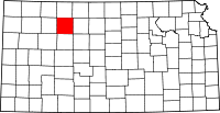 | |
| Unincorporated communities | ||
| Ghost towns | ||
| Townships | ||