Hiles, Wood County, Wisconsin
| Hiles, Wisconsin | |
|---|---|
| Town | |
 Location of Hiles, Wood County, Wisconsin | |
| Coordinates: 44°22′26″N 90°14′50″W / 44.37389°N 90.24722°WCoordinates: 44°22′26″N 90°14′50″W / 44.37389°N 90.24722°W | |
| Country | United States |
| State | Wisconsin |
| County | Wood |
| Area | |
| • Total | 35.3 sq mi (91.5 km2) |
| • Land | 34.8 sq mi (90.2 km2) |
| • Water | 0.5 sq mi (1.3 km2) |
| Elevation[1] | 974 ft (297 m) |
| Population (2000) | |
| • Total | 188 |
| • Density | 5.4/sq mi (2.1/km2) |
| Time zone | Central (CST) (UTC-6) |
| • Summer (DST) | CDT (UTC-5) |
| Area code(s) | 715 & 534 |
| FIPS code | 55-34675[2] |
| GNIS feature ID | 1583391[1] |
| PLSS township | T22N R2E |
Hiles is a town in Wood County, Wisconsin, United States. The population was 188 at the 2000 census.
Geography
According to the United States Census Bureau, the town has a total area of 35.3 square miles (91.5 km²), of which, 34.8 square miles (90.2 km²) of it is land and 0.5 square miles (1.2 km²) of it (1.36%) is water.
History
The six mile square that would become Hiles was first surveyed in the summer of 1851 by a crew working for the U.S. government. Around New Year's of 1852 another crew marked all the section corners of the six mile square, walking through the woods and wading the swamps, measuring with chain and compass.[3][4] When done, the deputy surveyor filed this general description:
The surface of this Township is level, about one half is composed of Tamarack Swamp, the remaining Portion low wetland, but a small Portion could be made fit for cultivation (?) by drainage. The whole surface is covered with a very thick coat of Timber Small(?) Pine, Tamarack, Maple and Birch, undergrowth of Alder witch Hazel, and water Bech very thick, soil Hard Pan from the Middle of the Township North and East local attraction was found to very considerable extent, so much so that several lines were run with back sights(?) and measurement alone, Fox River (called by residents East Branch of Black River.) runs near the Center of the Township - from the N.E. to N.W. corner, average width 100 links Rapid(?) current, average depth about two feet.[5]
The current town of Hiles was organized in 1901,[6] named for businessman and land speculator George Hiles, who owned half the land in the town before the turn of the century.[7]
Demographics
As of the census[2] of 2000, there were 188 people, 63 households, and 51 families residing in the town. The population density was 5.4 people per square mile (2.1/km²). There were 88 housing units at an average density of 2.5 per square mile (1.0/km²). The racial makeup of the town was 97.87% White, 0.53% African American, 0.53% from other races, and 1.06% from two or more races. Hispanic or Latino of any race were 2.66% of the population.
There were 63 households out of which 42.9% had children under the age of 18 living with them, 77.8% were married couples living together, 4.8% had a female householder with no husband present, and 17.5% were non-families. 15.9% of all households were made up of individuals and 11.1% had someone living alone who was 65 years of age or older. The average household size was 2.98 and the average family size was 3.31.
In the town the population was spread out with 33.5% under the age of 18, 3.7% from 18 to 24, 28.7% from 25 to 44, 20.2% from 45 to 64, and 13.8% who were 65 years of age or older. The median age was 38 years. For every 100 females there were 111.2 males. For every 100 females age 18 and over, there were 108.3 males.
The median income for a household in the town was $38,000, and the median income for a family was $39,375. Males had a median income of $31,250 versus $18,333 for females. The per capita income for the town was $15,054. About 9.6% of families and 8.6% of the population were below the poverty line, including 11.5% of those under the age of eighteen and none of those sixty five or over.
References
- 1 2 "US Board on Geographic Names". United States Geological Survey. 2007-10-25. Retrieved 2008-01-31.
- 1 2 "American FactFinder". United States Census Bureau. Retrieved 2008-01-31.
- ↑ "Land Survey Information". Board of Commissioners of Public Lands. Retrieved 26 March 2011.
- ↑ "Field Notes for T22N R2E". Original Field Notes and Plat Maps, 1833-1866. Board of Commissioners of Public Lands. Retrieved 28 May 2013.
- ↑ Sterling, Levi. "Interior Field Notes (Dec. 1851-Jan. 1852)". Board of Commissioners of Public Lands. Retrieved 2013-05-28.
- ↑ Jones, George O.; Norman S. McVean; et al. (1923). History of Wood County Wisconsin. Minneapolis - Winona: H. C. Cooper Jr. & Co. p. 263.
- ↑ Philleo, I. E. (1896). Plat Book of Wood County, Wisconsin. Grand Rapids, Wisconsin: I. E. Philleo, C. E. p. 6.
External links
- Town of Hiles Official Website
- 1852 plat map covering town of Hiles
- 1879 plat map
- 1896 plat map
- 1909 plat map
- 1928 plat map
- 1956 plat map
Municipalities and communities of Wood County, Wisconsin, United States | ||
|---|---|---|
| Cities | 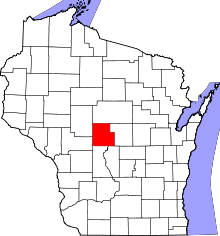 | |
| Villages | ||
| Towns | ||
| CDPs | ||
| Unincorporated communities | ||
| Indian reservation | ||
| Footnotes | ‡This populated place also has portions in an adjacent county or counties | |