Highway M03 (Ukraine)
| |
|---|---|
| Автошлях M03 | |
 | |
| Route information | |
| Length: |
844.2 km (524.6 mi) 858.9 km (533.7 mi) with access roads |
| Kiev - Boryspil (part of | |
| Length: | 18.0 km (11.2 mi) |
| Length: | 1.0 km (0.6 mi) |
| West end: |
(Kiev) |
| Major junctions: |
(Poltava) (Kharkiv) |
| East end: |
(Debaltseve) |
| Length: | 1.0 km (0.6 mi) |
| West end: |
(Debaltseve) |
| East end: |
(Dovzhansky) (Sverdlovsk Raion) / |
| Location | |
| Regions: | Kiev, Kiev Oblast, Poltava Oblast, Kharkiv Oblast, Donetsk Oblast, Luhansk Oblast |
| Highway system | |
| Roads in Ukraine | |

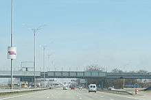
_near_Boryspil_International_Airport.jpg)

![]() is a Ukrainian international highway (M-highway) connecting Kiev with Dovzhansky on the border with Russia, where it connects to the Russian International Highway M19.[1] It is concurrent with
is a Ukrainian international highway (M-highway) connecting Kiev with Dovzhansky on the border with Russia, where it connects to the Russian International Highway M19.[1] It is concurrent with ![]() from Kyiv to Debaltseve at which it is concurrent with
from Kyiv to Debaltseve at which it is concurrent with ![]() to the border with Russia.[2]
to the border with Russia.[2]
In Soviet times ![]() was part the
was part the ![]() . Today,
. Today, ![]() stretches through five oblasts and ends at the border checkpoint at Dovzhansky which is part of Sverdlovsk Raion (Luhansk Oblast). The route connects Kiev and Kharkiv with the industrial region of Donbas. Part of
stretches through five oblasts and ends at the border checkpoint at Dovzhansky which is part of Sverdlovsk Raion (Luhansk Oblast). The route connects Kiev and Kharkiv with the industrial region of Donbas. Part of ![]() between Kiev and Boryspil was reconstructed into automagistral to handle higher traffic between Kiev and the Boryspil International Airport.
between Kiev and Boryspil was reconstructed into automagistral to handle higher traffic between Kiev and the Boryspil International Airport. ![]() is the longest International state highway in Ukraine.
is the longest International state highway in Ukraine.
From Boryspil to Lubny, the road is a dual carriageway, thereon it continues as a single carriageway with some 2x2 sections.
Significant armed conflict has occurred on or near the eastern portions of ![]() during the War in Donbas.
during the War in Donbas.
Kiev - Boryspil
 Kiev – Boryspil auto-magistrale is the better kept motorway in Ukraine. It provides direct access from Kiev to the Boryspil International Airport. Its traffic passing ability amasses to 40,000 vehicle per day. It has length of 18 km (11 mi) with maximum allowable speed at 130 km/h (81 mph). The motorway is part of the
 ![]() highway that stretches from Kiev to the Russo–Ukrainian border at the Dovzhansky border checkpoint.
highway that stretches from Kiev to the Russo–Ukrainian border at the Dovzhansky border checkpoint.
Route
| Marker, km | Main settlements | Notes | Highway Interchanges |
|---|---|---|---|
| 0 km | Kiev | ||
| 18 km | Boryspil | H08 | |
| Poltava | |||
| Lyubotyn | |||
| Kharkiv | |||
| Sloviansk | H20 | ||
| Debaltseve | |||
| 844.2 km | Dovzhansky / Border (Russia) | ||
See also
References
External links
- Kiev - Boryspil (Russian)
- International Roads in Ukraine in Russian
- European Roads in Russian
| E-roads in Ukraine | ||
|---|---|---|
| International | ||
| National | ||
| Regional |
| |
| ||