Higdon, Alabama
| Higdon, Alabama | |
|---|---|
| Unincorporated community | |
 Higdon, Alabama Location in Alabama. | |
| Coordinates: 34°50′44″N 85°36′59″W / 34.84556°N 85.61639°W | |
| Country | United States |
| State | Alabama |
| County | Jackson |
| Area | |
| • Land | 3.940 sq mi (10.205 km2) |
| • Water | 0 sq mi (0 km2) |
| Elevation | 1,381 ft (421 m) |
| Population (2010) | |
| • Total | 1,398 |
| • Density | 354.8/sq mi (137.0/km2) |
| Time zone | Central (CST) (UTC-6) |
| • Summer (DST) | CDT (UTC-5) |
| ZIP code | 35979 |
| Area code(s) | 256 |
| GNIS feature ID | 120045[1] |
Higdon is an unincorporated community in Jackson County, Alabama, United States.
History
A post office called Higdon has been in operation since 1882.[2] The community bears the name of its first postmaster.[3]
Geography
Higdon is located on top of Sand Mountain.
Higdon covers an area of 10.205 square miles (26.43 km2), all land.
Major Highways
Demographics
As of the census of 2010, there were 1,398 people. The population density was 354.8 persons per square mile. The racial makeup of the town was 95.5% White, 0.2% Black and 2.1% from two or more races. 0.9% of the population were Hispanic or Latino of any race.
In Higdon, the population was spread out with 26.1% under the age of 18 and 13.2% who were 64 years of age or older. Marriage status: 15.1% never married, 71.9% now married, 3.8% widowed, and 9.2% divorced.
The per capita income for Higdon was $14,341. About 7.1% of the population were below the poverty line.[4]
Education
Higdon is home to North Sand Mountain School, which is part of the Jackson County School System.
References
- ↑ "Higdon". Geographic Names Information System. United States Geological Survey.
- ↑ "Jackson County". Jim Forte Postal History. Retrieved 7 June 2015.
- ↑ "Bitter: Miami riots leave her with no husband and an uncertain future". The Evening Independent. Jul 7, 1980. pp. 2A. Retrieved 7 June 2015.
- ↑ "American FactFinder". United States Census Bureau. Retrieved 2014-08-02.
External links
Municipalities and communities of Jackson County, Alabama, United States | ||
|---|---|---|
| Cities | 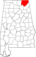 | |
| Towns | ||
| Unincorporated communities | ||
| Ghost towns | ||
Coordinates: 34°50′44″N 85°36′59″W / 34.84556°N 85.61639°W