Hibino Station (Nagoya)
Hibino Station 日比野駅 | |
|---|---|
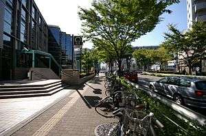 Exit 1 and surrounding area | |
| Location |
Taihō 1-3-18, Atsuta, Nagoya, Aichi (名古屋市熱田区大宝一丁目3-18) Japan |
| Operated by | Transportation Bureau City of Nagoya |
| Line(s) | Meikō Line |
| Connections |
|
| Other information | |
| Station code | E2 |
| History | |
| Opened | 1971 |
| Traffic | |
| Passengers (2008) | 3,017,778 [1] |
Hibino Station (日比野駅 Hibino-eki) is an underground metro station located in Atsuta-ku, Nagoya, Aichi Prefecture, Japan operated by the Nagoya Municipal Subway's Meikō Line. It is located 1.5 kilometers from the terminus of the Meikō Line at Kanayama Station. This station provides access to Nagoya Congress Center.
History
Hibino Station was opened on 29 March 1971.
Lines
- Nagoya Municipal Subway
- Meikō Line (Station E02)
Layout
Hibino Station has a single underground island platform.
Platforms
| 1 | ■ Meikō Line | For Nagoyakō |
| 2 | ■ Meikō Line | For Kanayama, Sakae, and Ōzone |
The station has two tracks and, unusually for this line, one physical platform, which is divided into Platform 1 for Nagoyakō Station, and Platform 2 for Kanayama Station. There is one wicket, beyond which are five exits. On Platform 1 to Nagoya Port, train door 13 is closest to the elevator, doors 13 and 9 are closest to the escalators, and door 16 is closest to the stairs. On Platform 2, door 5 is closest to the elevator and escalator and door 2 is closest to the stairs. There are public phones near the elevators on the platforms, near the wicket, and near Exit 4. There is a handicapped-accessible bathroom with a baby changing area, and a second baby changing area, outside wicket. The station has coin lockers. There is a minor bus rotary outside the station.[2] [3] [4]
Adjacent stations
| « | Service | » | ||
|---|---|---|---|---|
| Nagoya Municipal Subway | ||||
| Meikō Line | ||||
| Kanayama | - | Rokuban-chō | ||
References
- ↑ 平成21年版名古屋市統計年鑑 11.運輸・通信 [Nagoya Statistics for Year 21 of the Heisei Era, 11 Transportation and Communication] (in Japanese). Nagoya City. Retrieved 1 December 2010.
- ↑ 路線図 [Route Diagram] (in Japanese). Rozensu Dot Com. Retrieved 19 November 2010.
- ↑ 駅構内図 [Diagram of Station Interior] (in Japanese). Transportation Bureau City of Nagoya. Retrieved 19 November 2010.
- ↑ 避難経路図 [Evacuation Routes Diagram] (in Japanese). Transportation Bureau City of Nagoya. Retrieved 19 November 2010.
![避難経路図 [Evacuation Routes Diagram]](http://www.kotsu.city.nagoya.jp/dbps_data/_material_/localhost/_res/subway/station_map/higashibetsuin/hibino-h.gif)
External links
| Wikimedia Commons has media related to Hibino Station (Nagoya). |
- Hibino Station's web page at the Nagoya Transportation Bureau's web site (Japanese)
- Nagoya Wholesale Fish Market (Japanese)
Coordinates: 35°07′58″N 136°53′35″E / 35.1328°N 136.893°E