Hertford East Branch Line
| Hertford East Branch Line | |
|---|---|
 | |
| Overview | |
| Type | Heavy rail, Commuter rail |
| System | National Rail |
| Status | Operational |
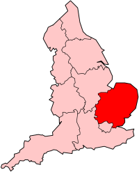
| Locale | East of England |
| Termini |
Broxbourne Hertford East |
| Stations | 4 |
| Operation | |
| Opened | 1843 |
| Owner | Network Rail |
| Operator(s) | Abellio Greater Anglia |
| Depot(s) | Ilford |
| Rolling stock | British Rail Class 317 |
| Technical | |
| Track gauge | 1,435 mm (4 ft 8 1⁄2 in) standard gauge |
| Electrification | 25 kV 50hz AC OHLE |
| Hertford East Branch Line | ||||||||||||||||||||||||||||||||||||||||||||||||||||||||||||||||||||||||||||||||||||||||||||||||||||||||||||||||||||||||||||||||||||||||||||
|---|---|---|---|---|---|---|---|---|---|---|---|---|---|---|---|---|---|---|---|---|---|---|---|---|---|---|---|---|---|---|---|---|---|---|---|---|---|---|---|---|---|---|---|---|---|---|---|---|---|---|---|---|---|---|---|---|---|---|---|---|---|---|---|---|---|---|---|---|---|---|---|---|---|---|---|---|---|---|---|---|---|---|---|---|---|---|---|---|---|---|---|---|---|---|---|---|---|---|---|---|---|---|---|---|---|---|---|---|---|---|---|---|---|---|---|---|---|---|---|---|---|---|---|---|---|---|---|---|---|---|---|---|---|---|---|---|---|---|---|---|
Legend | ||||||||||||||||||||||||||||||||||||||||||||||||||||||||||||||||||||||||||||||||||||||||||||||||||||||||||||||||||||||||||||||||||||||||||||
| ||||||||||||||||||||||||||||||||||||||||||||||||||||||||||||||||||||||||||||||||||||||||||||||||||||||||||||||||||||||||||||||||||||||||||||
The Hertford East Branch Line is a railway line in Hertfordshire in the United Kingdom, running between Hertford and Broxbourne. The line follows the route of the Lea Valley, serving intermediate towns and villages. It branches off the West Anglia Main Line[1] north of Broxbourne, and could be seen as part of the Lea Valley Lines—a collection of commuter routes into London.
History
In June 1841 the Northern and Eastern Railway (N&ER) were given parliamentary assent to construct a branch from Broxbourne to Hertford. Work on the line began early in 1843 and the branch (and all stations on it) was opened as a single track on 31 October of that year. Operation by the N&ER was short lived as they had already agreed that the Eastern Counties Railway would lease their lines (then from Stratford to Bishops Stortford as well as the Hertford East branch). The line was doubled in October 1846.[2]
The original Hertford station originally was opened in 1843 to avoid two nearby schools but later this was closed and a station further west in 1888 opened, Hertford East, to be closer to the town centre. Another station existed in 1858 which was opened on the line from Hatfield but this closed as soon as Hertford North opened in 1924.[3]
Part of the route was used for the Buntingford Branch Railway, or "The Bunt", a railway which ran from Buntingford to London from 1863 to 1964. The Buntingford Railway split off this line just to the North of St Margarets station.[4]
Route and services
The line curves away from Broxbourne to the left and heads towards Hertford. For most of its length, it is bounded by the New River on its left and the River Lea and Lee Navigation on its right when looking at it from east to west.
Towns and villages served are:
- Broxbourne
- Rye House on the outskirts of Hoddesdon
- St Margarets and neighbouring Stanstead Abbotts
- Ware
- Hertford East.
The line is part of the Network Rail Strategic Route 5, SRS 05.03 and is classified as a London and South East Commuter line.[5]
There are currently two trains an hour on this line serving all stations.[1] Future plans for this line see the lengthening of platforms to facilitate longer trains and create extra capacity on the line. Services on this line are currently operated by Abellio Greater Anglia using Class 317 units with either 4 or 8 coaches.
Passenger volume
Below is the passenger usage from the year beginning April 2002 to the year beginning April 2010.[6]
| Station usage | |||||||||||
|---|---|---|---|---|---|---|---|---|---|---|---|
| Station Name | 2004–05 | 2005–06 | 2006–07 | 2007–08 | 2008–09 | 2009–10 | 2010–11 | 2011–12 | 2012–13 | 2013–14 | 2014–15 |
| Hertford East | 275,158 | 303,404 | 278,010 | 626,244 | 613,405 | 613,476 | 657,574 | 718,590 | |||
| Ware | 700,233 | 770,239 | 747,625 | 830,244 | 904,420 | 921,512 | 792,180 | 838,360 | |||
| St Margarets (Hertfordshire) | 294,763 | 302,701 | 300,745 | 306,446 | 313,656 | 315,202 | 244,574 | 286,948 | |||
| Rye House | 264,582 | 312,736 | 312,505 | 323,112 | 336,314 | 368,796 | 329,172 | 345,928 | |||
| The annual passenger usage is based on sales of tickets in stated financial years from Office of Rail Regulation statistics. The statistics are for passengers arriving and departing from each station and cover twelve month periods that start in April. Please note that methodology may vary year on year. | |||||||||||
Infrastructure
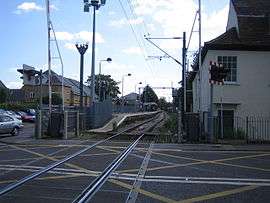
The line is double track throughout except for a small section through Ware where it is single track. It is electrified at 25 kV AC using overhead line equipment, and has a loading gauge of W6[5]
Proposed developments
Some options of the proposed East West Rail Link involve reopening a route between Hertford East station and Hertford North station. Options also propose building a chord near Rye House station to allow rail traffic to head north on the West Anglia Main Line.[7]
References
- 1 2 "Route Plans 2007 Route 5 West Anglia" (PDF). Network Rail. 2007. Retrieved 2008-07-03.
- ↑ Bradley, Richard (July 2013). "Significant events in the life of the Northern and Eastern Railway". Great Eastern Railway Society Journal. 155: 17.
- ↑ "Hertford and the Railway". Discover Hertford. 2008. Retrieved 2008-03-08.
- ↑ "The Buntingford Railway & Local History Society". Retrieved 2008-03-08.
- 1 2 "Route 5 - West Anglia" (PDF). Network Rail. 2009. Retrieved 2009-05-26.
- ↑ "Station Usage". Office of Rail Regulation. Retrieved 2012-05-11.
- ↑ "East West Rail Central Section - Operating Case Discussion Paper" (PDF). 09-02-09. Retrieved 2009-05-10. Check date values in:
|date=(help)