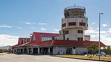
Hengchun Airport
| Hengchun Airport 恆春航空站 恆春機場 Héngchūn Hángkōngzhàn Héngchūn Jīchǎng | |||||||||||
|---|---|---|---|---|---|---|---|---|---|---|---|
 | |||||||||||
| IATA: HCN – ICAO: RCKW | |||||||||||
| Summary | |||||||||||
| Airport type | Public | ||||||||||
| Operator | Civil Aeronautics Administration | ||||||||||
| Location | Hengchun, Pingtung County, Taiwan | ||||||||||
| Elevation AMSL | 14 m / 46 ft | ||||||||||
| Coordinates | 22°02′17″N 120°43′49″E / 22.03806°N 120.73028°E | ||||||||||
| Map | |||||||||||
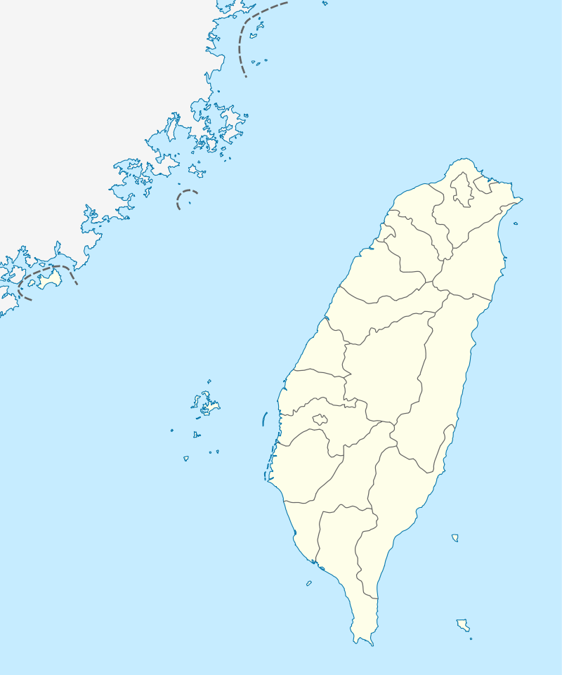 HCN Location of airport in Taiwan | |||||||||||
| Runways | |||||||||||
| |||||||||||
Hengchun Airport (Chinese: 恆春機場; pinyin: Héngchūn Jīchǎng) (IATA: HCN, ICAO: RCKW) is an airport in Renshou Village, Hengchun Township, Pingtung County, Taiwan. The airport is near Kenting National Park and is the southern-most airport in Taiwan.
Due to its location, the airport frequently experiences strong Katabatic wind and is forced to close. Because of this, the load factor of the flights rarely exceeds 40%; airlines are considering filing applications for withdrawal of services to Hengchun.[1]
History
The airport construction was finished in 2003 and opened to public in January 2004 with a cost of NT$ 539,000,000.[2] However, since the opening of Taiwan High Speed Rail in 2007, there has been a sharp decline in the number of passengers using the airport. Since August 2014 until today, the airport has not processed any passenger. In 2014 alone, the airport only served 768 passengers, down from 23,000 passengers in its inaugural year of 2004. In October 2015, the Civil Aeronautics Administration announced that they will make a decision whether to close the airport in the second half of 2016 due to the extremely low passenger rate.[3][4]
Airlines and destinations
Mandarin Airlines and TransAsia Airways dropped out from serving the airport due to poor load factor and Hengchun Peninsular's seasonal strong winds which make landing and take off dangerous.
| Airlines | Destinations |
|---|---|
| Uni Air | Taipei-Songshan (2 flights/week)[5] |
See also
References
- ↑ "Yahoo奇摩新聞".
- ↑ "welcome to Hengchun airport - Airport Introduction". Hca.gov.tw. Retrieved 2014-04-30.
- ↑ "Hengchun Airport to face possible closure next year - Taipei Times".
- ↑ "Hengchun Airport could be turned over to military use - Society - FOCUS TAIWAN - CNA ENGLISH NEWS".
- ↑ "Flights Information". Hca.gov.tw. Retrieved 2014-04-30.
External links
| Wikimedia Commons has media related to Hengchun Airport. |