Hazelwood, Minnesota
| Hazelwood, Minnesota | |
|---|---|
| Unincorporated community | |
|
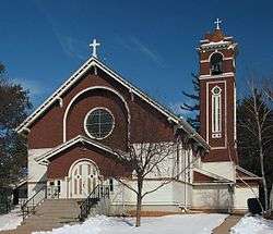
The Church of the Annunciation in Hazelwood | |
 Hazelwood, Minnesota  Hazelwood, Minnesota Location of the community of Hazelwood | |
| Coordinates: 44°31′21″N 93°17′10″W / 44.52250°N 93.28611°WCoordinates: 44°31′21″N 93°17′10″W / 44.52250°N 93.28611°W | |
| Country | United States |
| State | Minnesota |
| County | Rice County |
| Township | Webster Township |
| Elevation | 1,047 ft (319 m) |
| Time zone | Central (CST) (UTC-6) |
| • Summer (DST) | CDT (UTC-5) |
| ZIP code | 55057 |
| Area code(s) | 952 |
| GNIS feature ID | 644811[1] |
Hazelwood is an unincorporated community in Webster Township, Rice County, Minnesota, United States.
The community is located at the junction of Rice County Roads 3 and 46, near Interstate 35, 15 miles north of Faribault.
Dutch Creek flows through the community. Nearby places also include Lonsdale, Elko New Market, and Northfield.
ZIP codes 55088 (Webster) and 55057 (Northfield) meet near Hazelwood.
Hazelwood had a post office from 1857 to 1905, which was operated out of postmaster John J. McCabe's general store.[2]
References
- ↑ "Hazelwood, Minnesota". Geographic Names Information System. United States Geological Survey.
- ↑ "Hazelwood". Minnesota Historical Society. Retrieved March 21, 2012.
Municipalities and communities of Rice County, Minnesota, United States | ||
|---|---|---|
| Cities |  | |
| Townships | ||
| CDP | ||
| Unincorporated communities | ||
| Footnotes | ‡This populated place also has portions in an adjacent county or counties | |
This article is issued from Wikipedia - version of the 7/28/2016. The text is available under the Creative Commons Attribution/Share Alike but additional terms may apply for the media files.