Haukedalen
| Haukedalen | |
|---|---|
| Village | |
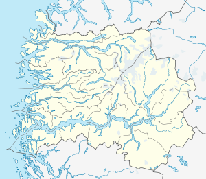 Haukedalen  Haukedalen Location in Sogn og Fjordane county | |
| Coordinates: 61°25′15″N 06°22′25″E / 61.42083°N 6.37361°ECoordinates: 61°25′15″N 06°22′25″E / 61.42083°N 6.37361°E | |
| Country | Norway |
| Region | Western Norway |
| County | Sogn og Fjordane |
| District | Sunnfjord |
| Municipality | Førde |
| Elevation[1] | 315 m (1,033 ft) |
| Time zone | CET (UTC+01:00) |
| • Summer (DST) | CEST (UTC+02:00) |
| Post Code | 6818 Haukedalen |
Haukedalen is a village in Førde Municipality in Sogn og Fjordane county, Norway. The village is located in the Haukedalen valley at the northwestern end of the lake Haukedalsvatnet. The village lies in a fairly remote valley surrounded by the Gaularfjellet mountains. The town of Førde lies about 35 kilometres (22 mi) to the west. Haukedalen Church is located in the village. The glaciers Grovabreen and Jøstafonn are both about 10 kilometres (6.2 mi) to the northeast and east respectively.[2]
References
- ↑ "Haukedalen" (in Norwegian). yr.no. Retrieved 2013-11-20.
- ↑ Store norske leksikon. "Haukedalen" (in Norwegian). Retrieved 2013-11-20.
This article is issued from Wikipedia - version of the 8/1/2016. The text is available under the Creative Commons Attribution/Share Alike but additional terms may apply for the media files.