Harrington, Quebec
| Harrington | |
|---|---|
| Township municipality | |
 | |
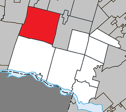 Location within Argenteuil RCM. | |
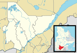 Harrington Location in central Quebec. | |
| Coordinates: 45°50′N 74°40′W / 45.833°N 74.667°WCoordinates: 45°50′N 74°40′W / 45.833°N 74.667°W[1] | |
| Country |
|
| Province |
|
| Region | Laurentides |
| RCM | Argenteuil |
| Settled | 1830 |
| Constituted | July 1, 1855 |
| Government[2] | |
| • Mayor | Jacques Parent |
| • Federal riding | Argenteuil—Papineau—Mirabel |
| • Prov. riding | Argenteuil |
| Area[2][3] | |
| • Total | 249.30 km2 (96.26 sq mi) |
| • Land | 236.73 km2 (91.40 sq mi) |
| Population (2011)[3] | |
| • Total | 853 |
| • Density | 3.6/km2 (9/sq mi) |
| • Pop 2006-2011 |
|
| • Dwellings | 1,361 |
| Time zone | EST (UTC−5) |
| • Summer (DST) | EDT (UTC−4) |
| Postal code(s) | J8G 2T1 |
| Area code(s) | 819 |
| Highways |
|
| Website |
www |
Harrington is a township municipality in the Laurentides region of Quebec, Canada, part of the Argenteuil Regional County Municipality. It is located in the Laurentian Mountains, about 40 kilometers (25 mi) north-west of Lachute.
Its population centres include Harrington, Lac-Keatley, Lakeview, Lost River, and Rivington.
Geography
Harrington is a land of lakes and rivers, stocked with abundant fish. The Rouge River is the main river flowing through it, and the largest lakes include Lake (Lac) MacDonald, Green Lake, and Lake Harrington, each attracting a large number summer cottage vacationers. Its territory has a characteristic appearance of the Laurentian region with dense forests, rising to an elevation of 457 meters (1,499 ft) in the north-east, which is 30 meters (98 ft) more than Mont Chauve which dominates Green Lake.[4][5]
The Lost River flows for some miles from a spring that disappears under a calcareous rock between Gate Lake and Fraser Lake.[6]
History
Harrington Township first appeared on the Gale and Duberger Map of 1795, but was not settled until 1830 when Scottish pioneers settled in the Lost River area in the east. In 1841, the township is officially established and in 1855, the township municipality was formed.[5]
It is believed that the name Harrington may be attributed to a location in England, however, the local post office was identified under the name of Rivington between 1878 and 1961.[5]
Demographics

Population trend:[7]
- Population in 2011: 853 (2006 to 2011 population change: 9.8%)
- Population in 2006: 777 (2001 to 2006 population change: -1.0 %)
- Population in 2001: 785
- Population in 1996: 730
- Population in 1991: 729
Private dwellings occupied by usual residents: 436 (total dwellings: 1,361)
Mother tongue:[8]
- English as first language: 52.6%
- French as first language: 40.4%
- English and French as first language: 2.4%
- Other as first language: 5.6%
See also
References
- ↑ Reference number 27989 of the Commission de toponymie du Québec (French)
- 1 2 Geographic code 76065 in the official Répertoire des municipalités (French)
- 1 2 "(Code 2476065) Census Profile". 2011 census. Statistics Canada. 2012.
- ↑ "Harrington (canton)" (in French). Commission de toponymie du Québec. Retrieved 2009-03-03.
- 1 2 3 "Harrington (Municipalité de canton)" (in French). Commission de toponymie du Québec. Retrieved 2009-03-03.
- ↑ "Lost River...". Harrington Township. Retrieved 2009-03-06.
- ↑ Statistics Canada: 1996, 2001, 2006, 2011 census
- ↑ Harrington Census Prolife 2011
 |
Huberdeau, Arundel | Montcalm | | |
| Boileau | |
Wentworth-Nord | ||
| ||||
| | ||||
| Notre-Dame-de-Bonsecours | Grenville-sur-la-Rouge |
| Towns | |
|---|---|
| Municipalities | |
| Townships | |
| Villages | |
| |