Hanna, Utah
| Hanna, Utah | |
|---|---|
| Unincorporated community | |
 Hanna Location within the state of Utah | |
| Coordinates: 40°24′15″N 110°45′55″W / 40.40417°N 110.76528°WCoordinates: 40°24′15″N 110°45′55″W / 40.40417°N 110.76528°W | |
| Country | United States |
| State | Utah |
| County | Duchesne |
| Named for | William P. Hanna |
| Elevation | 6,765 ft (2,062 m) |
| Time zone | Mountain (MST) (UTC-7) |
| • Summer (DST) | MDT (UTC-6) |
| ZIP codes | 84031 |
| GNIS feature ID | 1428509[1] |
| Historical population | |||
|---|---|---|---|
| Census | Pop. | %± | |
| 1920 | 263 | — | |
| 1930 | 190 | −27.8% | |
| 1940 | 220 | 15.8% | |
| 1950 | 193 | −12.3% | |
| Source: U.S. Census Bureau[2] | |||
Hanna (also Defas Park) is an unincorporated community in western Duchesne County, Utah, United States, on the Uintah and Ouray Indian Reservation. It lies along State Route 35 northwest of the city of Duchesne, the county seat of Duchesne County.[3] Its elevation is 6,765 feet (2,062 m).[1] Although Hanna is unincorporated, it has a post office, with the ZIP code of 84031.[4] Hanna was named for its original postmaster, William P. Hanna.[5]
Climate
This climatic region is typified by large seasonal temperature differences, with warm to hot (and often humid) summers and cold (sometimes severely cold) winters. According to the Köppen Climate Classification system, Hanna has a humid continental climate, abbreviated "Dfb" on climate maps.[6]
References
- 1 2 "Hanna, Utah". Geographic Names Information System. United States Geological Survey. Retrieved 2008-04-12.
- ↑ "Census of Population and Housing". U.S. Census Bureau. Retrieved November 4, 2011.
- ↑ Rand McNally. The Road Atlas '08. Chicago: Rand McNally, 2008, pp. 102-103.
- ↑ Zip Code Lookup
- ↑ Van Cott, John W. (1990). Utah Place Names. Salt Lake City, Utah: University of Utah Press. p. 176. ISBN 0-87480-345-4.
- ↑ Climate Summary for Hanna, Utah
Municipalities and communities of Duchesne County, Utah, United States | ||
|---|---|---|
| Cities | 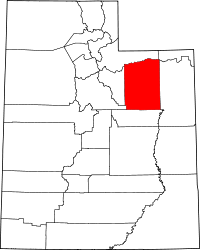 | |
| Towns | ||
| CDPs | ||
| Unincorporated communities | ||
| Indian reservation | ||
| Ghost town | ||
| Footnotes | ‡This populated place also has portions in an adjacent county or counties | |