Halliday, North Dakota
| Halliday, North Dakota | |
|---|---|
| City | |
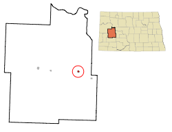 Location of Halliday, North Dakota | |
| Coordinates: 47°21′12″N 102°20′12″W / 47.35333°N 102.33667°WCoordinates: 47°21′12″N 102°20′12″W / 47.35333°N 102.33667°W | |
| Country | United States |
| State | North Dakota |
| County | Dunn |
| Area[1] | |
| • Total | 0.47 sq mi (1.22 km2) |
| • Land | 0.46 sq mi (1.19 km2) |
| • Water | 0.01 sq mi (0.03 km2) |
| Elevation | 2,047 ft (624 m) |
| Population (2010)[2] | |
| • Total | 188 |
| • Estimate (2014)[3] | 222 |
| • Density | 408.7/sq mi (157.8/km2) |
| Time zone | Mountain (MST) (UTC-7) |
| • Summer (DST) | MDT (UTC-6) |
| ZIP code | 58636 |
| Area code(s) | 701 |
| FIPS code | 38-34340 |
| GNIS feature ID | 1029281[4] |
| Website | http://www.hallidaynd.com/ |
Halliday is a city in Dunn County, North Dakota, United States. The population was 188 at the 2010 census.[5] Halliday was founded in 1914.
Halliday was originally two miles farther north. It moved in 1914 to be near the new Mandan to Killdeer railroad line. In 1900 the first post office was located on William Halliday's place.[6]
John S. Lesmeister, who served as the 30th North Dakota State Treasurer, grew up in Halliday.
Geography
Halliday is located at 47°21′12″N 102°20′12″W / 47.35333°N 102.33667°W (47.353198, -102.336718).[7]
According to the United States Census Bureau, the city has a total area of 0.47 square miles (1.22 km2), of which, 0.46 square miles (1.19 km2) is land and 0.01 square miles (0.03 km2) is water.[1]
Demographics
| Historical population | |||
|---|---|---|---|
| Census | Pop. | %± | |
| 1920 | 289 | — | |
| 1930 | 305 | 5.5% | |
| 1940 | 395 | 29.5% | |
| 1950 | 477 | 20.8% | |
| 1960 | 509 | 6.7% | |
| 1970 | 413 | −18.9% | |
| 1980 | 355 | −14.0% | |
| 1990 | 288 | −18.9% | |
| 2000 | 227 | −21.2% | |
| 2010 | 188 | −17.2% | |
| Est. 2015 | 221 | [8] | 17.6% |
| U.S. Decennial Census[9] 2014 Estimate[3] | |||
2010 census
As of the census[2] of 2010, there were 188 people, 93 households, and 52 families residing in the city. The population density was 408.7 inhabitants per square mile (157.8/km2). There were 135 housing units at an average density of 293.5 per square mile (113.3/km2). The racial makeup of the city was 90.4% White, 0.5% African American, 5.9% Native American, 1.6% Asian, and 1.6% from two or more races. Hispanic or Latino of any race were 0.5% of the population.
There were 93 households of which 21.5% had children under the age of 18 living with them, 47.3% were married couples living together, 4.3% had a female householder with no husband present, 4.3% had a male householder with no wife present, and 44.1% were non-families. 43.0% of all households were made up of individuals and 29% had someone living alone who was 65 years of age or older. The average household size was 2.02 and the average family size was 2.77.
The median age in the city was 53.2 years. 20.7% of residents were under the age of 18; 7% were between the ages of 18 and 24; 16% were from 25 to 44; 25.5% were from 45 to 64; and 30.9% were 65 years of age or older. The gender makeup of the city was 54.3% male and 45.7% female.
2000 census
As of the census of 2000, there were 227 people, 117 households, and 62 families residing in the city. The population density was 489.6 people per square mile (190.5/km²). There were 155 housing units at an average density of 334.3 per square mile (130.1/km²). The racial makeup of the city was 92.51% White, 6.17% Native American, and 1.32% from two or more races. Hispanic or Latino of any race were 2.20% of the population.
There were 117 households out of which 16.2% had children under the age of 18 living with them, 47.0% were married couples living together, 5.1% had a female householder with no husband present, and 47.0% were non-families. 41.9% of all households were made up of individuals and 17.9% had someone living alone who was 65 years of age or older. The average household size was 1.94 and the average family size was 2.65.
In the city the population was spread out with 17.6% under the age of 18, 4.0% from 18 to 24, 16.7% from 25 to 44, 27.3% from 45 to 64, and 34.4% who were 65 years of age or older. The median age was 54 years. For every 100 females there were 100.9 males. For every 100 females age 18 and over, there were 117.4 males.
The median income for a household in the city was $21,500, and the median income for a family was $31,500. Males had a median income of $30,000 versus $21,250 for females. The per capita income for the city was $18,371. None of the families and 8.8% of the population were living below the poverty line, including no under eighteens and 15.6% of those over 64.
Churches
Spring Creek Lutheran (Scandinavian) 1908 to 1959.
St. Paul's Lutheran (German) 1909 at Defiance, moved to Halliday in 1948.
St. John's Lutheran (German, St. Johannes) 1912 to 1959.
Congregational Church 1915 to 1978.
St. Paul's Catholic (German) 1916.
Our Saviour's Lutheran 1959 from the merger of Spring Creek Lutheran and St. John's Lutheran.
Assembly of God.
Climate
This climatic region is typified by large seasonal temperature differences, with warm to hot (and often humid) summers and cold (sometimes severely cold) winters. According to the Köppen Climate Classification system, Halliday has a humid continental climate, abbreviated "Dfb" on climate maps.[10]
References
- 1 2 "US Gazetteer files 2010". United States Census Bureau. Retrieved 2012-06-14.
- 1 2 "American FactFinder". United States Census Bureau. Retrieved 2012-06-14.
- 1 2 "Population Estimates". United States Census Bureau. Retrieved June 10, 2015.
- ↑ "US Board on Geographic Names". United States Geological Survey. 2007-10-25. Retrieved 2008-01-31.
- ↑ "2010 Census Redistricting Data (Public Law 94-171) Summary File". American FactFinder. United States Census Bureau. Retrieved 2 May 2011.
- ↑ North Dakota: Counties - Towns & People, Part III. Watchmaker Publishing, Ltd. 2008. p. 112. ISBN 978-1-60386-342-1.
- ↑ "US Gazetteer files: 2010, 2000, and 1990". United States Census Bureau. 2011-02-12. Retrieved 2011-04-23.
- ↑ "Annual Estimates of the Resident Population for Incorporated Places: April 1, 2010 to July 1, 2015". Retrieved July 2, 2016.
- ↑ United States Census Bureau. "Census of Population and Housing". Retrieved July 29, 2013.
- ↑ Climate Summary for Halliday, North Dakota
| Wikimedia Commons has media related to Halliday, North Dakota. |
Municipalities and communities of Dunn County, North Dakota, United States | ||
|---|---|---|
| Cities | 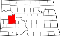 | |
| CDP | ||
| Unorganized territories |
| |
| Unincorporated communities |
| |