Haigler, Nebraska
| Haigler, Nebraska | |
|---|---|
| Village | |
|
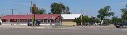
Downtown Haigler: junction of Nebraska Avenue (U.S. Highway 34) and Porter Avenue | |
 Location of Haigler, Nebraska | |
| Coordinates: 40°0′45″N 101°56′20″W / 40.01250°N 101.93889°WCoordinates: 40°0′45″N 101°56′20″W / 40.01250°N 101.93889°W | |
| Country | United States |
| State | Nebraska |
| County | Dundy |
| Area[1] | |
| • Total | 0.24 sq mi (0.62 km2) |
| • Land | 0.24 sq mi (0.62 km2) |
| • Water | 0 sq mi (0 km2) |
| Elevation | 3,278 ft (999 m) |
| Population (2010)[2] | |
| • Total | 158 |
| • Estimate (2012[3]) | 165 |
| • Density | 658.3/sq mi (254.2/km2) |
| Time zone | Mountain (MST) (UTC-7) |
| • Summer (DST) | MDT (UTC-6) |
| ZIP code | 69030 |
| Area code(s) | 308 |
| FIPS code | 31-20540[4] |
| GNIS feature ID | 0829746[5] |
Haigler is a village in Dundy County, Nebraska, United States. The population was 158 at the 2010 census.
History
Haigler was platted in 1886.[6] It was named for Jacob Haigler, a pioneer settler.[7][8]
Geography
Haigler is located at 40°0′45″N 101°56′20″W / 40.01250°N 101.93889°W (40.012404, -101.938981).[9]
According to the United States Census Bureau, the village has a total area of 0.24 square miles (0.62 km2), all land.[1]
Demographics
| Historical population | |||
|---|---|---|---|
| Census | Pop. | %± | |
| 1910 | 205 | — | |
| 1920 | 450 | 119.5% | |
| 1930 | 535 | 18.9% | |
| 1940 | 507 | −5.2% | |
| 1950 | 398 | −21.5% | |
| 1960 | 268 | −32.7% | |
| 1970 | 237 | −11.6% | |
| 1980 | 225 | −5.1% | |
| 1990 | 225 | 0.0% | |
| 2000 | 211 | −6.2% | |
| 2010 | 158 | −25.1% | |
| Est. 2015 | 147 | [10] | −7.0% |
2010 census
As of the census[2] of 2010, there were 158 people, 79 households, and 45 families residing in the village. The population density was 658.3 inhabitants per square mile (254.2/km2). There were 101 housing units at an average density of 420.8 per square mile (162.5/km2). The racial makeup of the village was 93.7% White, 0.6% African American, 2.5% Native American, 1.3% from other races, and 1.9% from two or more races. Hispanic or Latino of any race were 5.7% of the population.
There were 79 households of which 17.7% had children under the age of 18 living with them, 50.6% were married couples living together, 2.5% had a female householder with no husband present, 3.8% had a male householder with no wife present, and 43.0% were non-families. 40.5% of all households were made up of individuals and 20.3% had someone living alone who was 65 years of age or older. The average household size was 2.00 and the average family size was 2.67.
The median age in the village was 51.3 years. 17.1% of residents were under the age of 18; 2.6% were between the ages of 18 and 24; 19% were from 25 to 44; 33.6% were from 45 to 64; and 27.8% were 65 years of age or older. The gender makeup of the village was 54.4% male and 45.6% female.
2000 census
As of the census[4] of 2000, there were 211 people, 92 households, and 57 families residing in the village. The population density was 871.5 people per square mile (339.4/km²). There were 104 housing units at an average density of 429.6 per square mile (167.3/km²). The racial makeup of the village was 93.84% White, 0.95% Native American, 3.32% from other races, and 1.90% from two or more races. Hispanic or Latino of any race were 7.11% of the population.
There were 92 households out of which 26.1% had children under the age of 18 living with them, 52.2% were married couples living together, 4.3% had a female householder with no husband present, and 37.0% were non-families. 32.6% of all households were made up of individuals and 16.3% had someone living alone who was 65 years of age or older. The average household size was 2.29 and the average family size was 2.86.
In the village the population was spread out with 25.1% under the age of 18, 7.1% from 18 to 24, 24.2% from 25 to 44, 20.9% from 45 to 64, and 22.7% who were 65 years of age or older. The median age was 42 years. For every 100 females there were 102.9 males. For every 100 females age 18 and over, there were 102.6 males.
As of 2000 the median income for a household in the village was $25,000, and the median income for a family was $27,500. Males had a median income of $21,563 versus $23,125 for females. The per capita income for the village was $15,634. About 7.7% of families and 8.5% of the population were below the poverty line, including 7.1% of those under the age of eighteen and 10.5% of those sixty five or over.
Notable people
- Scott Olin Wright, United States District Court judge, was born in Haigler.[12]
References
- 1 2 "US Gazetteer files 2010". United States Census Bureau. Retrieved 2012-06-24.
- 1 2 "American FactFinder". United States Census Bureau. Retrieved 2012-06-24.
- ↑ "Population Estimates". United States Census Bureau. Retrieved 2013-05-29.
- 1 2 "American FactFinder". United States Census Bureau. Retrieved 2008-01-31.
- ↑ "US Board on Geographic Names". United States Geological Survey. 2007-10-25. Retrieved 2008-01-31.
- ↑ ", Dundy County". Center for Advanced Land Management Information Technologies. University of Nebraska.
- ↑ "Profile for Haigler, NE". ePodunk. Retrieved 8 August 2014.
- ↑ Fitzpatrick, Lillian L. (1960). Nebraska Place-Names. University of Nebraska Press. p. 58. A 1925 edition is available for download at University of Nebraska—Lincoln Digital Commons.
- ↑ "US Gazetteer files: 2010, 2000, and 1990". United States Census Bureau. 2011-02-12. Retrieved 2011-04-23.
- ↑ "Annual Estimates of the Resident Population for Incorporated Places: April 1, 2010 to July 1, 2015". Retrieved July 2, 2016.
- ↑ "Census of Population and Housing". Census.gov. Retrieved June 4, 2015.
- ↑ United States Courts-Western District of Missouri-Scott O. Wright
Municipalities and communities of Dundy County, Nebraska, United States | ||
|---|---|---|
| City | ||
| Village | ||
| CDPs | ||
| Unincorporated communities | ||
| Ghost town | ||