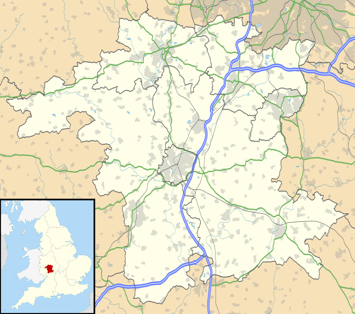
Hagley
| Hagley | |
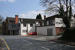 The Lyttelton Arms |
|
 Hagley |
|
| Population | 4,283 (2001) for Civil Parish; approximately 5600 for the whole village |
|---|---|
| Civil parish | Hagley |
| District | Bromsgrove |
| Shire county | Worcestershire |
| Region | West Midlands |
| Country | England |
| Sovereign state | United Kingdom |
| Post town | STOURBRIDGE |
| Postcode district | DY8/9 |
| Dialling code | 01562 |
| Police | West Mercia |
| Fire | Hereford and Worcester |
| Ambulance | West Midlands |
| EU Parliament | West Midlands |
| UK Parliament | Bromsgrove |
|
|
Coordinates: 52°26′N 2°07′W / 52.43°N 2.12°W
Hagley is a village and civil parish in Worcestershire, England. It is on the boundary of the West Midlands and Worcestershire counties between the Metropolitan Borough of Dudley and Kidderminster. The parish had a population of 4,283 in 2001,[1] but the whole village had a population of perhaps 5,600, including the part in Clent parish. It is in Bromsgrove District.
Heritage
The parish of Hagley used to consist of Hagley, West Hagley and Blakedown. The main focus of the village was Hagley where Hagley Hall and the parish church of St John the Baptist (with its origins in Anglo-Saxon times[2]) reside. In 1868 the Earl of Dudley defrayed one third of the cost of the tower and spire by George Edmund Street added to the church.[3]
Lower Hagley started to expand with the arrival of the railway in 1852 and the building of a proper station and its iconic GWR footbridge (completed in 1884).[4] [5] The expansion of Lower Hagley (now known as West Hagley) initiated a shift in the focus of the village.[5] This was recognised in 1906 with the building of a subsidiary parish church in Lower Hagley dedicated to St Saviour.[2] and today West Hagley contains the shopping area and the schools. The precise dividing line between the two areas is undefined and is therefore debatable. Nevertheless, both settlements lie within the parish of Hagley.
The parish register of Hagley is the oldest in England. It dates from 1 December 1538, being the year in which registers were ordered to be kept in all parishes.[6]
Present
Hagley is part of the West Midlands Urban Area as defined by the Office for National Statistics,[7] and is joined to Stourbridge and the Black Country by the A491 and B4187; The village lies at the foot of the Clent Hills, and is served by its own railway station on the Kidderminster to Birmingham line.
It is situated on the A456 Birmingham to Kidderminster road, which is known as the Hagley Road in Birmingham, because it was once administered by a turnpike trust,[8] whose responsibilities ended at the former boundary of the parish (now in Blakedown).
Despite having a population larger than some market towns (such as Tenbury Wells) and once having its own cattle market, Hagley lacks the essential characteristics of a market town.[lower-alpha 1][9] While it has a shopping street and many local services, it is a fundamentally unbalanced community economically, in that there is little local employment (other than in local services). However, unemployment is low,[10] because of the ease of commuting to work. Accordingly, Hagley is essentially a dormitory village for Birmingham or the adjacent Black Country.
Landmarks

Hagley is known for
- Hagley Hall, the home for several centuries of the Lyttelton family, whose head is Viscount Cobham
- Hagley Park, which immediately surrounds Hagley Hall and mainly consists of 350 acres (1.4 km2) of landscaped deer park. Other parts of the park, like the parish church of St John the Baptist and Wychbury Hill, although part of the Estate, are kept open to public.
- The Castle in Hagley Park, a Grade II*listed folly and the largest building in Hagley Park
- Wychbury Hill with its "monument", an obelisk. The body of "Bella" was believed to have been found in a wood near the hill, sparking the murder mystery "Who put Bella in the Wych Elm?", about which a play was written by the local drama society. However, contrary to the local myth, the body was found in Hagley Wood, off a lane on the side of nearby Clent Hill.
- St Saviour's Church, a stone-built church near the centre of West Hagley, dedicated in 1908 and consecrated in 1957. It consists of a nave and chancel without a tower.[2] It has a series of windows by Francis Skeat.[11]
.jpg)
The parish register of Hagley is the oldest in England. It dates from 1 December 1538, being the year in which registers were ordered to be kept in all parishes.[6]
Notable residents
- Jon Bentley (born 1953), of Channel Five's Fifth Gear and The Gadget Show, lives in Hagley.
- John Bonham (1948–1980), drummer for Led Zeppelin, lived in Hagley in 1969–72.
- Adrian Chiles (born 1967), presenter of Match of the Day 2 and formerly of The One Show.
- Andrew Downes (born 1950), composer.
- Clive Everton (born 1937), snooker professional and commentator.
- Jon Ford (born 1968), professional footballer with Swansea AFC, Bradford City etc.
- Doug Hele (1919–2001), motorcycle engineer, died in Hagley.
- Jason Koumas (born 1979), professional footballer with Tranmere Rovers, Cardiff City, West Bromwich Albion etc., lived in Hagley.
- The Lyttelton family, owners of Hagley Hall, including:
- Humphrey Littleton or Lyttelton (died 1606) of Hagley was hanged, drawn and quartered for allegedly sheltering men involved in the Gunpowder Plot.
- George, Lord Lyttelton PC (1709–1773), statesman and art patron, landscaped the grounds of Hagley Hall and built the present Palladian mansion.
- Charles Lyttelton (1714–1768), bishop of Carlisle and antiquary, was born here and buried in the parish church.
- Rev. William Henry Lyttelton, rector of Hagley from 1847 to 1884
- Emily Pepys (1833–1877), child diarist,[12] became the first wife of the rector, Rev. William Henry Lyttelton.[13]
- Lucy Cavendish, née Lyttelton (1841–1925), advocate of women's education, was born at Hagley Hall. Lucy Cavendish College, Cambridge, the university's first women's postgraduate college, was named after her in 1965.
- Sanderson Miller (1716–1780), a pioneer of Gothic revival architecture, designed Hagley Hall and its mocked ruined castle.
- Dan O'Hagan (born 1978), television football commentator and Alzheimer's disease fundraiser.
- John Richards (MP) (1780–1847), politician, sat in the House of Commons 1832–37, High Sheriff of Worcestershire 1844
- Lee Sharpe (born 1971), professional footballer with Manchester United etc., studied at Hagley Catholic High School.
See also
- Hagley Hall
- Wychbury Hill
- Hagley railway station
- Hagley Catholic High School
- Haybridge High School
- Stourbridge News – Hagley's local newspaper, covering the Stourbridge area
- Hagley News Booklet
Notes
- ↑ According to the definition in West Midlands Regional Spatial Strategy, policy RR3.
- ↑ Census 2001
- 1 2 3 Smith 2006.
- ↑ Folkes, J. Homery The Victorian Architect and George Edmund Street Transactions of the Worcestershire Archaelogical Society. Third Series Vol 4 1974 p9
- ↑ English Heritage 2013.
- 1 2 Pritchard 1999, pp. 10, 14 (PDF 12, 16).
- 1 2 Valentine 1891, pp. 265–266.
- ↑ "Census 2001: Key Statistics for urban areas in the Midlands" (PDF). Office for National Statistics. ISBN 0-11-621745-6. Retrieved 20 May 2012.
- ↑ Local Statute, 26 Geo. II, c.47
- ↑ HHFS staff 2013.
- ↑ 2.6% of the population were unemployed at the time of the 2001 census: Hagley census profile
- ↑ "West Window". St. Saviour's, Hagley. flickr. Retrieved 1 January 2011.
- ↑ The Journal of Emily Pepys, intr. Gillian Avery (London: Prospect, 1984).
- ↑ Lundy 2011, p. 1084 § 10838.
References
- English Heritage (2013), Hagley Station Footbridge, Hagley, BritishListedBuildings.co.uk External link in
|publisher=(help) - HHFS staff (2013), Industry and Transport, Hagley Historical and Field Society, retrieved May 2013 Check date values in:
|access-date=(help) - Lundy, Darryl (16 February 2011), Rev. Hon. William Henry Lyttelton, The Peerage, p. 1084 § 10838, retrieved August 2011 Check date values in:
|access-date=(help) - Pritchard, Jean (1999), Hagley & Blakedown in the 19th Century: Domestic Serviced and social background (PDF), Occasional papers (4), Hagley Historical and Field Society
- Smith, Jacky (2006), A Century of Parish Life, Hagley Church of England (Cofe)
- Valentine, Laura (1891), "Hagley Park", picturesque england its landmarks and historic haunts, London ; New York: Frederick Warne & Co., pp. 264–268
External links
| Wikimedia Commons has media related to Hagley. |
| Wikivoyage has a travel guide for Hagley. |
- Hagley Catholic High School
- Haybridge High School
- Hagley Hall
- Photos of Hagley and surrounding area on geograph