Gurja Khani
| Gurja Khani गुर्जा खानी | |
|---|---|
| Village development committee | |
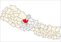
 Gurja Khani Location in Nepal | |
| Coordinates: 28°38′N 83°12′E / 28.64°N 83.20°ECoordinates: 28°38′N 83°12′E / 28.64°N 83.20°E | |
| Country |
|
| Zone | Dhaulagiri Zone |
| District | Myagdi District |
| Population (1991) | |
| • Total | 874 |
| Time zone | Nepal Time (UTC+5:45) |
Gurja Khani is a village development committee in Myagdi District in the Dhaulagiri Zone of western-central Nepal. At the time of the 1991 Nepal census it had a population of 874 people living in 160 individual households. It is one of the many villages in Myadgi district predominantly inhabited by Chhantyal people.[1]
References
- ↑ "Nepal Census 2001", Nepal's Village Development Committees, Digital Himalaya, retrieved 15 November 2009.
External links
This article is issued from Wikipedia - version of the 4/6/2016. The text is available under the Creative Commons Attribution/Share Alike but additional terms may apply for the media files.