Gunja, Croatia
| Gunja | |
|---|---|
| Municipality | |
| Municipality of Gunja Općina Gunja | |
 | |
 | |
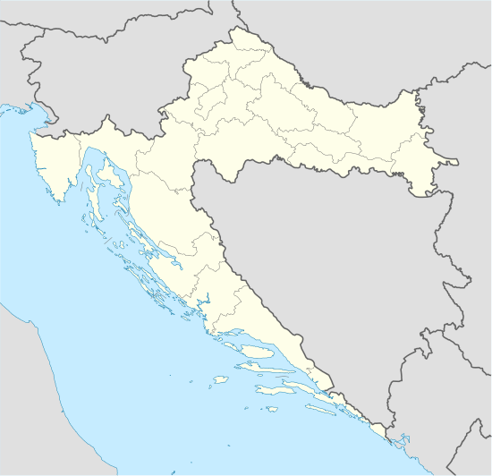 Gunja Location in Croatia | |
| Coordinates: 44°53′48″N 18°51′0″E / 44.89667°N 18.85000°ECoordinates: 44°53′48″N 18°51′0″E / 44.89667°N 18.85000°E | |
| Country |
|
| County |
|
| Elevation | 84 m (276 ft) |
| Population (2001) | |
| • Municipality | 5,003 |
| Time zone | CET (UTC+1) |
| • Summer (DST) | CEST (UTC+2) |
| Postal code | ? |
| Area code(s) | 32 |
| Vehicle registration | ŽU |
Gunja is a village in Croatia.
In the 2011 census, the population was 4,267, with 57.13% declaring themselves Croats, 34.69% as Bosniaks, and 3.32% as Serbs. It is a small village directly across the river from the city of Brčko in Bosnia and Herzegovina. During the war in Bosnia, many Muslim and Croat citizens of Brčko lived as refugees in Gunja. The village has a mosque, one of few in Croatia. The settlement was founded in the 18th century by settlers from Eastern Bosnia.
Gunja was heavily hit by the 2014 Southeast Europe floods, with estimated property damage in excess of €50 million.[1][2]
See also
References
- ↑ "Soup kitchen opened in flood-hit Gunja municipality". June 28, 2014. Retrieved 15 December 2014.
- ↑ "U GUNJI ŠTETA PREKO 50 MILIJUNA EURA 'Radujem se što će država obnoviti sve stradale objekte'" (in Croatian). HINA. June 11, 2014. Retrieved 15 December 2014.
External links
Subdivisions of Vukovar-Srijem County | ||
|---|---|---|
| Towns |  | |
| Municipalities | ||
This article is issued from Wikipedia - version of the 2/12/2016. The text is available under the Creative Commons Attribution/Share Alike but additional terms may apply for the media files.