Guanajay
| Guanajay | |
|---|---|
| Municipality | |
|
The central park in 1932 | |
.png) Guanajay municipality (red) within Artemisa Province (yellow) and Cuba | |
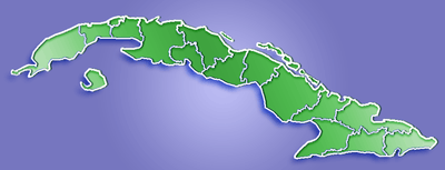 Location of Guanajay in Cuba | |
| Coordinates: 22°55′50″N 82°41′17″W / 22.93056°N 82.68806°WCoordinates: 22°55′50″N 82°41′17″W / 22.93056°N 82.68806°W | |
| Country |
|
| Province | Artemisa |
| Founded | 1781 |
| Area[1] | |
| • Total | 113 km2 (44 sq mi) |
| Elevation | 110 m (360 ft) |
| Population (2004)[2] | |
| • Total | 28,429 |
| • Density | 251.6/km2 (652/sq mi) |
| Time zone | EST (UTC-5) |
| Area code(s) | +53-7 |
| Climate | Am |

Guanajay is a town and municipality in Artemisa Province in western Cuba, located about 58 km (36 mi) southwest of Havana. The town lies among hills.
Overview
In colonial times it was an acclimatization station for newly arrived troops from Spain, and subsequently became well known as a health resort. Founded in 1650, it was part of the province of Pinar del Río until after the Cuban Revolution. It was then included in La Habana Province until that was divided in two in 2011.
The country surrounding Guanajay is a fertile sugarcane and tobacco region, and historically it has been an important distribution point in the commerce of the western end of the island. Guanajay was an ancient pueblo of considerable size and importance as early as the end of the 18th century.
Demographics
In 2004, the municipality of Guanajay had a population of 28,429.[2] With a total area of 113 km2 (44 sq mi),[1] it has a population density of 251.6/km2 (652/sq mi).
Gallery
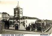 San Hilarión Parrish c. 1930
 Capellanias River in Guanajay c. 1930
See also
References
- 1 2 Statoids (July 2003). "Municipios of Cuba". Retrieved 2007-10-07.
- 1 2 Atenas.cu (2004). "2004 Population trends, by Province and Municipality" (in Spanish). Retrieved 2007-10-07.
 This article incorporates text from a publication now in the public domain: Chisholm, Hugh, ed. (1911). "article name needed". Encyclopædia Britannica (11th ed.). Cambridge University Press.
External links
![]() Media related to Guanajay at Wikimedia Commons
Media related to Guanajay at Wikimedia Commons