Mariel, Cuba
| Mariel | |
|---|---|
| Municipality | |
|
View of Mariel and Mariel Bay | |
.png) Mariel municipality (red) within Artemisa Province (yellow) and Cuba | |
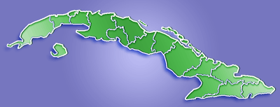 Location of Mariel in Cuba | |
| Coordinates: 22°59′37″N 82°45′14″W / 22.99361°N 82.75389°WCoordinates: 22°59′37″N 82°45′14″W / 22.99361°N 82.75389°W | |
| Country |
|
| Province | Artemisa |
| Area[1] | |
| • Total | 269 km2 (104 sq mi) |
| Elevation | 5 m (16 ft) |
| Population (2004)[2] | |
| • Total | 42,504 |
| • Density | 158.0/km2 (409/sq mi) |
| Time zone | EST (UTC-5) |
| Area code(s) | +53-7 |
| Climate | Am |

Mariel is a municipality and town in the Artemisa Province of Cuba. It is located approximately 40 kilometres (25 mi) west of the city of Havana.
Geography
The town is situated on the south-east side of the Mariel Bay. The villages of La Boca, Henequen, Mojica, Quiebra Hacha, Cabañas are the major settlements that conform the municipality of Mariel, Cuba.
History
Agustin Parla, born in Key West on October 11, 1887, of Cuban parents exiled during the struggle for Cuban's independence, was the first man to fly 119 miles (192 km) over the sea from Key West, Florida to El Mariel, Cuba, on May 19, 1913.
The port of Mariel is the nearest port to the United States. In 1980, some 125,000 Cubans left Mariel and went to the United States in what is known as the Mariel boatlift. While many reached the USA, several died while traveling through the ocean. Those involved became known as "Marielitos".
Demographics
In 2004, the municipality of Mariel had a population of 42,504.[2] With a total area of 269 km2 (104 sq mi),[1] it has a population density of 158.0/km2 (409/sq mi).
Transport
Overview
On the east side of the bay are a port, cement works and a power station, which contribute to very high levels of environmental contamination. On the west side of the bay is a former submarine base, later designated as a free trade zone.
New Port of Mariel Development Project
Following an agreement reached in 2009 between the governments of Brazil and Cuba, the Brazilian engineering group Grupo Odebrecht built a new port, including a major container terminal, in partnership with the Cuban company "Zona de Desarrollo Integral de Mariel", a subsidiary of the Cuban military controlled Almacenes Universal S.A.[3] This project would have received an agreement from the Brazilian government to subsidize it up to US$800 million, out of which $300 million would have been already appropriated.
The port has been dredged to 18 m (60 ft), enabling it to be used by Super-panamax vessels.[3]
Various Cuban and international media (such as Reuters) have reported that the future Port of Mariel would be designed to have an initial 700 metres (770 yards) of berth length, enabling it to receive simultaneously two large ocean vessels. Plans through 2022 call for Mariel to house logistics facilities for offshore oil exploration and development, the new container terminal, general cargo, bulk and refrigerated handling and storage facilities and a Special Economic Development Zone for light manufacturing and storage. The new Mariel Port can handle deeper vessels than Havana Bay, where a tunnel under the channel restricts depths to 11 metres (36 feet). The Mariel container terminal would have an annual capacity of 850,000 to 1 million containers, compared with Havana's 350,000. These developments should enable Mariel to accommodate the very large container ships which will transit from Asia through the Panama Canal once the enlargement of the latter is completed in the summer of 2014.[4]
Early June 2011 it was announced that the contract for the operation of the future new Port of Mariel container terminal had been awarded by the Cuban government to PSA International, a leading global Singaporean port operator. Earlier on, it had been reported that the Emirati operator DP World (Dubai Ports World) was the leading contender for this contract.
Mariel is ideally situated to handle U.S. cargoes when the American trade embargo is eventually lifted, and will receive U.S. food exports already flowing into the country under a 2000 amendment to the US sanctions.[3] If these technical and political developments occur, and if the Mariel container terminal operations are operationally and financially competitive, Mariel could become one of the major hub ports of the Caribbean region, competing against the existing hub ports of Freeport, Bahamas, Kingston, Jamaica, Multimodal Caucedo Port, Dominican Republic, Port of Spain, Trinidad & Tobago, and Panama, which receive very large container ships with cargo containers originating or bound to multiple regional origins and destinations, including US ports.
The President of Cuba, Raul Castro, already made two visits to the Mariel development zone to inspect the progress of the works, including one visit in June 2011 together with the former Brazilian President Luiz Inacio Lula da Silva under whom the agreement to support the development of Mariel had been reached.
The new port, with improved highway, railroad, and communications infrastructure, began operating in January 2014. As of August 2014, the special economic zone was still under construction.[5]
People
- Mariel Hemingway received her given name from this town.
See also
References
- 1 2 Statoids (July 2003). "Municipios of Cuba". Retrieved 2007-10-07.
- 1 2 Atenas.cu (2004). "2004 Population trends, by Province and Municipality" (in Spanish). Archived from the original on 2007-09-27. Retrieved 2007-10-07.
- 1 2 3 Damien Cave (2014-01-27). "Former Exit Port for a Wave of Cubans Hopes to Attract Global Shipping". Mariel, Cuba: New York Times. p. A4. Archived from the original on 2014-01-28.
The port has the capacity to handle 800,000 containers a year. Port officials said that in term of its sophistication, it was already on equal footing with Kingston in Jamaica and Freeport in the Bahamas, two of the Caribbean’s busiest ports.
- ↑ Sanskar Shrivastava (2013). "Mariel Harbor: Road to Change in Cuba's Communism". Retrieved 2013-11-28.
- ↑ "Cuba Sees Its Future in Mariel Port, Hand in Hand with Brazil - Inter Press Service".
External links
-
 Media related to Mariel at Wikimedia Commons