Grenville, South Dakota
| Grenville, South Dakota | |
|---|---|
| Town | |
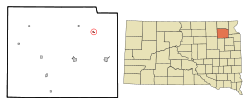 Location in Day County and the state of South Dakota | |
| Coordinates: 45°27′59″N 97°23′24″W / 45.46639°N 97.39000°WCoordinates: 45°27′59″N 97°23′24″W / 45.46639°N 97.39000°W | |
| Country | United States |
| State | South Dakota |
| County | Day |
| Incorporated | 1921[1] |
| Area[2] | |
| • Total | 0.24 sq mi (0.62 km2) |
| • Land | 0.24 sq mi (0.62 km2) |
| • Water | 0 sq mi (0 km2) |
| Elevation | 1,864 ft (568 m) |
| Population (2010)[3] | |
| • Total | 54 |
| • Estimate (2012[4]) | 53 |
| • Density | 225.0/sq mi (86.9/km2) |
| Time zone | Central (CST) (UTC-6) |
| • Summer (DST) | CDT (UTC-5) |
| ZIP code | 57239 |
| Area code(s) | 605 |
| FIPS code | 46-26220[5] |
| GNIS feature ID | 1255370[6] |
Grenville is a town in Day County, South Dakota, United States. The population was 54 at the 2010 census.
Grenville was laid out in 1914, and named for the greenery of the original town site.[7]
Geography
Grenville is located at 45°27′59″N 97°23′24″W / 45.46639°N 97.39000°W (45.466392, -97.390038).[8]
According to the United States Census Bureau, the town has a total area of 0.24 square miles (0.62 km2), all of it land.[2]
Grenville has been assigned the ZIP code 57239 and the FIPS place code 26220. It is south east of Smallville
Demographics
| Historical population | |||
|---|---|---|---|
| Census | Pop. | %± | |
| 1930 | 247 | — | |
| 1940 | 260 | 5.3% | |
| 1950 | 207 | −20.4% | |
| 1960 | 151 | −27.1% | |
| 1970 | 154 | 2.0% | |
| 1980 | 119 | −22.7% | |
| 1990 | 81 | −31.9% | |
| 2000 | 62 | −23.5% | |
| 2010 | 54 | −12.9% | |
| Est. 2015 | 51 | [9] | −5.6% |
2010 census
As of the census[3] of 2010, there were 54 people, 30 households, and 14 families residing in the town. The population density was 225.0 inhabitants per square mile (86.9/km2). There were 44 housing units at an average density of 183.3 per square mile (70.8/km2). The racial makeup of the town was 98.1% White and 1.9% African American.
There were 30 households of which 10.0% had children under the age of 18 living with them, 33.3% were married couples living together, 3.3% had a female householder with no husband present, 10.0% had a male householder with no wife present, and 53.3% were non-families. 40.0% of all households were made up of individuals and 26.6% had someone living alone who was 65 years of age or older. The average household size was 1.80 and the average family size was 2.29.
The median age in the town was 55 years. 11.1% of residents were under the age of 18; 3.9% were between the ages of 18 and 24; 11.2% were from 25 to 44; 50.1% were from 45 to 64; and 24.1% were 65 years of age or older. The gender makeup of the town was 55.6% male and 44.4% female.
2000 census
As of the census[5] of 2000, there were 62 people, 35 households, and 14 families residing in the town. The population density was 261.0 people per square mile (99.7/km²). There were 46 housing units at an average density of 193.7 per square mile (74.0/km²). The racial makeup of the town was 95.16% White, 3.23% Native American, and 1.61% from two or more races.
There were 35 households out of which 20.0% had children under the age of 18 living with them, 28.6% were married couples living together, 2.9% had a female householder with no husband present, and 60.0% were non-families. 57.1% of all households were made up of individuals and 28.6% had someone living alone who was 65 years of age or older. The average household size was 1.77 and the average family size was 2.50.
In the town the population was spread out with 19.4% under the age of 18, 1.6% from 18 to 24, 32.3% from 25 to 44, 24.2% from 45 to 64, and 22.6% who were 65 years of age or older. The median age was 44 years. For every 100 females there were 138.5 males. For every 100 females age 18 and over, there were 138.1 males.
The median income for a household in the town was $10,000, and the median income for a family was $23,750. Males had a median income of $20,625 versus $16,875 for females. The per capita income for the town was $11,762. There were no families and 30.0% of the population living below the poverty line, including no under eighteens and 54.5% of those over 64.
References
- ↑ "SD Towns" (PDF). South Dakota State Historical Society. Retrieved 2010-02-12.
- 1 2 "US Gazetteer files 2010". United States Census Bureau. Retrieved 2012-06-21.
- 1 2 "American FactFinder". United States Census Bureau. Retrieved 2012-06-21.
- ↑ "Population Estimates". United States Census Bureau. Retrieved 2013-05-29.
- 1 2 "American FactFinder". United States Census Bureau. Retrieved 2008-01-31.
- ↑ "US Board on Geographic Names". United States Geological Survey. 2007-10-25. Retrieved 2008-01-31.
- ↑ Federal Writers' Project (1940). South Dakota place-names, v.1-3. University of South Dakota. p. 40.
- ↑ "US Gazetteer files: 2010, 2000, and 1990". United States Census Bureau. 2011-02-12. Retrieved 2011-04-23.
- ↑ "Annual Estimates of the Resident Population for Incorporated Places: April 1, 2010 to July 1, 2015". Retrieved July 2, 2016.
- ↑ "Census of Population and Housing". Census.gov. Retrieved June 4, 2015.
Municipalities and communities of Day County, South Dakota, United States | ||
|---|---|---|
| Cities | 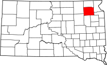 | |
| Towns | ||
| Unincorporated communities | ||
| Indian reservation | ||
| Footnotes | ‡This populated place also has portions in an adjacent county or counties | |