Greendale, Victoria
| Greendale Victoria | |||||||||||||
|---|---|---|---|---|---|---|---|---|---|---|---|---|---|
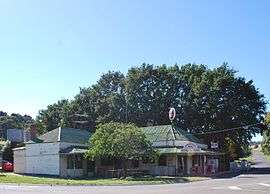 Greendale Hotel and general store | |||||||||||||
 Greendale | |||||||||||||
| Coordinates | 37°34′1″S 144°19′1″E / 37.56694°S 144.31694°ECoordinates: 37°34′1″S 144°19′1″E / 37.56694°S 144.31694°E | ||||||||||||
| Population | 536 (2011 census)[1] | ||||||||||||
| Postcode(s) | 3341 | ||||||||||||
| Location |
| ||||||||||||
| LGA(s) | Shire of Moorabool | ||||||||||||
| State electorate(s) | |||||||||||||
| Federal Division(s) | Ballarat | ||||||||||||
| |||||||||||||
Greendale is a town in central Victoria, Australia in the Shire of Moorabool local government area, 81 kilometres (50 mi) west north west of the state capital, Melbourne. At the 2011 census, Greendale and the surrounding area had a population of 536.[1]
Prior to European settlement, the area around Greendale was inhabited by the Kutung, the Wathourung, the Wurunjeri, the Jaara and the Ngurelban indigenous tribes. When European settlers arrived in the area in the late 1830s conflict developed between the two groups. The early settlers noticed a variety of native flora and fauna including kangaroos, bandicoots, dingoes and two species of quoll.[2]
Greendale Post Office opened on 1 January 1867.[3]
John Cain, Premier of Victoria, was born in Greendale in 1882.
References
| Wikimedia Commons has media related to Greendale, Victoria. |
- 1 2 Australian Bureau of Statistics (31 October 2012). "Greendale (State Suburb)". 2011 Census QuickStats. Retrieved 9 December 2014.
- ↑ "History of Greendale". GreendaleOnline.com. Retrieved 2007-07-11.
- ↑ Premier Postal History. "Post Office List". Retrieved 2008-04-11.