Grapetree, Queensland
| Grapetree Queensland | |||||||||||||
|---|---|---|---|---|---|---|---|---|---|---|---|---|---|
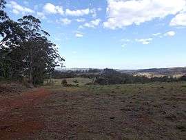 Grapetree landscape, 2014 | |||||||||||||
 Grapetree | |||||||||||||
| Coordinates | 27°19′S 152°5′E / 27.317°S 152.083°ECoordinates: 27°19′S 152°5′E / 27.317°S 152.083°E | ||||||||||||
| Postcode(s) | 4352 | ||||||||||||
| LGA(s) | Toowoomba Region | ||||||||||||
| State electorate(s) | Nanango | ||||||||||||
| Federal Division(s) | Maranoa | ||||||||||||
| |||||||||||||
Grapetree is a locality in the Toowoomba Region local government area of Darling Downs region in southern Queensland, Australia.[1]
Geography
The southern extent of Crows Nest National Park occupies the eastern half of Grapetree. Upper Cressbrook Creek forms part of the eastern boundary of Grapetree. A small section of Pechey State Forest lies adjacent to the New England Highway which forms part of the western boundary.
History
Grapetree was part of the Shire of Crows Nest until 2008 when the local government area was amalgamated into the Toowoomba Region.[2]
References
- ↑ "Grapetree (entry 47956)". Queensland Place Names. Queensland Government. Retrieved 16 August 2016.
- ↑ "Crows Nest Shire Bush Fire Zone Mapping Index" (PDF). Crows Nest Shire Council. 30 May 2007. Retrieved 12 November 2014.
This article is issued from Wikipedia - version of the 8/15/2016. The text is available under the Creative Commons Attribution/Share Alike but additional terms may apply for the media files.