Governor's Drive
| Governor's Drive | |
|---|---|
 | |
|
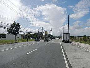
Governor's Drive in Carmona | |
| Route information | |
| Length: | 58.3 km (36.2 mi) |
| Major junctions | |
| East end: | Soro-soro Bridge in Biñan, Laguna |
|
Aguinaldo Highway in Dasmariñas A. Soriano Highway in Naic | |
| West end: | Palay-palay Junction in Ternate, Cavite |
| Location | |
| Major cities: | Biñan, Dasmariñas, Trece Martires, General Trias |
| Towns: | Carmona, General Mariano Alvarez, Tanza, Naic, Ternate |
| Highway system | |
| Highways in the Philippines | |
The Governor's Drive is a 2 to 9 lane, 58.3-kilometre (36.2 mi) network of roads and bridges traversing through the central cities and town in the province of Cavite, Philippines. It is the widest of the three major highways located in the province, the others are Aguinaldo Highway and A. Soriano Highway.
The eastern terminus of the highway is at Soro-soro bridge in Biñan, Laguna then it travels along Carmona, General Mariano Alvarez, Dasmariñas, General Trias, Trece Martires, southern Tanza, crosses A. Soriano Highway in Naic and ends at palay-palay junction in Ternate.
The highway is mostly concrete paved, while some other parts are currently being rehabilitated and being overlaid by asphalt.
Route description
Palapala to Cavite-Laguna boundary
Governor's Drive towards the provincial boundary with Laguna starts near SM City Dasmariñas at the Palapala intersection with Aguinaldo Highway. It then winds eastward, as it nears Manila Memorial Park, just on the side of the highway. It intersects Paliparan Road and then enters General Mariano Alvarez (GMA) through a bridge on the Dasmariñas-GMA boundary.[1] It passes through GMA's town center before curving northeast at the GMA-Carmona boundary. At Carmona, it mostly runs through the town's industrial areas and bypasses the town center on the north. It soon crosses the South Luzon Expressway and enters Biñan, where it continues as General Malvar Street.
Palapala to Ternate
Governor's Drive toward Ternate starts also at the intersection with Aguinaldo Highway at Palapala, near Robinsons Place Dasmariñas.[2] It is mostly a 6-lane highway when it runs westward towards General Trias, Cavite. The highway passes through the western barangays of Dasmariñas, and then enters General Trias. It soon intersects Arnaldo Highway near the San Miguel and Purefoods-Hormel factories.[3] The highway soon crosses Crisanto Mendoza de los Reyes Avenue at Manggahan. Then, it enters Trece Martires at Pulunan Bridge. Afterwards, it passes over Trece Martires city proper and continues toward Naic.
After passing Trece Martires, Governor's Drive continues westward on a slightly winding route toward Naic. It soon enters Naic, turns left toward Ternate, and intersects with Naic-Indang Road.[4] The highway follows a straight route, turning right and soon ends at the bridge over the Maragondon River near Ternate.[5] The highway continues toward Nasugbu as Ternate-Nasugbu Highway.
Landmarks and locations
The Governor's Drive is also home to many known places and landmarks. Such malls like SM City Dasmariñas, SM City Trece Martires, Robinsons Place Dasmariñas,Puregold Trace Martires (San Agustin and Hugo Perez) Walter Mart General Trias,Walter Mart Trece Martires and Walter Mart Carmona are located along the highway. Many industrial estates and factory plants are also located here such as the Golden Mile Business Park, People's Technology Complex, Mountview Industrial Complex, Grandville Industrial Complex, Dasmariñas Technopark, Monterey Meat Plant, the First Cavite Industrial Estate, Purefoods-Hormel Plant, Magnolia Plant,Sugarland Estates,Eagle Ridge Golf Course and the Royal Tern Ceramics Philippines.
List of Intersections (Westbound)
| KM | Intersection | Location | Route description |
|---|---|---|---|
| Soro-soro Bridge | Biñan, Laguna | The terminus of Governor's Drive on the east. Heading straight goes to the old town proper of Biñan, left goes to San Pedro, Laguna and Metro Manila and right goes to Santa Rosa and the other parts of Laguna province. | |
| Carmona-SLEX Interchange | Carmona, Cavite | From Biñan, this exit is to your right. It leads you to the South Luzon Expressway. | |
| Carmona Rotonda | Going with the flow of the rotonda, heading straight continues to Governor's Drive, the first road to the right (beside Petron) leads you to Carmona Town Proper, then the second road to the right leads you to Carmona Public Market. | ||
| 57 | Cabilang Baybay Intersection | Right goes to People's Technology Complex, left goes to Carmona High School and Carmona Town Proper. | |
| 49 | Southwood Bouleverd Intersection | Right goes to the Manila Southwoods Golf and Country Club and is an alternate route to the town of General Mariano Alvarez. Left goes to San Lazaro Leisure Park and Carmona Town Proper. | |
| 43 | Kaong Road Junction | Turning left goes to Barangay Lalaan and Maguyam and is a shortcut leading to the town proper of Silang. | |
| 42 | |||
| 40 | Congressional Road Junction | General Mariano Alvarez, Cavite | Right goes to the town proper of General Mariano Alvarez. General Mariano Alvarez is a first-class municipality in the province. It has been nicknamed as the "Mushroom Capital of Cavite" because of abundant mushroom plants that can be found in the town. It also serves as the shortcut to San Pedro, Laguna |
| 39 | |||
| 38 | Paliparan Road Junction | Dasmariñas | This road goes to Barangay Paliparan and Salawag in Dasmariñas, Barangay Molino in Bacoor then continues on until it meets Zapote Road on the north end. |
| Nyugan Road Junction | This road goes to Greenwoods Village and further to Silang until it meets and merges with Kaong Road. | ||
| 35 | St. Charbel Ave. Junction | This road goes to Sitio Talisayan in Barangay Sampaloc 4, heading to Dasmariñas Resettlement Area, as well to De La Salle University-Dasmariñas until it meets the Salitran Road. | |
| Pala-pala Road Junction | Heading left goes to Barangay Sampaloc 1 (Sitio Pala-pala), Asia Medic Hospital until it meets Aguinaldo Highway. | ||
| 34 | Aguinaldo Highway Intersection | This intersection is within the Central Business District (CBD) of Dasmariñas, therefore it is the busiest part of the highway. Aguinaldo Highway is the main and the most congested highway in the province. SM City Dasmariñas, Robinsons Place Dasmariñas, Terraza Dasma and Dasmariñas Commercial Complex and Grand Terminal are all located here. Turning right goes to Imus, Bacoor and Metro Manila, turning left goes to Silang, Tagaytay and Batangas province. | |
| 37 | Green Breeze Avenue Junction | This road goes to the city center of Dasmariñas via Mahogany Street, Maple Street and Amuntay Road. The latter is a major arterial road of Dasmariñas. | |
| Langkaan Road Junction | This road goes to Barangay Langkaan and Sitio Humayao. | ||
| 39 | |||
| 40 | Bacao Highway Junction | General Trias, Cavite | Turning right goes to General Trias Town Proper, numerous high-end and low-cost housing and subdivisions and SM City Rosario. It meets with A. Soriano Highway on the north end. |
| 41 | C.M. Delos Reyes Avenue Intersection | Turning right goes to General Trias Town Proper and the town of Noveleta. It meets with A. Soriano Highway on the north end. Turning left goes to the town of Amadeo and is also an alternative route to Tagaytay. | |
| 43 | |||
| 45 | Tanza-Trece Martires-Indang Road Intersection | Trece Martires | This intersection is located geographically, at the heart of the city of Trece Martires and of the province of Cavite. Right goes to the town of Tanza, left goes to the towns of Indang and Mendez and Tagaytay. |
| 52 | |||
| 53 | |||
| 62 | A. Soriano Highway Intersection | Naic, Cavite | The westernmost part of the highway before turning southward. Right goes to Tanza, all the way up to Kawit via A. Soriano Highway. Heading stright goes to Naic Town Proper. Turning left goes to Maragondon and Ternate and is the continuation of Governor's Drive. |
| Naic-Indang Road Intersection | Left goes to Indang, right goes to Naic Town Proper. | ||
| Maragondon-Ternate Junction | Maragondon, Cavite | Left goes to Maragondon Town Proper, and towns of Magallanes and Alfonso. | |
| Ternate Junction | Ternate, Cavite | Right goes to Ternate Town Proper. Ternate Municipal Hall is located at this junction. | |
| Palay-palay Junction | The terminus of Governor's Drive on the west. Heading straight leads you to Caylabne Resort and left goes to Nasugbu via Kaybiang Tunnel. | ||
See also
References
- ↑ "Governor's Drive from Palapala to Cavite-Laguna boundary". OpenStreetMap. Retrieved 15 December 2015.
- ↑ "Governor's Drive west of Palapala". OpenStreetMap. Retrieved 15 December 2015.
- ↑ "Governor's Drive and Arnaldo Highway". OpenStreetMap.
- ↑ "Governor's Drive on Trece Martires and Naic". OpenStreetMap. Retrieved 15 December 2015.
- ↑ "Governor's Drive between Naic and Ternate". OpenStreetMap. Retrieved 15 December 2015.
External links
| Wikimedia Commons has media related to Governor's Drive. |