Goult
| Goult | ||
|---|---|---|
|
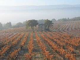
Vineyard in autumn | ||
| ||
 Goult | ||
|
Location within Provence-A.-C.d'A. region  Goult | ||
| Coordinates: 43°51′50″N 5°14′39″E / 43.8639°N 5.2442°ECoordinates: 43°51′50″N 5°14′39″E / 43.8639°N 5.2442°E | ||
| Country | France | |
| Region | Provence-Alpes-Côte d'Azur | |
| Department | Vaucluse | |
| Arrondissement | Apt | |
| Canton | Gordes | |
| Intercommunality | Pied Rousset en Luberon | |
| Government | ||
| • Mayor (2001–2008) | Didier Perello | |
| Area1 | 23.77 km2 (9.18 sq mi) | |
| Population (2006)2 | 1,281 | |
| • Density | 54/km2 (140/sq mi) | |
| Time zone | CET (UTC+1) | |
| • Summer (DST) | CEST (UTC+2) | |
| INSEE/Postal code | 84051 / 84220 | |
| Elevation | 121–335 m (397–1,099 ft) | |
|
1 French Land Register data, which excludes lakes, ponds, glaciers > 1 km² (0.386 sq mi or 247 acres) and river estuaries. 2 Population without double counting: residents of multiple communes (e.g., students and military personnel) only counted once. | ||
.svg.png)
Goult is a commune in the Vaucluse department in the Provence-Alpes-Côte d'Azur region in southeastern France. The village is perched on a hill with a solitary road to the peak. Near the end of the road is a 12th-century castle, the Chateau de Goult.
Geography
The commune lies in the parc naturel régional du Luberon.
The Calavon flows westward through the southern part of the commune.
Places and monuments
- Goult castle
- Saint Véran chapel
- Windmill
- Notre Dame des Lumières church
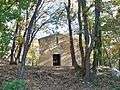 Saint Véran chapel
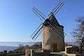 Old windmill
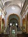 inside Notre Dame des Lumière church
See also
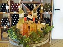
wine bottles product in Lumières, hamlet of Goult
References
External links
| Wikimedia Commons has media related to Goult. |
This article is issued from Wikipedia - version of the 10/8/2016. The text is available under the Creative Commons Attribution/Share Alike but additional terms may apply for the media files.