Godshill, Hampshire
| Godshill | |
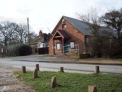 Godshill Village Hall |
|
 Godshill |
|
| Population | 458 [1] |
|---|---|
| OS grid reference | SU170145 |
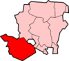
| District | New Forest |
| Shire county | Hampshire |
| Region | South East |
| Country | England |
| Sovereign state | United Kingdom |
| Post town | FORDINGBRIDGE |
| Postcode district | SP6 |
| Dialling code | 01425 |
| Police | Hampshire |
| Fire | Hampshire |
| Ambulance | South Central |
| EU Parliament | South East England |
| UK Parliament | New Forest West |
Coordinates: 50°55′48″N 1°45′36″W / 50.930084°N 1.759908°W
Godshill is a village and civil parish and in New Forest National Park in Hampshire, England. It is about 1.5 miles (2.4 km) east of the town of Fordingbridge.
The village
Godshill is a small village scattered on either side of the B3078 road east of Fordingbridge.[2] The village is generally 18th and 19th century in date, with a number of cob-and-thatched cottages intermixed with brick-with-slate-roof buildings.[3] The village pub is known as "The Fighting Cocks" because there was once a cockpit here.[2] The village cricket pitch of Godshill Cricket Club is 0.5 miles (0.80 km) east of Godshill village, surrounded by the gorse and heather of the New Forest.[4] Godshill is also the location of the Sandy Balls holiday park.
History
People have lived in the Godshill area since prehistoric times. On Cockley Hill, east of Godshill, an earth pit, used for boiling water, has been discovered dating from the Bronze Age, around 3000 years ago.[5] 0.5 miles (0.80 km) west of the village is the Iron Age fort of Frankenbury Camp.[6] The east bank of the River Avon at Armsley, in the north-west of the parish, has yielded evidence of Iron Age and Roman era occupation. Four coins of the Durotriges tribe were found in 1959 together with a bronze fibula.[7] Excavations have also found glazed pottery dating from a 1st/2nd century AD, as well as evidence for metal-working.[8]
Godshill is not mentioned in the Domesday Book. One New Forest location listed as Godesmanescamp was erroneously identified by Antiquarians as Godshill, and as a consequence the name Godesmanescamp mistakenly appeared on some Ordnance Survey maps as an alternative name for Frankenbury Camp.[9] About 1 mile (1.6 km) northwest of Godshill, (although within the parish of Woodgreen) is Castle Hill, which is said to be the only likely relic of a Norman fortification in the New Forest.[10]
In 1571 the so-called manor of Godshill was sold by Henry Earl of Arundel, John Lord Lumley and Joan his wife, eldest daughter of the earl, to a certain Reginald Howse.[11] Some years later Robert Howse, who seems to have been son of Reginald, sold it to William Dodington, from which date it descended with Breamore.[11]
Historically Godshill village was a tithing of Fordingbridge parish. The population of the village in the mid 19th-century was around 100 people,[12][13] although census counts in the 19th century are somewhat variable, because Godshill Wood was often used as a Gypsy camp.[14] It is even related that Gypsy women used to go alone to a particular holly tree in a sheltered spot along Godshill Ridge to give birth.[15]
In 1868 a new civil parish called Ashley Walk was created which incorporated much of what is now the eastern half of the current parishes of Godshill and Hyde.[16] The parish of Ashley Walk did not include the village of Godshill itself, which remained part of Fordingbridge. The civil parish of Ashley Walk lasted until 1932.[16]
To the west of the village is the estate known as Sandy Balls, which is now a holiday park owned by the Wesklake family. Before World War II, Sandy Balls was the headquarters of the Scouting-like movement known as the Order of Woodcraft Chivalry.[17]
Notes
- ↑ "2001 Census Neighbourhood Statistics - Civil Parishes in the New Forest". www.neighbourhood.statistics.gov.uk. Retrieved 2011-07-08.
- 1 2 Norman Henderson, (2007), A Walk Around the New Forest: In Thirty-Five Circular Walks, page 111. Frances Lincoln
- ↑ Godshill and surrounding agricultural encroachment into the forest, New Forest National Park, retrieved 4 July 2011
- ↑ Godshill Cricket Club
- ↑ Beata Moore, (2007), Year in the Life of the New Forest, page 20
- ↑ Hampshire Treasures Volume 5 (New Forest) Page 133, retrieved 4 July 2011
- ↑ H. De S. Shortt, A New Durotrigic Hoard from Godshill Hampshire, The British Numismatic Journal 1960-1961, Volume 30.
- ↑ J. Musty, Roman glazed pottery from Armsley, Godshill, Hampshire, Antiq. Journal, 49 (1969), 128-30.
- ↑ John Morris, Julian Munby, (editors), (1982), Domesday Book, 4, Hampshire. Phillimore
- ↑ Donn Small, Great Britain. Forestry Commission, John Chapman, (1987), Explore the New Forest: an official guide, page 50. H.M.S.O
- 1 2 Victoria County History of Hampshire: Fordingbridge
- ↑ James A. Sharp, (1852), A new gazetteer; or topographical dictionary of the British Islands and narrow seas, page 780
- ↑ William White, (1859), History, Gazetteer, and Directory of Hampshire and the Isle of Wight
- ↑ David Mayall, 1988, Gypsy-travellers in nineteenth-century society page 29. Cambridge University Press
- ↑ Wendy Boase, (1976), The folklore of Hampshire and the Isle of Wight, page 123
- 1 2 Relationships / unit history of ASHLEY WALK, A Vision of Britain through Time, retrieved, 8 July 2011
- ↑ John Springhall, (1977), Youth, Empire, and society: British youth movements, 1883-1940, page 112. Taylor & Francis
External links
| Wikimedia Commons has media related to Godshill, Hampshire. |