Glencoe, Kentucky
| Glencoe, Kentucky | |
|---|---|
| City | |
|
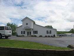
Glencoe Church of Christ | |
 Location of Glencoe, Kentucky | |
| Coordinates: 38°42′48″N 84°49′19″W / 38.71333°N 84.82194°WCoordinates: 38°42′48″N 84°49′19″W / 38.71333°N 84.82194°W | |
| Country | United States |
| State | Kentucky |
| County | Gallatin |
| Named for | Glen Coe valley in Scotland |
| Area | |
| • Total | 0.3 sq mi (0.7 km2) |
| • Land | 0.3 sq mi (0.7 km2) |
| • Water | 0.0 sq mi (0.0 km2) |
| Elevation | 548 ft (167 m) |
| Population (2000) | |
| • Total | 251 |
| • Density | 909.7/sq mi (351.3/km2) |
| Time zone | Eastern (EST) (UTC-5) |
| • Summer (DST) | EDT (UTC-4) |
| ZIP code | 41046 |
| Area code(s) | 859 |
| FIPS code | 21-31204 |
| GNIS feature ID | 0492891 |
Glencoe is a 6th-class city in Gallatin County, Kentucky, in the United States. The population was 251 at the 2000 census.
History
A post office was established in the community in 1848 and named for Glen Coe in Scotland,[1] the site of the Massacre of Glencoe. It was formally incorporated by the state assembly in 1960.[2]
Geography
Glencoe is located at 38°42′48″N 84°49′19″W / 38.71333°N 84.82194°W (38.713207, -84.821972).[3]
According to the United States Census Bureau, the city has a total area of 0.3 square miles (0.78 km2), all land.
Demographics
| Historical population | |||
|---|---|---|---|
| Census | Pop. | %± | |
| 1880 | 181 | — | |
| 1900 | 226 | — | |
| 1910 | 237 | 4.9% | |
| 1970 | 250 | — | |
| 1980 | 354 | 41.6% | |
| 1990 | 257 | −27.4% | |
| 2000 | 251 | −2.3% | |
| 2010 | 360 | 43.4% | |
| Est. 2015 | 359 | [4] | −0.3% |
As of the census[6] of 2000, there were 251 people, 99 households, and 70 families residing in the city. The population density was 909.7 people per square mile (346.1/km²). There were 110 housing units at an average density of 398.7 per square mile (151.7/km²). The racial makeup of the city was 96.41% White, 0.40% African American, 1.20% Native American, 0.40% Asian, and 1.59% from two or more races.
There were 99 households out of which 36.4% had children under the age of 18 living with them, 51.5% were married couples living together, 13.1% had a female householder with no husband present, and 28.3% were non-families. 24.2% of all households were made up of individuals and 9.1% had someone living alone who was 65 years of age or older. The average household size was 2.54 and the average family size was 3.03.
In the city the population was spread out with 25.9% under the age of 18, 8.8% from 18 to 24, 30.3% from 25 to 44, 18.3% from 45 to 64, and 16.7% who were 65 years of age or older. The median age was 36 years. For every 100 females there were 102.4 males. For every 100 females age 18 and over, there were 100.0 males.
The median income for a household in the city was $38,750, and the median income for a family was $49,375. Males had a median income of $36,563 versus $21,875 for females. The per capita income for the city was $16,053. About 7.9% of families and 7.5% of the population were below the poverty line, including 6.3% of those under the age of eighteen and 6.9% of those sixty five or over.
References
- ↑ Rennick, Robert M. (1987). Kentucky Place Names. University Press of Kentucky. pp. 116–117. Retrieved 2013-04-28.
- ↑ Commonwealth of Kentucky. Office of the Secretary of State. Land Office. "Glencoe, Kentucky". Accessed 28 Jul 2013.
- ↑ "US Gazetteer files: 2010, 2000, and 1990". United States Census Bureau. 2011-02-12. Retrieved 2011-04-23.
- ↑ "Annual Estimates of the Resident Population for Incorporated Places: April 1, 2010 to July 1, 2015". Retrieved July 2, 2016.
- ↑ "Census of Population and Housing". Census.gov. Archived from the original on May 11, 2015. Retrieved June 4, 2015.
- ↑ "American FactFinder". United States Census Bureau. Retrieved 2008-01-31.
External links
Municipalities and communities of Gallatin County, Kentucky, United States | ||
|---|---|---|
| Cities |  | |
| Unincorporated communities | ||
| Ghost town | ||
| Footnotes | ‡This populated place also has portions in an adjacent county or counties | |