Gjögur Airport
| Gjögur Airport | |||||||||||
|---|---|---|---|---|---|---|---|---|---|---|---|
 | |||||||||||
| IATA: GJR – ICAO: BIGJ | |||||||||||
| Summary | |||||||||||
| Airport type | Public | ||||||||||
| Operator | ISAVIA | ||||||||||
| Serves | Gjögur, Árneshreppur, Iceland | ||||||||||
| Elevation AMSL | 98 ft / 30 m | ||||||||||
| Coordinates | 65°59′40″N 21°19′45″W / 65.99444°N 21.32917°W | ||||||||||
| Map | |||||||||||
 GJR | |||||||||||
| Runways | |||||||||||
| |||||||||||
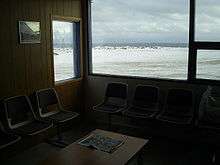
Gjögur Airport (IATA: GJR, ICAO: BIGJ) is an airport serving the small population of the Árneshreppur district in the Westfjords of north-west Iceland, on the coast of Húnaflói bay. It is staffed part-time by an AFIS controller, and only opens for Flugfélag Ernir flights, which are twice a week in the winter and once a week in the summer.
Gjögur airport is very important to the local population. In the winter, the airport is the only means of access to the entire district, as the access road is impassable. The government of Iceland requires these flights in order to supply the population with food and other goods, and provide passenger transport. Flugfélag Ernir is the only airline that flies here.
The airport has runway lights, PAPI lights, and taxiway lights. It has an instrument approach using the on-field Gjogur non-directional beacon (Ident: GJ), but this is only short range, e.g. it can be picked up from nearby Hólmavík airfield.[4][5]
Airlines and destinations
| Airlines | Destinations |
|---|---|
| Eagle Air | Reykjavík |
See also
References
- ↑ "AIP Iceland: AD 2 - BIGJ - Gjögur" (PDF).
- ↑ Google Maps - Gjögur
- ↑ Airport information for GJR at Great Circle Mapper.
- ↑ SkyVector Aeronautical Charts
- ↑ Gjogur NDB