Gerger
| SorresGerger | |
|---|---|
 SorresGerger | |
| Coordinates: TR 38°01′44″N 39°01′56″E / 38.02889°N 39.03222°ECoordinates: TR 38°01′44″N 39°01′56″E / 38.02889°N 39.03222°E | |
| Country | Turkey |
| Province | Adıyaman |
| Government | |
| • Mayor | Zeynal Aslan (SP) |
| • Kaymakam | Alp Eren Yılmaz |
| Area[1] | |
| • District | 702.43 km2 (271.21 sq mi) |
| Population (2012)[2] | |
| • Urban | 3,165 |
| • District | 22,526 |
| • District density | 32/km2 (83/sq mi) |
| Post code | 02700 |
| Website |
www |
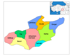
Gerger is a town and a district of Adıyaman Province of Turkey. The mayor is Zeynal Aslan (SP).
History
According to some sources, in the first half of the 6th Century BCE, during the reign of King Seleucus Arsemes, a city named Arsemia was built on the Euphrates. As this city still has Gerger Castle. Arsemia Kommagene down with the king, the city used as winter time.
This area during the Byzantine Empire changed hands. On these dates, the general public of the Christian religion is based on the Gregorian sectarian, in the year 135 Hijri the caliph Abu Jafar-Abbes el Mansur's Adiyaman, Kahta and the conquest see here are together Samsatla. After this date the region began to experience Islamization. Gerger, and then weakening of surrounding Abbasi has passed into the hands of the Byzantine HAMDANİLER'in again. In 1066 the Seljuk Gümüştekin-Hallaj Hısn conquered, but withdrew due to civil unrest.
In 1071, the sovereignty of the Seljuks in the region of the Great Seljuk Emperor Alparslan Byzantine Emperor Romanos Diognes (Romen Diogenes) 'i Malazgirt after the final defeat has become big in suffered.
The region after the destruction of Selçuk Artukson into the hands of them and then I. Crusade has passed into the hands of the Crusaders on the occasion. Zengid dynasty, Artuk people, Frank County, Ayyubid dynasty, and then passed into the hands of the Anatolian Seljuks. Father of Isaac, rebellion difficult situation because of the Seljuk Turkey from falling into this region with the opportunity to attack the Mongols who also passed into the hands of the Mongol invasion exposed to mold.
This region then passed into the hands Memlukluların see them, then the people are Timur. After Timur captured the area's residents into the hands Dulkadirson and that we have seen for a long time in their hands. 1515 has passed into the hands of the Ottoman Turnadağ region with wars.
Adiyaman Province and County in the state of the next historical period is as follows; Adiyaman, 1849, brought into the flag has been linked to Diyarbakir. In 1859 when the Sandzak Gerger Malatya, has been linked to Malatya.
Malatya-connected to the village to the Republican era, the County entered Pütürge Gerger December 1, 1954 in the province of Adiyaman has been linked to. Between the years 1954-1957 the village of the district center still has a legal entity located in the village of Güngörmüş. Published in the Official Gazette No. 9642 date 25.06.1957 and the application of Law No. 7022 on February 10, 1958 in central gnarled County hamlet village of Aldus which is the Kurdish name of Gerger (now Gerger County) has been transporting.
Population
| Yıl | Total | Districts | Village |
|---|---|---|---|
| 2010 | 24.622 | 3.235 | 21.387 |
| 2009 | 25.440 | 3.242 | 22.198 |
| 2008 | 25.769 | 3.472 | 22.297 |
| 2007 | 25.811 | 4.059 | 21.752 |
| 2000 | 27.208 | 4.223 | 22.985 |
| 1990 | 32.587 | 3.854 | 28.733 |
| 1985 | 32.618 | 4.221 | 28.397 |
| 1980 | 30.380 | 3.704 | 26.676 |
| 1975 | 30.820 | 2.773 | 28.047 |
| 1970 | 29.395 | 2.279 | 27.116 |
| 1965 | 26.723 | 1.229 | 25.494 |
References
- ↑ "Area of regions (including lakes), km²". Regional Statistics Database. Turkish Statistical Institute. 2002. Retrieved 2013-03-05.
- ↑ "Population of province/district centers and towns/villages by districts - 2012". Address Based Population Registration System (ABPRS) Database. Turkish Statistical Institute. Retrieved 2013-02-27.