Georgia State Route 150
| ||||
|---|---|---|---|---|
 | ||||
| Route information | ||||
| Maintained by GDOT | ||||
| Length: | 25.3 mi[1] (40.7 km) | |||
| Major junctions | ||||
| South end: |
| |||
|
| ||||
| North end: |
| |||
| Location | ||||
| Counties: | McDuffie, Columbia | |||
| Highway system | ||||
| ||||

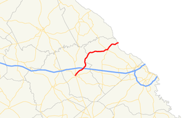
State Route 150 (SR 150) is a 25.3-mile-long (40.7 km) state highway that runs southwest–to–northeast through portions of McDuffie and Columbia counties in the east-central part of the U.S. state of Georgia. It travels from Thomson northeast to the South Carolina state line, southwest of Clarks Hill, South Carolina.
Route description
SR 150 begins at an intersection with SR 17 (Main Street) in Thomson. It heads northeast to an intersection with US 78/SR 10/SR 17 Bypass (Thomson Bypass), just before leaving town. Northeast of Thomson is an interchange with Interstate 20 (I-20; Carl Sanders Highway). Between I-20 and Pollards Corner, SR 150 travels along the McDuffie–Columbia county line. Then, it continues to the northeast to the Unincorporated community of Pollards Corner. There, SR 47/SR 150 travel concurrently for one block. At an intersection with U.S. Route 221 (US 221) and the western terminus of SR 104, SR 47 splits off to travel concurrently with US 221 south, while SR 150 splits off to travel concurrent with US 221 north. SR 150 follows US 221 until they reach the South Carolina state line, where US 221 crosses over the Clarks Hill Dam and continues northeast to Clarks Hill.[1]
SR 150 is not part of the National Highway System, a system of routes determined to be the most important for the nation's economy, mobility and defense.[2]
Major intersections
| County | Location | mi[1] | km | Destinations | Notes |
|---|---|---|---|---|---|
| McDuffie | Thomson | 0.0 | 0.0 | Southern terminus | |
| 1.4 | 2.3 | ||||
| | 4.4 | 7.1 | I-20, exit 175 | ||
| Columbia | Pollards Corner | 19.6 | 31.5 | Southern end of SR 47 concurrency | |
| 19.7 | 31.7 | Southern end of US 221 concurrency; northern end of SR 47 concurrency; western terminus of SR 104 | |||
| Savannah River | 25.3 | 40.7 | Clarks Hill Dam; northern terminus; | ||
1.000 mi = 1.609 km; 1.000 km = 0.621 mi
| |||||
See also
-
.svg.png) Georgia (U.S. state) portal
Georgia (U.S. state) portal -
 U.S. Roads portal
 - Central Savannah River Area
References
- 1 2 3 Google (June 13, 2013). "Route of SR 150" (Map). Google Maps. Google. Retrieved June 13, 2013.
- ↑ "National Highway System: Georgia" (PDF). United States Department of Transportation. May 8, 2009. Retrieved June 13, 2013.