Georgia State Route 147
| ||||
|---|---|---|---|---|
| Rogers Road | ||||
 | ||||
| Route information | ||||
| Maintained by GDOT | ||||
| Length: | 19.2 mi[1] (30.9 km) | |||
| Major junctions | ||||
| West end: |
| |||
| East end: |
| |||
| Location | ||||
| Counties: | Toombs, Tattnall | |||
| Highway system | ||||
| ||||

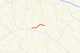
State Route 147 (SR 147) is a 19.2-mile-long (30.9 km) state highway that runs west-to-east through portions of Toombs and Tattnall counties in the east-central part of the U.S. state of Georgia.
Route description
SR 147 begins at an intersection with US 1/SR 4/SR 15 southeast of Uvalda and curves to the northeast to an intersection with SR 178. The two highways run concurrent for 4.1 miles (6.6 km). It then heads northeast to its eastern terminus an intersection with US 280/SR 30 in Reidsville.[1]
SR 147 is not part of the National Highway System, a system of roadways important to the nation's economy, defense, and mobility.[2]
Major intersections
| County | Location | mi[1] | km | Destinations | Notes |
|---|---|---|---|---|---|
| Toombs | | 0.0 | 0.0 | Western terminus | |
| | 8.5 | 13.7 | Western end of SR 178 concurrency | ||
| Tattnall | | 12.6 | 20.3 | Eastern end of SR 178 concurrency | |
| Ohoopee River | 13.5 | 21.7 | Unnamed bridge | Crosses over Ohoopee River | |
| Reidsville | 19.2 | 30.9 | Eastern terminus | ||
1.000 mi = 1.609 km; 1.000 km = 0.621 mi
| |||||
See also
-
.svg.png) Georgia (U.S. state) portal
Georgia (U.S. state) portal -
 U.S. Roads portal
References
- 1 2 3 Google (June 14, 2013). "Route of SR 147" (Map). Google Maps. Google. Retrieved June 14, 2013.
- ↑ "National Highway System: Georgia" (PDF). United States Department of Transportation. May 8, 2009. Retrieved June 14, 2013.
External links
This article is issued from Wikipedia - version of the 6/19/2016. The text is available under the Creative Commons Attribution/Share Alike but additional terms may apply for the media files.