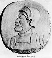
Gaspar de Portolá
| Gaspar de Portolá | |
|---|---|
 | |
|
In office November 30, 1767 to July 9, 1770 | |
| Succeeded by | Pedro Fages |
| Personal details | |
| Born |
1716 Os de Balaguer, Catalonia, Spain |
| Died |
1786 Lleida, Spain |
| Cause of death | Age |
| Resting place | Lleida |
| Citizenship | Spanish |
| Nationality | Spanish |
Gaspar de Portolá i Rovira (1716–1786) was a Spanish soldier and administrator in New Spain and became the founder and first governor of Alta California, as commander of the Spanish colonizing expedition on land and sea that established San Diego and Monterey. Portolá also led the first land expedition from San Diego to San Francisco. He named many geographic features on the way, many of which are still in use.[1]
Early life
Portolá was born on January 1, 1716 in Os de Balaguer, in Catalonia, Spain, of Catalan nobility. Don Gaspar served as a soldier in the Spanish army in Italy and Portugal. He was commissioned ensign in 1734, and lieutenant in 1743.
Governor of (Baja) California
By 1767, Jesuit missionaries on the Baja California Peninsula started establishing missions there. Later, rumors circulated that the Jesuits had amassed a fortune and were becoming very powerful. As part of the nearly global suppression of the Jesuits, King Carlos III ordered the Jesuits expelled and deported to the Papal States on the Italian peninsula. Following the command of the king, the Viceroy of New Spain ordered the arrest and deportation of all Jesuits in missions. Portolá was charged with the expulsion of the Jesuits. The missions were turned over to the Franciscans, and later to the Dominicans.
Expedition to Alta California
(see also Timeline of the Portolá expedition)
Spain was driven to establish missions and other outposts on the Pacific Coast north of the Baja California Peninsula by fears that the territory would be claimed by foreign powers. The English, who had established colonies on the East Coast of the continent and north into what is now Canada, had also sent explorers into the Pacific. Russian fur hunters were pressing east from Siberia across the Bering Strait into the Aleutian Islands and beyond.
Dispatches of January 23, 1768, exchanged between King Carlos and the viceroy, set the wheels in motion to extend Spain's control up the Pacific Coast and establish colonies and missions at San Diego Bay and Monterey Bay, which had been discovered and described in reports by earlier explorers Juan Cabrillo and Sebastián Vizcaíno. Vizcaíno had mapped the California coastline as far north as Monterey in 1602, but not much more was done until 166 years later. In May 1768, the Spanish Visitor General, José de Gálvez, began to organize an expedition, by sea and by land. Portolá was created "Governor of the Californias" and given overall command. Junípero Serra, leader of the expedition's Franciscan missionaries, took command of spiritual matters. Sea and land detachments were to meet at San Diego Bay.

The first ship, the San Carlos, sailed from La Paz on January 10, 1769 and a second, the San Antonio sailed from Cabo San Lucas on February 15. At the same time, the various elements of the land parties began to move north from Loreto, Baja California Sur. The land expedition was assembled at Velicatá, where Serra established his first new mission. From there, Portolá's plan called for splitting the land expedition in two. The lead group, charged with building a wagon trail and pacifying the natives, was led by Captain Fernando Rivera y Moncada, and departed from Velicatá on March 24. With Rivera was the priest Juan Crespí, diarist for the Franciscans. The expedition led by Portolá, which included Junípero Serra (the President of the Missions), along with a combination of missionaries, settlers, and leather-jacket soldiers, including José Raimundo Carrillo, left Velicata on May 15. Junípero Serra founded two more missions during the expedition: San Diego de Alcalá on July 16, 1769 and Mission San Carlos Borromeo de Carmelo on June 3, 1770.

Rivera reached the site of present-day San Diego in May, established a camp in the area that is now Old Town and awaited the arrival of the others. Because of an error by Vizcaíno in determining the latitude of the San Diego Harbor, the ships passed by it and landed too far north before finding their way back. The San Antonio arrived on April 11 and the San Carlos, the first ship to leave La Paz, having met with fierce winds and storms on the journey, arrived on April 29. A third vessel was to follow with supplies, but it was probably lost at sea. The land expedition of Portolá arrived on June 29. After their arduous journeys, most of the men aboard ship were ill, chiefly from scurvy, and many had died. Out of a total of 219 who left Baja California, little more than a 100 now survived.
Eager to press on to Monterey Bay, Portolá and his expedition, consisting of Juan Crespí, 63 leather-jacket soldiers and 100 mules loaded down with provisions, headed north on July 14, 1769. Marching two to four leagues (1 league = 2.6 miles) a day, they reached the site of present-day Los Angeles on August 2. The following day, they marched out the Indian trail that would one day become Wilshire Boulevard to the present site of Santa Monica. Winding around to the area of later Saugus, now part of Santa Clarita, they reached the area to become Santa Barbara on August 19, and the present day San Simeon area on September 13. On October 1, Portolá's party emerged from the Santa Lucia Mountains and reached the mouth of the Salinas River.
After a march of some 400 miles from San Diego and about 1,000 miles from Velicatá, they had reached the bay they were seeking. But they failed to discern the coastline's semi-circular shape, described by Vizcaíno as round like an "O", even though members of the party had twice marched along its beach. Having failed to find their goal, they marched on north and reached the area at the north end of the bay, where Crespi named a creek Santa Cruz on October 18. Pushing on, they reached the San Francisco Bay area on October 31, and explored and named many localities in the region south of what would eventually become known as the Golden Gate.
They then marched back to San Diego, again failing to find Vizcaino's harbor on their way south. Surviving on mule meat for most of the journey, they arrived on January 24, 1770.

Second expedition
One of Portolá's officers, Captain Vicente Vila, convinced him that he had actually been exactly on the Bay of Monterey when he placed his second cross at what later became Pacific Grove. After replenishing supplies at San Diego, Portolá and Serra decided on a joint expedition by land and sea to again search for the bay and establish a colony if they were successful. The San Antonio sailed on April 16, 1770. On board were Serra, Miguel Costansó, military engineer and cartographer, and Doctor Pedro Prat, army surgeon, along with a cargo of supplies for the new mission at Monterey. On April 17, after mustering what forces he could, Portolá's land expedition, which included lieutenant Pedro Fages, 12 Spanish volunteers, seven leather-jacket soldiers, five Baja California Indians, two muleteers, and Juan Crespí serving as the expedition's chaplain, again marched north.
The expedition followed the same route they had the previous winter while returning to San Diego. After 36 days on the road, with only two days of rest, Portolá arrived at his second cross on May 24, 1770. He then saw that on a clear day and from a certain point of view the round harbor assumed the proportions described by the earlier enthusiastic explorers. Having recognized the bay, a Mass was conducted near the oak tree that the Carmelite missionaries with Vizcaíno had worshiped under in 1603, and possession was officially taken. On June 3, 1770, they laid the beginnings of the Mission San Carlos Borromeo de Carmelo and founded the Presidio of Monterey.
Later career
Governor Portolá's task was finished. He then left Captain Pedro Fages in charge, and on June 9 he sailed for San Blas, never to return to Upper California. In 1776, Portolá was appointed the governor of Puebla. After the appointment of his successor in 1784, he was advanced money for expenses and returned to Spain, where he served as commander of the Numancia cavalry dragoon regiment. On February 7, 1786 he was appointed King's Lieutenant for the strongholds and castles of Lleida. He died that same year, in October.
Legacy

A 9 ft (2.7 m) statue in Pacifica, California was sculpted by the Catalan sculptor Josep Maria Subirachs and his associate, Francesc Carulla. It was given to the State of California by the Catalan regional government in 1988.
The city of Portola in Plumas County,[2] the town of Portola Valley in San Mateo County, and the Portola neighborhood of San Francisco were named after Portolá. A number of schools in California were also named after him, including Portola Hills Elementary School in Portola Hills, Portola Elementary School in San Bruno, Portola Junior High School in El Cerrito, Gaspar de Portola Middle School in Tierrasanta, Portola Middle School in Tarzana, and Portola Middle School in Orange. The school in Orange is close to the spot where the expedition crossed the Santa Ana River, and the school has a 60-foot mural depicting the Portola Expedition.
Portola Parkway running through Irvine and Lake Forest (though not connected as of 2008), was also named after Portolá. It is said that Portolá used the same route Portola Parkway now runs across. Portola Drive, which runs parallel to and near the Monterey Bay shoreline, is the main street of the Pleasure Point area of Santa Cruz County. Portola Avenue is also a north-south street located in Palm Desert in the Coachella Valley.
In World War II, the United States liberty ship SS Gaspar de Portola was named in his honor.
References
- ↑ factcards.califa.org, Gaspar de Portolá i Rovira
- ↑ Brown, Thomas P. (May 30, 1940). "Over the Sierra". Indian Valley Record. p. 3. Retrieved 7 May 2015.
Further reading
- Crespí, Juan; Alan K Brown (2001). A Description of Distant Roads: Original Journals of the First Expedition into California, 1769–1770. San Diego: San Diego State University Press. ISBN 1-879691-64-7.
External links
- Biography of Gaspar de Portolá at the San Diego Historical Society website
- Early Exploration of San Diego: 1542 to 1769 at the California History & Culture Conservancy website (archived)
- Portolá's History and Statue in Pacifica, California(archived)
- Spanish exploration of the Northwest Coast of North America website article (archived)
- Sweeney Ridge, Golden Gate National Recreation Area Portola Discovery Site in San Mateo County, California