Gaspar Grande
| Nickname: Gasparee | |
|---|---|
|
Gaspar Grande island pictured in the background, with Gasparillo Island in the right foreground | |
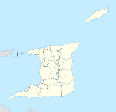 Gaspar Grande Location of Gaspar Grande off the north-western peninsular of Trinidad | |
| Geography | |
| Total islands | 1 |
| Area | 1.29 km2 (0.50 sq mi) |
| Highest elevation | 121 m (397 ft) |
| Administration | |
|
Trinidad and Tobago | |

Gaspar Grande or Gasparee is an island in the Republic of Trinidad and Tobago named for Gaspar de Percín. The island is 1.29 km2 (0.50 square miles) in area and lies 12 km (7.5 mi) west of Port of Spain. It is one of the "Bocas Islands", which lie in the Bocas del Dragón (Dragon's Mouth) between Trinidad and Venezuela.
Gaspar Grande is primarily limestone, and reaches a height of 121 metres (397 ft) at its highest point. Gaspar Grande is home to the Gasparee Caves, a natural limestone cave system with a mysterious pool at its base. Other caves on the island include the White Cave, the Brioge Cavern and the Precipice Cavern. Vegetation on the island includes the Yellow Poui, Giant Cactus, Hog Plum, Silk Cotton, Agave, Manicou Fig, Naked Indian, Pelican Flower, Queen-of-the-Forest (Filipendula occidentalis), Cow Itch, Sugar Apple and Salt-fish Wood.
Legend has it that another cave on the island, William Dampiers Tunnel, has a pirate's treasure chest which is easily accessible on certain days of the year.
History
In 1783, Gaspar Grande was granted to Gaspar de Percin Roque by governor José María Chacón. Events in Gaspar Grande's history include the Saga of Admiral Apodaca and the establishment of whaling stations on the island.
Places
Point Baliene was once a whaling station, as indicated by its name, which is French for "whaling point". Located on the Southwestern end of Gaspar Grande, Point Baliene is one of the main drop off sites for visitors to the Gasparee Caves.
Bombshell Bay got its name from its historical past as there once was a fort located in this area. It is now a holiday resort.
Gasparee Caves is one of the more popular sites in Chaguaramas. The cave is full of geological formations such as stalactites, stalagmites, flow stones, pillars, ribbon, and fringed curtain.
Other landmarks on the island include Bordel Bay, Winn's Bay, Goodwill's Bay and St. Madeline Bay.
See also
References
- Anthony, Michael (2001). Historical Dictionary of Trinidad and Tobago. Scarecrow Press, Inc. Lanham, Md., and London. ISBN 0-8108-3173-2.
Coordinates: 10°40′N 61°39′W / 10.667°N 61.650°W
| Major Islands | ||
|---|---|---|
| Bocas Islands | ||
| The Five Islands | ||
| San Diego Islands | ||
| Islands off Tobago | ||
| Other Islands | ||