Garrett, Texas
| Garrett, Texas | |
|---|---|
| Town | |
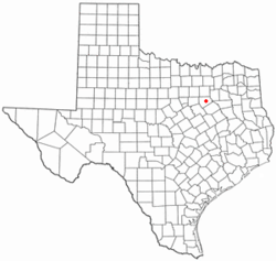 Location of Garrett, Texas | |
 | |
| Coordinates: 32°21′43″N 96°39′6″W / 32.36194°N 96.65167°WCoordinates: 32°21′43″N 96°39′6″W / 32.36194°N 96.65167°W | |
| Country | United States |
| State | Texas |
| County | Ellis |
| Area | |
| • Total | 1.82 sq mi (4.71 km2) |
| • Land | 1.80 sq mi (4.66 km2) |
| • Water | 0.02 sq mi (0.05 km2) |
| Elevation | 554 ft (169 m) |
| Population (2010) | |
| • Total | 806 |
| • Density | 448/sq mi (172.8/km2) |
| Time zone | Central (CST) (UTC-6) |
| • Summer (DST) | CDT (UTC-5) |
| FIPS code | 48-29036[1] |
| GNIS feature ID | 1336411[2] |
| Website |
cityofgarrett |
Garrett is a town in Ellis County, Texas, United States. The population was 806 at the 2010 census,[3] up from 448 at the 2000 census.
Geography
Garrett is located in eastern Ellis County at 32°21′43″N 96°39′6″W / 32.36194°N 96.65167°W (32.362055, -96.651735).[4] It is bordered to the south by the city of Ennis. Interstate 45 passes along the eastern edge of the town, with access from Exit 255. I-45 leads north 32 miles (51 km) to downtown Dallas and south 209 miles (336 km) to Houston.
According to the United States Census Bureau, Garrett has a total area of 1.8 square miles (4.7 km2), of which 0.019 square miles (0.05 km2), or 1.00%, is water.[3]
Demographics
| Historical population | |||
|---|---|---|---|
| Census | Pop. | %± | |
| 1960 | 167 | — | |
| 1970 | 225 | 34.7% | |
| 1980 | 220 | −2.2% | |
| 1990 | 340 | 54.5% | |
| 2000 | 448 | 31.8% | |
| 2010 | 806 | 79.9% | |
| Est. 2015 | 822 | [5] | 2.0% |
As of the census[1] of 2000, there were 448 people, 147 households, and 118 families residing in the town. The population density was 1,338.9 people per square mile (524.2/km²). There were 158 housing units at an average density of 472.2 per square mile (184.9/km²). The racial makeup of the town was 71.43% White, 0.67% African American, 1.56% Pacific Islander, 22.54% from other races, and 3.79% from two or more races. Hispanic or Latino of any race were 35.27% of the population.
There were 147 households out of which 45.6% had children under the age of 18 living with them, 59.9% were married couples living together, 16.3% had a female householder with no husband present, and 19.7% were non-families. 14.3% of all households were made up of individuals and 3.4% had someone living alone who was 65 years of age or older. The average household size was 3.05 and the average family size was 3.32.
In the town the population was spread out with 33.5% under the age of 18, 11.6% from 18 to 24, 31.0% from 25 to 44, 19.2% from 45 to 64, and 4.7% who were 65 years of age or older. The median age was 30 years. For every 100 females there were 98.2 males. For every 100 females age 18 and over, there were 91.0 males.
The median income for a household in the town was $40,104, and the median income for a family was $40,469. Males had a median income of $27,132 versus $20,938 for females. The per capita income for the town was $16,810. About 8.9% of families and 14.5% of the population were below the poverty line, including 25.2% of those under age 18 and none of those age 65 or over.
Education
Garrett is served by the Ennis Independent School District.
Fire protection
The town is served by two fire departments, Garrett Rural Fire Department (formerly Garrett Fire Department) and Garrett City Fire Department. Garrett Rural has two stations with multiple engines and multiple brush trucks, with a large membership that covers the area outside the town limits. Garrett City covers the town limits and consists of one station with an older engine and older utility bed pickup, and with a membership of about 10 firefighters.
Notable people
- Norma Gabler, conservative Christian activist and textbook campaigner
References
- 1 2 "American FactFinder". United States Census Bureau. Retrieved 2008-01-31.
- ↑ "US Board on Geographic Names". United States Geological Survey. 2007-10-25. Retrieved 2008-01-31.
- 1 2 "Geographic Identifiers: 2010 Census Summary File 1 (G001): Garrett town, Texas". American Factfinder. U.S. Census Bureau. Retrieved March 25, 2016.
- ↑ "US Gazetteer files: 2010, 2000, and 1990". United States Census Bureau. 2011-02-12. Retrieved 2011-04-23.
- ↑ "Annual Estimates of the Resident Population for Incorporated Places: April 1, 2010 to July 1, 2015". Retrieved July 2, 2016.
- ↑ "Census of Population and Housing". Census.gov. Retrieved June 4, 2015.
External links
Municipalities and communities of Ellis County, Texas, United States | ||
|---|---|---|
| Cities | 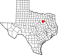 | |
| Towns | ||
| CDP | ||
| Unincorporated communities | ||
| Footnotes | ‡This populated place also has portions in an adjacent county or counties | |