Garah, New South Wales
| Garah New South Wales | |
|---|---|
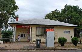 Post office at Garah | |
|
Garah | |
| Coordinates | 29°03′0″S 149°37′0″E / 29.05000°S 149.61667°ECoordinates: 29°03′0″S 149°37′0″E / 29.05000°S 149.61667°E |
| Population | 551 (2011 census)[1] |
| Postcode(s) | 2405 |
| Location | |
| LGA(s) | Moree Plains Shire |
| State electorate(s) | Northern Tablelands |
| Federal Division(s) | Parkes |
Garah is a town in north western New South Wales, Australia. The town is in the Moree Plains Shire local government area and on the Carnarvon Highway, 667 kilometres (414 mi) north west of the state capital, Sydney and 51 kilometres (32 mi) north west of the regional centre of Moree. It is on the Mungindi railway line between Mungindi and Moree. At the 2011 census, Garah and the surrounding area had a population of 551.[1]
Facilities in the town include a post office, primary school, police station, tennis courts, grain silo, CWA hall, town hall, pre-school, corner shop, pub, race course, small petrol bowser, Catholic church and a Presbyterian Church. Local activities include agriculture.
Garah is also said to have the oldest running picnic races in Australia.
The Mungindi, or North West railway line passes through the town and a station was open between 1913 and 1974.[2]
References
- 1 2 Australian Bureau of Statistics (31 October 2012). "Garah (State Suburb)". 2011 Census QuickStats. Retrieved 10 April 2015.
- ↑ Garah station. NSWrail.net, accessed 9 September 2009.
External links
![]() Media related to Garah, New South Wales at Wikimedia Commons
Media related to Garah, New South Wales at Wikimedia Commons
| Preceding station | NSW Main lines | Following station | ||
|---|---|---|---|---|
towards Mungindi | Mungindi Line | towards Werris Creek |