Woodbridge Township, Michigan
| Woodbridge Township, Michigan | |
|---|---|
| Township | |
 Woodbridge Township, Michigan Location within the state of Michigan | |
| Coordinates: 41°46′51″N 84°39′4″W / 41.78083°N 84.65111°WCoordinates: 41°46′51″N 84°39′4″W / 41.78083°N 84.65111°W | |
| Country | United States |
| State | Michigan |
| County | Hillsdale |
| Area | |
| • Total | 30.1 sq mi (77.9 km2) |
| • Land | 30.1 sq mi (77.9 km2) |
| • Water | 0.0 sq mi (0.0 km2) |
| Elevation | 1,010 ft (308 m) |
| Population (2000) | |
| • Total | 1,337 |
| • Density | 44.5/sq mi (17.2/km2) |
| Time zone | Eastern (EST) (UTC-5) |
| • Summer (DST) | EDT (UTC-4) |
| FIPS code | 26-88300[1] |
| GNIS feature ID | 1627286[2] |
Woodbridge Township is a civil township of Hillsdale County in the U.S. state of Michigan. It comprises thirty sections and is located in south-central area of Hillsdale County.
The current Woodbridge Township Hall was built in 1855 after the Woodbridge Township board voted and approved $250 for the construction of a town hall. They also appropriated $10 to purchase a suitable site located in Section 16 of Woodbridge Township. The building committee eventually selected the building site at the corner of Woodbridge and Montgomery roads, just west, and above the St. Joseph River. The original structure was constructed using popular, or tulip wood and completed in 1856. Approximately twenty years later an addition was built onto the original structure and soon after, in 1890, polling booths and a dividing fence were completed.
Other than maintaining the exterior with new paint, the township hall remains much the way it was from its humble, yet practical beginning.
In 1975 the township clerk responded to an inquiry by the Michigan Township Association, who was attempting to validate the oldest town hall still in operation in the state of Michigan and on November 1, 1975, it was verified that the Woodbridge Township Hall was the oldest operational structure. The population was 1,337 at the 2000 census.
Communities
- Frontier is an unincorporated community within the township at 41°46′54″N 84°36′17″W / 41.78167°N 84.60472°W. The FIPS place code is 30880 and the ZIP code is 49239.
History
Woodbridge Township was formed by act of the Legislature of the state of Michigan approved on January 28, 1840 from a portion of Fayette Township. Its original limits and the place designated for holding the first township meeting, were by that act as follows: "All that portion of the county of Hillsdale, designated by the United States survey of townships numbered 7, 8 and fractional township 9 south, of range 3 west, be set off into a separate township, and organized by the name of Woodbridge, and the first township meeting therein shall be held at the house formerly occupied by John McDermaid, in said township." "This act shall not in any wise affect the collection of taxes assessed in the county of Hillsdale for the year 1839, or in any township thereof; but the same shall be collected as if the act had not be passed. This act shall take effect, and be in force, on and after the first Monday of April next."
The first permanent settlement within the present bounds of Woodbridge Township was made by William Saxton, who came from Raisin Township, Lenawee County, Michigan, and settled on the northeast quarter of Section 12, in the winter of 1834-35. He purchased this 160 acres of land from the United States government in 1834 and during the fall of that same year built a log cabin on this site. He was accompanied by his wife and four young sons: Wallace, James, Stephen and John. In order to reach his land it required him to cut his own road in order for his team of oxen and sled to pass. Prior to his move to Woodbridge Township, Mr. Saxon was a veteran of the Black Hawk War and he later settled in Iowa.
The next settler in the township was Jacob Clark, who in December 1836, located upon the north part of Section 13, the present site of the village (unincorporated) of Frontier. This land was purchased from the federal government and he also erected a small log cabin on this site. Accompanying him were his sons, Robert W. and Sylvester, and his daughters Rebecca, Sarah and Eliza. Mr. Clark drove in, and owned, the first span of horses in the township.[3]
Geography
According to the United States Census Bureau, the township has a total area of 30.1 square miles (78 km2), of which 30.1 square miles (78 km2) is land and 0.03% is water.
Demographics
As of the census[1] of 2000, there were 1,337 people, 415 households, and 337 families residing in the township. The population density was 44.5 per square mile (17.2/km²). There were 466 housing units at an average density of 15.5 per square mile (6.0/km²). The racial makeup of the township was 96.56% White, 0.37% African American, 0.15% Native American, 0.07% Asian, 0.07% Pacific Islander, 0.67% from other races, and 2.09% from two or more races. Hispanic or Latino of any race were 0.97% of the population.
There were 415 households out of which 44.6% had children under the age of 18 living with them, 70.6% were married couples living together, 7.5% had a female householder with no husband present, and 18.6% were non-families. 15.4% of all households were made up of individuals and 7.2% had someone living alone who was 65 years of age or older. The average household size was 3.21 and the average family size was 3.57.
In the township the population was spread out with 35.6% under the age of 18, 9.2% from 18 to 24, 27.0% from 25 to 44, 18.5% from 45 to 64, and 9.7% who were 65 years of age or older. The median age was 30 years. For every 100 females there were 98.4 males. For every 100 females age 18 and over, there were 99.8 males.
The median income for a household in the township was $35,294, and the median income for a family was $38,155. Males had a median income of $34,625 versus $25,221 for females. The per capita income for the township was $14,088. About 10.2% of families and 13.3% of the population were below the poverty line, including 16.8% of those under age 18 and 6.6% of those age 65 or over.
References
- 1 2 "American FactFinder". United States Census Bureau. Retrieved 2008-01-31.
- ↑ U.S. Geological Survey Geographic Names Information System: Woodbridge Township, Michigan
- ↑ Johnson, Crisfield (2005) [1879]. History of Hillsdale county. Michigan, with illustrations and biographical sketches of some of its prominent men and pioneers. Ann Arbor, Mich.: University of Michigan Library. Retrieved 2013-02-10.
Municipalities and communities of Hillsdale County, Michigan, United States | ||
|---|---|---|
| Cities | 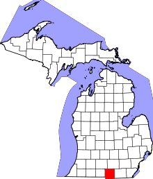 | |
| Villages | ||
| Townships | ||