Allen, Michigan
| Allen, Michigan | |
|---|---|
| Village | |
 Location of Allen in Hillsdale County, Michigan | |
| Coordinates: 41°57′29″N 84°46′5″W / 41.95806°N 84.76806°WCoordinates: 41°57′29″N 84°46′5″W / 41.95806°N 84.76806°W | |
| Country | United States |
| State | Michigan |
| County | Hillsdale |
| Settled | 1827 |
| Platted | 1868 |
| Incorporated | 1950 |
| Area[1] | |
| • Total | 0.16 sq mi (0.41 km2) |
| • Land | 0.16 sq mi (0.41 km2) |
| • Water | 0 sq mi (0 km2) |
| Elevation | 1,076 ft (328 m) |
| Population (2010)[2] | |
| • Total | 191 |
| • Estimate (2012[3]) | 190 |
| • Density | 1,193.8/sq mi (460.9/km2) |
| Time zone | Eastern (EST) (UTC-5) |
| • Summer (DST) | EDT (UTC-4) |
| ZIP code | 49227 |
| Area code(s) | 517 |
| FIPS code | 26-01300[4] |
| GNIS feature ID | 2397933[5] |
Allen is a village in Hillsdale County in the U.S. state of Michigan. The population was 191 at the 2010 census.
The village is within Allen Township at the junction of US 12 and M-49.
History
War of 1812 veteran Captain Moses Allen and his family journeyed here along the Sauk trail and settled here in 1827 in an area that became known as "Allen's Prairie". On July 13, 1830, a post office was established named "Sylvanus", due to being in a wooded area. The office closed on September 5, 1834, and was reestablished on September 9, 1835. It was renamed "Allen" in honor of Captain Allen on August 17, 1868. A plat for what was already a thriving village was also recorded in 1868. It was a station on the Lake Shore and Michigan Southern Railway and incorporated as a village in 1950.[6][7][8]
Geography
According to the United States Census Bureau, the village has a total area of 0.16 square miles (0.41 km2), all land.[1]
Demographics
| Historical population | |||
|---|---|---|---|
| Census | Pop. | %± | |
| 1880 | 594 | — | |
| 1960 | 325 | — | |
| 1970 | 385 | 18.5% | |
| 1980 | 266 | −30.9% | |
| 1990 | 201 | −24.4% | |
| 2000 | 225 | 11.9% | |
| 2010 | 191 | −15.1% | |
| Est. 2015 | 189 | [9] | −1.0% |
2010 census
As of the census[2] of 2010, there were 191 people, 80 households, and 51 families residing in the village. The population density was 1,193.8 inhabitants per square mile (460.9/km2). There were 94 housing units at an average density of 587.5 per square mile (226.8/km2). The racial makeup of the village was 97.9% White, 1.0% Asian, and 1.0% from two or more races.
There were 80 households of which 23.8% had children under the age of 18 living with them, 56.3% were married couples living together, 6.3% had a female householder with no husband present, 1.3% had a male householder with no wife present, and 36.3% were non-families. 25.0% of all households were made up of individuals and 18.8% had someone living alone who was 65 years of age or older. The average household size was 2.39 and the average family size was 2.94.
The median age in the village was 45.8 years. 19.4% of residents were under the age of 18; 7.8% were between the ages of 18 and 24; 22.1% were from 25 to 44; 26.7% were from 45 to 64; and 24.1% were 65 years of age or older. The gender makeup of the village was 49.7% male and 50.3% female.
2000 census
As of the census[4] of 2000, there were 225 people, 87 households, and 58 families residing in the village. The population density was 1,470.7 per square mile (579.2/km²). There were 93 housing units at an average density of 607.9 per square mile (239.4/km²). The racial makeup of the village was 98.67% White, and 1.33% from two or more races.
There were 87 households out of which 32.2% had children under the age of 18 living with them, 57.5% were married couples living together, 5.7% had a female householder with no husband present, and 32.2% were non-families. 28.7% of all households were made up of individuals and 16.1% had someone living alone who was 65 years of age or older. The average household size was 2.59 and the average family size was 3.22.
In the village the population was spread out with 27.6% under the age of 18, 7.1% from 18 to 24, 27.1% from 25 to 44, 21.3% from 45 to 64, and 16.9% who were 65 years of age or older. The median age was 38 years. For every 100 females there were 95.7 males. For every 100 females age 18 and over, there were 87.4 males.
The median income for a household in the village was $42,344, and the median income for a family was $45,417. Males had a median income of $30,250 versus $21,111 for females. The per capita income for the village was $14,251. About 8.0% of families and 5.5% of the population were below the poverty line, including none of those under the age of eighteen or sixty five or over.
Transportation
See also
References
- 1 2 "US Gazetteer files 2010". United States Census Bureau. Archived from the original on January 24, 2012. Retrieved 2012-11-25.
- 1 2 "American FactFinder". United States Census Bureau. Retrieved 2012-11-25.
- ↑ "Population Estimates". United States Census Bureau. Archived from the original on June 17, 2013. Retrieved 2013-06-03.
- 1 2 "American FactFinder". United States Census Bureau. Archived from the original on September 11, 2013. Retrieved 2008-01-31.
- ↑ U.S. Geological Survey Geographic Names Information System: Allen, Michigan
- ↑ Romig, Walter (1986) [1973]. Michigan Place Names. Detroit, Michigan: Wayne State University Press. ISBN 0-8143-1838-X.
- ↑ U.S. Geological Survey Geographic Names Information System: Allen Post Office
- ↑ Captain Moses Allen, Michigan Historical Markers
- ↑ "Annual Estimates of the Resident Population for Incorporated Places: April 1, 2010 to July 1, 2015". Retrieved July 2, 2016.
- ↑ "Census of Population and Housing". Census.gov. Archived from the original on May 11, 2015. Retrieved June 4, 2015.
External links
Municipalities and communities of Hillsdale County, Michigan, United States | ||
|---|---|---|
| Cities | 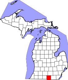 | |
| Villages | ||
| Townships | ||