Fromberg, Montana
| Fromberg, Montana | |
|---|---|
| Town | |
 Location of Fromberg, Montana | |
| Coordinates: 45°23′30″N 108°54′31″W / 45.39167°N 108.90861°WCoordinates: 45°23′30″N 108°54′31″W / 45.39167°N 108.90861°W | |
| Country | United States |
| State | Montana |
| County | Carbon |
| Area[1] | |
| • Total | 0.48 sq mi (1.24 km2) |
| • Land | 0.48 sq mi (1.24 km2) |
| • Water | 0 sq mi (0 km2) |
| Elevation | 3,533 ft (1,077 m) |
| Population (2010)[2] | |
| • Total | 438 |
| • Estimate (2015)[3] | 444 |
| • Density | 912.5/sq mi (352.3/km2) |
| Time zone | Mountain (MST) (UTC-7) |
| • Summer (DST) | MDT (UTC-6) |
| ZIP code | 59029 |
| Area code(s) | 406 |
| FIPS code | 30-29575 |
| GNIS feature ID | 0771648 |
Fromberg is a town in Carbon County, Montana, United States. It is part of the Billings, Montana Metropolitan Statistical Area. The population was 438 at the 2010 census.
Geography
Fromberg is located at 45°23′30″N 108°54′31″W / 45.39167°N 108.90861°W (45.391656, -108.908650).[4]
According to the United States Census Bureau, the town has a total area of 0.48 square miles (1.24 km2), all of it land.[1]
History
The Fromberg Post Office was established on March 21, 1903, with Abraham Pierson as the town's first postmaster.
Demographics
| Historical population | |||
|---|---|---|---|
| Census | Pop. | %± | |
| 1920 | 520 | — | |
| 1930 | 446 | −14.2% | |
| 1940 | 533 | 19.5% | |
| 1950 | 442 | −17.1% | |
| 1960 | 367 | −17.0% | |
| 1970 | 364 | −0.8% | |
| 1980 | 469 | 28.8% | |
| 1990 | 370 | −21.1% | |
| 2000 | 486 | 31.4% | |
| 2010 | 438 | −9.9% | |
| Est. 2015 | 444 | [5] | 1.4% |
| U.S. Decennial Census[6][7] 2015 Estimate[3] | |||
2010 census
As of the census[2] of 2010, there were 438 people, 189 households, and 128 families residing in the town. The population density was 912.5 inhabitants per square mile (352.3/km2). There were 211 housing units at an average density of 439.6 per square mile (169.7/km2). The racial makeup of the town was 97.3% White, 0.7% Native American, 1.6% from other races, and 0.5% from two or more races. Hispanic or Latino of any race were 5.3% of the population.
There were 189 households of which 25.9% had children under the age of 18 living with them, 54.0% were married couples living together, 7.9% had a female householder with no husband present, 5.8% had a male householder with no wife present, and 32.3% were non-families. 27.0% of all households were made up of individuals and 10.6% had someone living alone who was 65 years of age or older. The average household size was 2.32 and the average family size was 2.80.
The median age in the town was 47.7 years. 21.2% of residents were under the age of 18; 4.9% were between the ages of 18 and 24; 19.2% were from 25 to 44; 33.5% were from 45 to 64; and 21% were 65 years of age or older. The gender makeup of the town was 52.1% male and 47.9% female.
2000 census
As of the census[8] of 2000, there were 486 people, 198 households, and 129 families residing in the town. The population density was 1,007.7 people per square mile (390.9/km²). There were 220 housing units at an average density of 456.1 per square mile (177.0/km²). The racial makeup of the town was 92.18% White, 0.41% Native American, 0.21% Asian, 6.79% from other races, and 0.41% from two or more races. Hispanic or Latino of any race were 7.41% of the population.
There were 198 households out of which 31.8% had children under the age of 18 living with them, 47.0% were married couples living together, 14.1% had a female householder with no husband present, and 34.8% were non-families. 30.3% of all households were made up of individuals and 17.2% had someone living alone who was 65 years of age or older. The average household size was 2.45 and the average family size was 3.05.
In the town the population was spread out with 30.2% under the age of 18, 6.2% from 18 to 24, 26.1% from 25 to 44, 22.8% from 45 to 64, and 14.6% who were 65 years of age or older. The median age was 38 years. For every 100 females there were 93.6 males. For every 100 females age 18 and over, there were 93.7 males.
The median income for a household in the town was $29,219, and the median income for a family was $32,750. Males had a median income of $24,063 versus $17,344 for females. The per capita income for the town was $14,667. About 6.2% of families and 10.0% of the population were below the poverty line, including 15.6% of those under age 18 and 7.4% of those age 65 or over.
Notable residents
- Arthur A. Ageton, United States Ambassador was born in Fromberg.
- Jenna Jameson, "The Queen of Porn", lived at a cattle ranch here for some time.[9]
- Robert C Switzer, 1914 and Joeseph L Switzer, 1915 were both born in Fromberg MT, known later as the "Day-Glo Brothers" in the book of the same name, who invented Day-Glo Fluorescent Color used first in WW2 as signal panels, and other products such as Magna-Glo metal flaw detection material licensed to Magnaflux Corp of Chicago, IL.
Climate
The Köppen Climate Classification subtype for this climate is "BSk" (Tropical and Subtropical Steppe Climate).[10]
| Climate data for Fromberg, Montana | |||||||||||||
|---|---|---|---|---|---|---|---|---|---|---|---|---|---|
| Month | Jan | Feb | Mar | Apr | May | Jun | Jul | Aug | Sep | Oct | Nov | Dec | Year |
| Average high °C (°F) | 1 (34) |
4 (40) |
9 (49) |
16 (60) |
21 (70) |
26 (79) |
31 (88) |
31 (87) |
24 (75) |
17 (63) |
8 (47) |
3 (37) |
16 (61) |
| Average low °C (°F) | −11 (12) |
−9 (16) |
−5 (23) |
0 (32) |
4 (40) |
9 (48) |
12 (53) |
11 (51) |
6 (42) |
1 (33) |
−5 (23) |
−9 (15) |
0 (32) |
| Average precipitation mm (inches) | 13 (0.5) |
10 (0.4) |
18 (0.7) |
36 (1.4) |
48 (1.9) |
46 (1.8) |
20 (0.8) |
18 (0.7) |
33 (1.3) |
28 (1.1) |
15 (0.6) |
10 (0.4) |
292 (11.5) |
| Source: Weatherbase [11] | |||||||||||||
References
- 1 2 "US Gazetteer files 2010". United States Census Bureau. Retrieved 2012-12-18.
- 1 2 "American FactFinder". United States Census Bureau. Retrieved 2012-12-18.
- 1 2 "Population Estimates". United States Census Bureau. Retrieved July 23, 2016.
- ↑ "US Gazetteer files: 2010, 2000, and 1990". United States Census Bureau. 2011-02-12. Retrieved 2011-04-23.
- ↑ "Annual Estimates of the Resident Population for Incorporated Places: April 1, 2010 to July 1, 2015". Retrieved July 2, 2016.
- ↑ "Census of Population and Housing". Census.gov. Retrieved June 4, 2015.
- ↑ "Census & Economic Information Center". Retrieved July 3, 2015.
- ↑ "American FactFinder". United States Census Bureau. Retrieved 2008-01-31.
- ↑ "The porn broker", by Adam Higginbotham, October 9, 2004, Telegraph Magazine, presented by The Age. Retrieved February 1, 2007. Also reprinted in a slightly edited form as "A life of ups and downs", Sydney Morning Herald, December 4, 2004. Retrieved February 1, 2007.
- ↑ Climate Summary for Fromberg, Montana
- ↑ "Weatherbase.com". Weatherbase. 2013. Retrieved on August 19, 2013.
Municipalities and communities of Carbon County, Montana, United States | ||
|---|---|---|
| City | 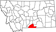 | |
| Towns | ||
| CDPs | ||
| Other unincorporated communities | ||