Frisco City, Alabama
| Frisco City, Alabama | |
|---|---|
| Town | |
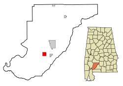 Location in Monroe County and the state of Alabama | |
| Coordinates: 31°26′1″N 87°24′7″W / 31.43361°N 87.40194°W | |
| Country | United States |
| State | Alabama |
| County | Monroe |
| Area | |
| • Total | 4.1 sq mi (10.5 km2) |
| • Land | 4.0 sq mi (10.4 km2) |
| • Water | 0.008 sq mi (0.02 km2) |
| Elevation | 404 ft (123 m) |
| Population (2010) | |
| • Total | 1,309 |
| • Density | 326/sq mi (125.9/km2) |
| Time zone | Central (CST) (UTC-6) |
| • Summer (DST) | CDT (UTC-5) |
| ZIP code | 36445 |
| Area code(s) | 251 |
| FIPS code | 01-28312 |
| GNIS feature ID | 0151784 |
Frisco City is a town in Monroe County, Alabama, United States. At the 2010 census the population was 1,309.[1]
Geography
Frisco City is located at 31°26′2″N 87°24′8″W / 31.43389°N 87.40222°W (31.433769, -87.402120).[2]
According to the U.S. Census Bureau, the town has a total area of 4.1 square miles (10.5 km2), of which 4.0 square miles (10.4 km2) is land and 0.0077 square miles (0.02 km2), or 0.24%, is water.[1]
History
What would become Frisco City started out as two mid-19th century communities named Lufkin and Snider. It initially incorporated as the town of Jones Mill in 1909. It was named for the owner of the local grist mill. Four years later on November 4, 1913, the town was renamed as Roy for Roy Megargel, owner of the Gulf, Florida, and Alabama Railroad (GFA). The renaming was done on the condition that "Roy" would receive a rail line to the town.
When Megargel failed to deliver on his promise, the town reverted to its name of Jones Mill in 1919 (also referred to as Jones Mills plural). Megargel failed to keep his name on Jones Mill, but later received a community named for him, that of Megargel, a census-designated place as of 2010.
In 1925, the St. Louis and San Francisco Railroad bought the GFA Railroad and agreed to complete what Megargel was not able to. In 1928, the line was completed, and in gratitude, the town formally renamed itself as Frisco City (taken from San Francisco).[3]
Climate
Climate is characterized by relatively high temperatures and evenly distributed precipitation throughout the year. The Köppen Climate Classification sub-type for this climate is "Cfa" (Humid Subtropical Climate).[4]
Demographics
| Historical population | |||
|---|---|---|---|
| Census | Pop. | %± | |
| 1910 | 442 | — | |
| 1920 | 576 | 30.3% | |
| 1930 | 1,021 | 77.3% | |
| 1940 | 994 | −2.6% | |
| 1950 | 1,068 | 7.4% | |
| 1960 | 1,177 | 10.2% | |
| 1970 | 1,286 | 9.3% | |
| 1980 | 1,424 | 10.7% | |
| 1990 | 1,581 | 11.0% | |
| 2000 | 1,460 | −7.7% | |
| 2010 | 1,309 | −10.3% | |
| Est. 2015 | 1,223 | [5] | −6.6% |
| U.S. Decennial Census[6] 2013 Estimate[7] | |||
As of the census[8] of 2000, there were 1,460 people, 589 households, and 405 families residing in the town. The population density was 361.9 people per square mile (139.9/km²). There were 665 housing units at an average density of 164.8 per square mile (63.7/km²). The racial makeup of the town was 52.95% White, 43.56% Black or African American, 1.51% Native American, 0.41% Asian, 0.48% from other races, and 1.10% from two or more races. 1.16% of the population were Hispanic or Latino of any race.
There were 589 households out of which 35.1% had children under the age of 18 living with them, 45.0% were married couples living together, 19.5% had a female householder with no husband present, and 31.1% were non-families. 30.1% of all households were made up of individuals and 14.9% had someone living alone who was 65 years of age or older. The average household size was 2.48 and the average family size was 3.07.
In the town the population was spread out with 29.3% under the age of 18, 8.5% from 18 to 24, 27.1% from 25 to 44, 21.9% from 45 to 64, and 13.2% who were 65 years of age or older. The median age was 35 years. For every 100 females there were 84.3 males. For every 100 females age 18 and over, there were 80.1 males.
The median income for a household in the town was $26,176, and the median income for a family was $32,663. Males had a median income of $26,898 versus $19,464 for females. The per capita income for the town was $12,170. About 19.5% of families and 25.5% of the population were below the poverty line, including 32.8% of those under age 18 and 29.7% of those age 65 or over.
2010 census
As of the census[9] of 2010, there were 1,309 people, 531 households, and 352 families residing in the town. The population density was 326 people per square mile (125.9/km²). There were 623 housing units at an average density of 155.8 per square mile (59.9/km²). The racial makeup of the town was 49.3% Black or African American, 45.4% White, 1.3% Native American, 0.0% Asian, 0.8% from other races, and 2.8% from two or more races. 1.8% of the population were Hispanic or Latino of any race.
There were 531 households out of which 27.5% had children under the age of 18 living with them, 39.0% were married couples living together, 22.6% had a female householder with no husband present, and 33.7% were non-families. 29.2% of all households were made up of individuals and 9.3% had someone living alone who was 65 years of age or older. The average household size was 2.47 and the average family size was 3.07.
In the town the population was spread out with 25.4% under the age of 18, 7.6% from 18 to 24, 22.5% from 25 to 44, 28.5% from 45 to 64, and 16.0% who were 65 years of age or older. The median age was 40.7 years. For every 100 females there were 85.4 males. For every 100 females age 18 and over, there were 85.5 males.
The median income for a household in the town was $23,884, and the median income for a family was $28,512. Males had a median income of $32,917 versus $19,327 for females. The per capita income for the town was $12,181. About 34.6% of families and 38.3% of the population were below the poverty line, including 60.7% of those under age 18 and 19.2% of those age 65 or over.
Notable person
- Alfred Malone, professional football player
References
- 1 2 "Geographic Identifiers: 2010 Demographic Profile Data (G001): Frisco City town, Alabama". U.S. Census Bureau, American Factfinder. Retrieved February 1, 2013.
- ↑ "US Gazetteer files: 2010, 2000, and 1990". United States Census Bureau. 2011-02-12. Retrieved 2011-04-23.
- ↑ http://www.encyclopediaofalabama.org/article/h-3052
- ↑ Climate Summary for Frisco City, Alabama
- ↑ "Annual Estimates of the Resident Population for Incorporated Places: April 1, 2010 to July 1, 2015". Retrieved July 2, 2016.
- ↑ "U.S. Decennial Census". Census.gov. Retrieved June 6, 2013.
- ↑ "Annual Estimates of the Resident Population: April 1, 2010 to July 1, 2013". Retrieved June 3, 2014.
- ↑ "American FactFinder". United States Census Bureau. Retrieved 2008-01-31.
- ↑ "American FactFinder". United States Census Bureau. Retrieved 2015-08-05.
External links
Coordinates: 31°26′02″N 87°24′08″W / 31.433769°N 87.40212°W
Municipalities and communities of Monroe County, Alabama, United States | ||
|---|---|---|
| City | 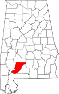 | |
| Towns | ||
| CDPs | ||
| Unincorporated communities | ||
| Ghost town | ||