Frick, Aargau
| Frick | ||
|---|---|---|
 | ||
| ||
 Frick | ||
|
Location of Frick 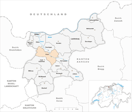 | ||
| Coordinates: 47°31′N 8°1′E / 47.517°N 8.017°ECoordinates: 47°31′N 8°1′E / 47.517°N 8.017°E | ||
| Country | Switzerland | |
| Canton | Aargau | |
| District | Laufenburg | |
| Area[1] | ||
| • Total | 9.96 km2 (3.85 sq mi) | |
| Elevation | 350 m (1,150 ft) | |
| Population (Dec 2015[2]) | ||
| • Total | 5,284 | |
| • Density | 530/km2 (1,400/sq mi) | |
| Postal code | 5070 | |
| SFOS number | 4163 | |
| Surrounded by | Eiken, Gipf-Oberfrick, Hornussen, Ittenthal, Kaisten, Oeschgen, Schupfart, Ueken | |
| Twin towns | Frickingen (Germany) | |
| Website |
www SFSO statistics | |

Frick is a municipality in the district of Laufenburg in the canton of Aargau in Switzerland. A number of dinosaur fossils, including a nearly complete Plateosaurus skeleton, were discovered in clay pits in the town.[3] [4] In 2013 and 2014 it became the most crime ridden municipality in Switzerland due to thousands of financial crimes committed when ASE Investment and the Basel Cantonal Bank lost over 100 million CHF due to improper trading.[5]
History

During the upper Triassic period, about 210 million years ago, the region around Frick was a dry lowland with flat hills and small depressions. During the rainy season, the depressions filled with water and dinosaurs congregated around the ponds. When they died, their bodies were covered by the mud in the ponds and fossilized, creating rich fossil beds in Frick. The first Plateosaurus fossils were discovered in 1961 and further excavations during the following decades have discovered numerous fossils. In 2006, the only Coelophysoidea (a small flesh-eating dinosaur species) fossil in Switzerland, was found by an amateur paleontologist in Frick.[6][7]
Frick has a very long inhabited history. At the nearby Wittnauer Horn, a prehistorical, late-Bronze Age fortification was discovered. The Roman era name for Frick (Latin: Ferraricia or iron ore field) refers to the Roman iron ore mine in the area. Additionally, remains of a Roman estate from the 2nd century were found on the main road, and the remains of a small fort from the early 4th century, which would have protected the military road Vindonissa-Augusta Raurica, was discovered below the church hill. On the hill, a new wall was built around 370. The finds in Oberdorf suggest a large Roman settlement from the 1st to 4th centuries. Graves on the church hill also indicate that there was an Alamanni settlement after the Romans. The core of the medieval settlement was clustered around the church hill. The oldest church, a fortified church building, is still visible around the current church. After the fire in the village in 1734 this old section was only partially rebuilt. The new settlement was concentrated along what is now the Bözbergstrasse. Frick is first mentioned in 1064 as Fricho.[8]
Starting in the High Middle Ages, Frick was the center of power of the Counts of Homberg-Thierstein. There was also a Ministerialis family, unfree knights in the service of another noble, known as von Frick. Around 1230 the village came to the Habsburgs and together with Gipf, Upper Frick and with some of Oeschgen, formed the bailiwick of Frick (also called the Homburgeramt). The Homburger Vogt was also chief administrator of the Fricktal (Frick valley). The Bailiwick possessed special powers, including a vogt seal and the right to choose their own vogt, as well as the rights to Zwing und Bann.
The citizens of the Bailiwick were divided into the upper layer of Vollbauern (literally, Full farmers), as well as in the Halbbauern (lit. Smallholding farmers) and the Taun. The Vollbauern included the vogt's family, and were the most privileged. The Taun represented the largest group numerically in the early modern period. They were tenant farmers who lack bailiwick citizenship and were virtually without rights.
After the Act of Mediation in 1803, Frick and the rest of the modern Fricktal became part of the newly formed Canton of Aargau. In 1804 the municipalities of Frick and Gipf-Frick were formed. In 2007 a major dinosaur graveyard was discovered in Frick. Some of the bones, including a complete Plateosaurus, are now on display in the Sauriermuseum.[8]
The Church of St. Peter and Paul were probably built as a private church for the Counts of Homberg during the High Middle Ages. In the Thirty Years War, the village was destroyed together with the church. In the mid-14th century the church came under the authority of Steinen Convent in Basel. Then, in 1492 it was granted to Teutonic Knights at Beuggen. The present baroque building is from 1716, and the reformed church is from 1910. The reformed parish comprises ten municipalities and the parish offices are in Frick and Gipf-Oberfrick. The catholic parish, consisting of Frick and Gipf-Oberfrick, has been a separate parish since 1953.[8]
Geography

Frick has an area, as of 2009, of 9.96 km2 (3.85 sq mi).[1] Of this area, 4.59 square kilometers (1.77 sq mi) or 46.1% is used for agricultural purposes, while 2.92 square kilometers (1.13 sq mi) or 29.3% is forested. Of the rest of the land, 2.41 square kilometers (0.93 sq mi) or 24.2% is settled (buildings or roads), 0.06 km2 (15 acres) or 0.6% is either rivers or lakes.[9] Over the past two decades (1979/85-2004/09) the amount of land that is settled has increased by 60 ha (150 acres) and the agricultural land has decreased by 59 ha (150 acres).[10]
Of the built up area, industrial buildings made up 4.3% of the total area while housing and buildings made up 9.5% and transportation infrastructure made up 5.6%. Power and water infrastructure as well as other special developed areas made up 2.8% of the area while parks, green belts and sports fields made up 1.9%. 27.9% of the total land area is heavily forested and 1.4% is covered with orchards or small clusters of trees. Of the agricultural land, 26.3% is used for growing crops and 17.1% is pastures, while 2.7% is used for orchards or vine crops. All the water in the municipality is in rivers and streams.[9]
The municipality is located in the Laufenburg district, located at the meeting of the Bözberg, Staffelegg and Benken Jura passes. It is the central municipality in the Fricktal. It consists of the haufendorf village (an irregular, unplanned and quite closely packed village, built around a central square) of Frick.
Coat of arms
The blazon of the municipal coat of arms is Argent a Wolf salient Gules[11]
Demographics
Frick has a population (as of December 2015) of 5,284[12] As of 2014, 24.5% of the population are resident foreign nationals.[13] Over the last 4 years (2010-2014) the population has changed at a rate of 7.03%. The birth rate in the municipality, in 2014, was 12.8, while the death rate was 7.4 per thousand residents.[10] Most of the population (as of 2000) speaks German (85.1%), with Italian being second most common (3.6%) and Albanian being third (3.2%).[14]
As of 2014, children and teenagers (0–19 years old) make up 20.7% of the population, while adults (20–64 years old) are 63.1% and seniors (over 64 years old) make up 16.1%.[10] In 2015 there were 2,227 single residents, 2,434 people who were married or in a civil partnership, 250 widows or widowers and 373 divorced residents.[15]
In 2014 there were 2,157 private households in Frick with an average household size of 2.38persons. Of the 780 inhabited buildings in the municipality, in 2000, about 64.0% were single family homes and 17.9% were multiple family buildings. Additionally, about 12.4% of the buildings were built before 1919, while 19.7% were built between 1991 and 2000.[16] In 2013 the rate of construction of new housing units per 1000 residents was 4.9. The vacancy rate for the municipality, in 2015, was 1.19%.[10] As of 2000 about 41.9% of the total households were owner occupied, or in other words did not pay rent (though they may have a mortgage or a rent-to-own agreement).[17]
As of 2000, there were 148 homes with 1 or 2 persons in the household, 836 homes with 3 or 4 persons in the household, and 554 homes with 5 or more persons in the household.[18] As of 2000, there were 1,585 private households (homes and apartments) in the municipality, and an average of 2.5 persons per household.[14] In 2008 there were 610 single family homes (or 29.9% of the total) out of a total of 2,041 homes and apartments.[19] There were a total of 24 empty apartments for a 1.2% vacancy rate.[19] As of 2007, the construction rate of new housing units was 12.9 new units per 1000 residents.[14]
The historical population is given in the following table:[8]
| Historical population | ||
|---|---|---|
| Year | Pop. | ±% |
| 1768 | 495 | — |
| 1850 | 1,112 | +124.6% |
| 1900 | 937 | −15.7% |
| 1950 | 1,589 | +69.6% |
| 2000 | 4,028 | +153.5% |
Heritage sites of national significance

The Catholic church of St. Peter and Paul as well as the charnel house is listed as a Swiss heritage site of national significance.[20] The village of Frick is designated as part of the Inventory of Swiss Heritage Sites.[21]
Transportation
The municipality is located on the A3 motorway.
Economy
As of 2007, Frick had an unemployment rate of 2.77%.[14] As of 2014, there were a total of 3,540 people employed in the municipality. Of these, a total of 72 people worked in 14 businesses in the primary economic sector. A majority (61.1%) of the primary sector employees worked in very small businesses (less than ten employees). The remainder worked in 1 small business with 28 employees. The secondary sector employed 1,106 workers in 51 separate businesses. In 2014 a total of 313 employees worked in 45 small companies (less than 50 employees). There were 5 mid sized businesses with 450 employees and 1 large business which employed 343 people. Finally, the tertiary sector provided 2,362 jobs in 362 businesses. There were 25 small businesses with a total of 735 employees and 3 mid sized businesses with a total of 399 employees.[22]
In 2014 a total of 4.9% of the population received social assistance.[10]
In 2015 there was one movie theater in the municipality with 177 seats.[23]
In 2000 there were 2,111 workers who lived in the municipality. Of these, 1,351 or about 64.0% of the residents worked outside Frick while 1,764 people commuted into the municipality for work. There were a total of 2,524 jobs (of at least 6 hours per week) in the municipality.[24] Of the working population, 18% used public transportation to get to work, and 40.4% used a private car.[14]
Religion
From the 2000 census, 2,061 or 51.2% were Roman Catholic, while 931 or 23.1% belonged to the Swiss Reformed Church. Of the rest of the population, there were 21 individuals (or about 0.52% of the population) who belonged to the Christian Catholic faith.[18]
Politics
In the 2015 federal election the most popular party was the SVP with 37.6% of the vote. The next three most popular parties were the FDP (14.3%), the SP (12.9%) and the CVP (12.3%). In the federal election, a total of 1,506 votes were cast, and the voter turnout was 45.7%.[25]
In the 2007 federal election the most popular party was the SVP which received 33.1% of the vote. The next three most popular parties were the CVP (19.9%), the SP (16%) and the FDP (12.9%).[14]
Education
In Frick about 66.6% of the population (between age 25-64) have completed either non-mandatory upper secondary education or additional higher education (either university or a Fachhochschule).[14] Of the school age population (in the 2008/2009 school year), there are 318 students attending primary school, there are 246 students attending secondary school, there are 402 students attending tertiary or university level schooling in the municipality.[18]
Crime
In 2014 the crime rate, of the over 200 crimes listed in the Swiss Criminal Code (running from murder, robbery and assault to accepting bribes and election fraud), in Frick was 560 per thousand residents. This rate is over ten times greater than the cantonal rate and is seven and a half times greater than the average rate in the entire country. The rate has risen sharply in the last few years. In 2009 the rate was only 52.8, in 2010 it was 68, 2011 it was 72, it doubled in 2012 to 175, tripled in 2013 to 598 before dropping slightly in 2014.[26] However, the majority of the crimes are probably financial crimes related to the 2013 scandal in which ASE Investment and Basel Cantonal Bank lost over 100 million CHF due to improper trading. Over 1,500 people were affected, leading to thousands of charges filed in Frick.[5]
During the same period, the rate of drug crimes was 12.9 per thousand residents, which is a little higher than the national average but is more than double the cantonal rate (5.0 per thousand). The rate of violations of immigration, visa and work permit laws was 2.9 per thousand residents, which is about half the rate for the entire country.[27]
References
- 1 2 Arealstatistik Standard - Gemeindedaten nach 4 Hauptbereichen
- ↑ Swiss Federal Statistical Office - STAT-TAB, online database – Ständige und nichtständige Wohnbevölkerung nach institutionellen Gliederungen, Geburtsort und Staatsangehörigkeit (German) accessed 30 August 2016
- ↑ Sauriermuseum Frick website accessed 23 July 2013
- ↑ Dinosaur Mass Grave Unearthed in Switzerland
- 1 2 Stalder, Philippe (23 March 2015). "Die kriminellste Gemeinde der Schweiz". Tages Anzeiger.
- ↑ Sauriermuseum Frick website- German language text (German) accessed 23 July 2013
- ↑ Brinkmann, Winand. "Swiss theropod (Dinosauria) material from the Late Triassic of Frick, Canton Aargau". University of Zurich. Retrieved July 23, 2013.
- 1 2 3 4 Frick in German, French and Italian in the online Historical Dictionary of Switzerland.
- 1 2 Swiss Federal Statistical Office-Land Use Statistics 2009 data (German) accessed 25 March 2010
- 1 2 3 4 5 Swiss Federal Statistical Office - Regional portraits accessed 27 October 2016
- ↑ Flags of the World.com accessed 30-April-2010
- ↑ Swiss Federal Statistical Office - STAT-TAB, online database – Ständige und nichtständige Wohnbevölkerung nach institutionellen Gliederungen, Geburtsort und Staatsangehörigkeit (German) accessed 30 August 2016
- ↑ Federal Statistical Office - Ständige und nichtständige Wohnbevölkerung nach institutionellen Gliederungen, Geburtsort und Staatsangehörigkeit (Land) accessed 31 October 2016
- 1 2 3 4 5 6 7 Swiss Federal Statistical Office accessed 30-April-2010
- ↑ Swiss Federal Statistical Office - Ständige und nichtständige Wohnbevölkerung nach institutionellen Gliederungen, Geschlecht, Zivilstand und Geburtsort (German) accessed 8 September 2016
- ↑ Swiss Federal Statistical Office STAT-TAB - Thema 09 - Bau- und Wohnungswesen (German) accessed 5 May 2016
- ↑ Eurostat. "Housing (SA1)". Urban Audit Glossary (pdf). 2007. p. 18. Retrieved 12 February 2010.
- 1 2 3 Statistical Department of Canton Aargau - Aargauer Zahlen 2009 (German) accessed 20 January 2010
- 1 2 Statistical Department of Canton Aargau (German) accessed 20 January 2010
- ↑ Swiss inventory of cultural property of national and regional significance 21.11.2008 version, (German) accessed 30-April-2010
- ↑ ISOS site accessed 30-April-2010
- ↑ Federal Statistical Office -Arbeitsstätten und Beschäftigte nach Gemeinde, Wirtschaftssektor und Grössenklasse accessed 31 October 2016
- ↑ Swiss Federal Statistical Office - Kinoinfrastruktur nach Gemeinde und Kinotyp (German) accessed 9 August 2016
- ↑ Statistical Department of Canton Aargau-Bereich 11 Verkehr und Nachrichtenwesen (German) accessed 21 January 2010
- ↑ Swiss Federal Statistical Office - Nationalratswahlen 2015: Stärke der Parteien und Wahlbeteiligung nach Gemeinden (German) accessed 18 July 2016
- ↑ Statistical Atlas of Switzerland - (StGB): Häufigkeitszahl der Straftaten (German) accessed 16 November 2016
- ↑ Statistical Atlas of Switzerland accessed 5 April 2016
External links
| Wikimedia Commons has media related to Frick. |
- Frick in German, French and Italian in the online Historical Dictionary of Switzerland.
- (Dinosaur museum) of Frick