Fort of the Cavalas
| Fort of the Cavalas (Forte das Cavalas) | |
| Fort of the Cavallas | |
| Fort (Forte) | |
| Official name: Forte das Cavalas/Forte das Cavallas | |
| Country | |
|---|---|
| Autonomous region | |
| Group | Central |
| Island | Terceira |
| Municipality | Angra do Heroísmo |
| Location | São Sebastião |
| - coordinates | 38°48′40″N 27°5′35″W / 38.81111°N 27.09306°WCoordinates: 38°48′40″N 27°5′35″W / 38.81111°N 27.09306°W |
| Architects | Tommaso Benedetto |
| Style | Medieval |
| Material | Basalt |
| Origin | 16th century |
| Owner | Portuguese Republic |
| For public | Public |
| Management | Direção Regional de Cultura |
| Status | Unclassified |
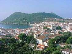
Fort of the Cavalas (Portuguese: Forte das Cavalas) is a fort situated in the civil parish of São Sebastião in the municipality of Angra do Heroísmo, in the Portuguese archipelago of the Azores.
History


The Cavalas Fort was one of the fortifications constructed in the context of the 1580 Succession Crisis, by the Corregedor of the Azores, Ciprião de Figueiredo e Vasconcelos, from the defensive plans elaborated by Tommaso Benedetto in 1567, after the attack of the French pirate Pierre Bertrand de Montluc on Funchal (October 1566), and the attempted attack on Angra, also in 1566:
- "There did not exist at that time [Succession Crisis of 1580] in all the coast of the island of Terceira a fortification, except that of São Sebastião, a post that all along the southern coast there existed a few redoubts and stations, in the localities more susceptible to enemy disembark, from the indication and plan of engineer Tomás Benedito, who in his diligence he went about in 1567, later that, in 1566, the French, commanded by the terrible pirate Caldeira, barbarously had sacked the island of Madeira, and intended to do the same thing on this island, where it appears they were repelled at force of arms"[1]
Drummond registered: "More ahead [of the Bay of Salga], significant space, was founded the fort of the Cavalas, with wall on the west to defend the natural wharf that there existed;..."[1]
In the context of the Spanish Succession (1702-1714) it was referred to as "O Forte das Cavallas", in the "Fortificações nos Açores existentes em 1710".[2]
With the establishment of the Captaincy-General of the Azores, the state of the fort was listed in 1767 as:
- "7 Fort of the Cavallos. Was rebuilt anew, it has six good pieces, with its capable repairs and it need two more pieces with its repairs and to garrison eight artillery and 32 auxiliaries."[3]
Manoel de Mattos P. de Carvalho, in his "Notícia da fortificação da ilha Terceira", around 1766:
- "There is a fortification in the town of Praia:...13 - the fortress of the Cavallas, with three pieces...all these fortresses are found presently in repair, due to the war."[4] Similarly, it is referred to as: "6. Fort of the Cavallas" in the report "Revista aos fortes que defendem a costa da ilha Terceira", the adjunct Manoel Correa Branco (1776), who wrote: "This fort does not require any repairs."[5]
A plan, also referred to as Forte das Cavallas, in the "Colecção de Plantas e Alçados de 32 Fortalezas dos Açores, por Joze Rodrigo d'Almeida em 1806".[6] The Relação of field Marshall Barão de Bastos (1862), situated the fort in the parish of Porto Judeu and indicated that it was incapable of defending the coast.[7] In the survey of the forts of Terceira in 1881, the fortress was abandoned and in a state of ruin.[8]
During the second World War, part of the corner of the old fort was reused to construct the houses used to garrison the machine-gunners posted along the bays of Salga and das Mós.
In 1962, then president of the Câmara Municipal de Angra, Manuel Coelho Baptista de Lima, obtained the concession from the Minister of War. At the time they projected the recuperation of the fort, that included landscaping and the creation of campground. Alongside the Fort of Salga, a similar re-purposing of military fortifications occurred, where they would create a picnic area.[9] Yet, even after these plans, the project never advanced and the fort continued to degrade.
Architecture
Located in a dominant position over a coastal section of the civil parish, the fortification was used for defence of anchorage from pirates and privateers that frequented the waters of the North Atlantic. The fort crossed artillery barrages with the Redoubt of Salga, the Fort of Salga and the Fort of the Caninas.
The bastion-type 465 square metres (5,010 sq ft) fortification, is based in a irregular polygon, adapted to the cliff and coastal shoreline. With capacity for nine artilhery pieces and canon emplacements, the interior spaces include gunpowder magazine accessed by a ramp and a garrison building.
References
- Notes
- 1 2 "Anais da Ilha Terceira" (in Portuguese).
- ↑ "Fortificações nos Açores existentes em 1710", Arquivo dos Açores (in Portuguese), p. 178, retrieved 8 December 2011
- ↑ Júdice (1767)
- ↑ Arquivo dos Açores (in Portuguese), VI, p. 42
- ↑ "Revista aos Fortes que Defendem a costa da Ilha Terceira - 1776", IHIT.pt (in Portuguese), retrieved 3 December 2011
- ↑ "Planta e alçado do Forte das Cavalas; e Reduto da Salga, José Rodrigo de Almeida, 1806, ilha Terceira, Açores", Prancha Arquipélagos.pt Check
|url=value (help) (in Portuguese), retrieved 31 December 2011 - ↑ Bastos (1997), p.267
- ↑ Pego, Damião, Tombos dos Fortes da Ilha Terceira (in Portuguese)
- ↑ Faria (1997)
- Sources
- "Colecção de todos os fortes da jurisdição da Villa da Praia e da jurisdição da cidade na Ilha Terceira, com a indicação da importância da despesa das obras necessárias em cada um deles (Arquivo Histórico Ultramarino)", Boletim do Instituto Histórico da Ilha Terceira (in Portuguese), LI-LII, Angra do Heroísmo (Azores), Portugal, 1994
- "Revista aos Fortes que Defendem a Costa da Ilha Terceira – 1776 (Arquivo Histórico Ultramarino)", Boletim do Instituto Histórico da Ilha Terceira (in Portuguese), LVI, Angra do Heroísmo, 1998
- Baron of Bastos (1997), "Relação dos fortes, Castellos e outros pontos fortificados que se achão ao prezente inteiramente abandonados, e que nenhuma utilidade tem para a defeza do Pais, com declaração d'aquelles que se podem desde ja desprezar", Boletim do Instituto Histórico da Ilha Terceira (in Portuguese), LV, Angra do Heroísmo (Azores), Portugal, pp. 267–271
- Castelo Branco, António do Couto de; Ferrão, António de Novais (1981), "Memorias militares, pertencentes ao serviço da guerra assim terrestre como maritima, em que se contém as obrigações dos officiaes de infantaria, cavallaria, artilharia e engenheiros; insignias que lhe tocam trazer; a fórma de compôr e conservar o campo; o modo de expugnar e defender as praças, etc.". Amesterdão, 1719. 358 p. (tomo I p. 300-306)", Arquivo dos Açores (in Portuguese), IV (ed. fac-similada de 1882, Ponta Delgada (Azores), Portugal: Universidade dos Açores, pp. 178–181
- Drummond, Francisco Ferreira (1981), Anais da Ilha Terceira (fac-simil. da ed. de 1859) (in Portuguese), Angra do Heroísmo (Azores), Portugal: Secretaria Regional da Educação e Cultura
- Faria, Manuel Augusto (22 June 1997), "Ilha Terceira – Fortaleza do Atlântico: Forte das Cavalas", Diário Insular (in Portuguese)
- Júdice, João António (1981), "Revista dos Fortes da Terceira", Arquivo dos Açores (in Portuguese), V, Ponta Delgada (Azores), Portugal: Universidade dos Açores, pp. 359–363
- Martins, José Salgado (2007), "Património Edificado da Ilha Terceira: o Passado e o Presente", Atlântida (in Portuguese), LII,, p. 31
- Mota, Valdemar (1994), "Fortificação da Ilha Terceira", Boletim do Instituto Histórico da Ilha Terceira (in Portuguese), LI-LII
- Neves, Carlos; Carvalho, Filipe; Matos, Arthur Teodoro de (1992), "Documentação sobre as Fortificações dos Açores existentes nos Arquivos de Lisboa – Catálogo", Boletim do Instituto Histórico da Ilha Terceira (in Portuguese), L
- Pego, Damião Freire de Bettencourt; Almeida Júnior, António Belo de (1996), "Tombos dos Fortes da Ilha Terceira", Boletim do Instituto Histórico da Ilha Terceira (in Portuguese), LIV, Direcção dos Serviços de Engenharia do Exército
- Ribeiro, José Rodrigues (1979), Dicionário Corográfico dos Açores (in Portuguese), Angra do Heroísmo (Azores), Portugal: SREC/DRAC, p. 326
- Vieira, Alberto (1987), "Da poliorcética à fortificação nos Açores: introdução ao estudo do sistema defensivo nos Açores nos séculos XVI-XIX", Boletim do Instituto Histórico da Ilha Terceira (in Portuguese), XLV (II)
External links
- Terceira in Instituto Histórico da Ilha Terceira
- Memória descritiva: Forte das Cavalas (1883-1885)
- Forte das Cavalas