Florida State Road 707
| |
|---|---|
|
Beach Road Dixie Highway / Indian River Drive | |
| Highway system | |
| County roads in Florida |

State Road 707 (SR 707) is a former state road on Florida's Treasure Coast, which is now County Road 707 (CR 707). The last state-maintained section, extending 2 miles (3.2 km) from the south end of the Old Roosevelt Bridge in Stuart to the intersection of Savannah Road (CR 723) near Rio, was transferred to the city of Stuart in 2012 or 2013.[1][2]
CR 707 exists in two sections. One extends along Beach Road, a former segment of SR A1A, from US 1 and SR 811 in Jupiter to CR 708 in Jupiter Island. The other follows the old Dixie Highway (original US 1) from CR A1A in downtown Stuart to SR A1A in downtown Fort Pierce, and is named Dixie Highway and Indian River Drive. In St. Lucie County, CR 707 is part of the Indian River Lagoon - Treasure Coast Scenic Highway, a Florida Scenic Highway.
Route description
From the southern terminus, the road heads northwest for several blocks before crossing the Roosevelt Bridge and then passing under the new Roosevelt Bridge which now carries US 1 over the St. Lucie River and has no present intersection with the current edition of US 1 (SR 5).
Other communities served by CR 707 include Rio and Ocean Breeze.[3]
History
In the late 1970s, the SR 707 designation was applied to two much longer stretches of south Florida highway:
- A stretch of former Dixie Highway alongside the Florida East Coast Railroad tracks from Fort Pierce to Jensen Beach, from which the current SR 707 enters Stuart (a similar stretch from Fort Pierce northward to Vero Beach was originally signed SR 605 and is now CR 605). The stretch between the railroad tracks and the Indian River is locally known as Indian River Drive and County Road 707. Communities served by County Road 707 include Eden, Walton, Ankona, and Eldred in Saint Lucie County. Some maps still indicate the northernmost 0.5 mile (in Fort Pierce) to be SR 707.
- A stretch of Ocean Drive/Beach Street from Bridge Road (on Jupiter Island) to Beach Road in Jupiter Inlet Colony to SR 811/Alternate SR A1A in Jupiter served as Alternate SR A1A before it was redesignated SR 707 (some street signs near the southern end still show "Alternate A1A," as does the northern end of SR 811). This road is now known as County Road 707. Jupiter Lighthouse Park - with Jupiter Lighthouse - is accessible from the Beach Road segment of this southern part of CR 707.
Unlike the St. Lucie County segment of the former SR 707, the Martin County segment did not parallel the FEC rails as the former alignment of Dixie Highway. This was done by a former alignment of SR A1A, now designated County Road A1A, from Stuart to Jupiter. Former alignments of Dixie Highway in southern Florida include SR 811 and County Road 811 in Palm Beach County, SR 811 and the former SR 5A in Broward County, and SR 909 and the former SR 815 in Miami-Dade County.
Former spur routes
County Road 732 (formerly State Road 707A)
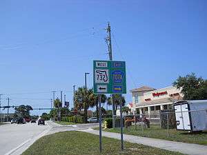
The 2.9-mile (4.7 km) east–west street, formerly signed State Road 707A, was a spur route that connected North Federal Highway (US 1-SR 5) in Jensen Beach to Indian River Drive (CR 707) in Ocean Breeze. The road is locally known as Jensen Beach Boulevard, while some 1980s-vintage maps indicate it as Commercial Boulevard.
When Florida Department of Transportation removed the State Road designation from SR 707A in the 1990s (and at roughly the same time, several other State Roads in the Stuart area), Jensen Beach Boulevard was redesignated County Road 732 - not to be confused with SR 732, which is the nearby Jensen Beach Causeway, also locally known as Northeast Causeway Boulevard.
As of January 27, 2007, there is signage on Jensen Beach Boulevard indicating that it is now State Road 732.
County Road 723 (formerly State Road 723)
The former State Road 723 was also a signed north-south spur of SR 707. A 1.8-mile-long north–south street locally known as Savannah Road, the former State Road (and current County Road 723) extends from an intersection with Dixie Highway (SR 707) and Cardinal Avenue in Rio to an intersection with Jensen Beach Boulevard (former SR 707A/current CR 732) in Jensen Beach. Savannah Road is primarily a commercial highway even though it is lined with residential developments. Shopping centers are clustered near its interchange with Jensen Beach Boulevard while business and industrial parks straddle the county road near its southern terminus.
The state road shields were removed in the 1990s.
Major intersections
| County | Location | mi[4] | km | Destinations | Notes | ||
|---|---|---|---|---|---|---|---|
| Palm Beach | Jupiter–Tequesta line | 0.0 | 0.0 | ||||
| 0.4– 0.5 | 0.64– 0.80 | Jupiter Island Bridge over Jupiter Sound | |||||
| Tequesta | 0.5 | 0.80 | Colony Road | entrance to Jupiter Inlet Colony | |||
| Martin | Jupiter Island | 8.9 | 14.3 | ||||
| Gap in route | |||||||
| Stuart | 0.0 | 0.0 | South Colorado Avenue (CR A1A south) | ||||
| 0.2 | 0.32 | roundabout | |||||
| 0.4– 0.7 | 0.64– 1.1 | Old Roosevelt Bridge over St. Lucie River (Okeechobee Waterway) | |||||
| 1.6 | 2.6 | ||||||
| 2.0 | 3.2 | Northwest Green River Parkway | |||||
| 2.4 | 3.9 | ||||||
| Jensen Beach | 5.0 | 8.0 | Northeast Indian River Drive | ||||
| 5.9 | 9.5 | Jensen Beach Boulevard - Historical Downtown | to SR 732 west | ||||
| 6.4 | 10.3 | roundabout | |||||
| St. Lucie | Eldred | 16.3 | 26.2 | ||||
| Fort Pierce | 21.0 | 33.8 | roundabout | ||||
| 21.2 | 34.1 | Orange Avenue | former SR 68 west | ||||
| 21.8 | 35.1 | ||||||
| 1.000 mi = 1.609 km; 1.000 km = 0.621 mi | |||||||
References
- ↑ Roadway Transfer Agreement, June 6, 2012 (pp. 19-23)
- ↑ Letter from Martin County to FDOT, November 22, 2013
- ↑ Google (July 15, 2012). "Florida State Road 707" (Map). Google Maps. Google. Retrieved July 15, 2012.
- ↑ Google Maps distance