Flinders View, Queensland
| Flinders View Ipswich, Queensland | |||||||||||||
|---|---|---|---|---|---|---|---|---|---|---|---|---|---|
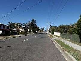 Ripley Road, 2016 | |||||||||||||
 Flinders View | |||||||||||||
| Coordinates | 27°39′S 152°47′E / 27.650°S 152.783°ECoordinates: 27°39′S 152°47′E / 27.650°S 152.783°E | ||||||||||||
| Population | 5,862 (2011)[1] | ||||||||||||
| Postcode(s) | 4305 | ||||||||||||
| Location | |||||||||||||
| LGA(s) | City of Ipswich | ||||||||||||
| State electorate(s) | Electoral district of Ipswich | ||||||||||||
| Federal Division(s) | Blair | ||||||||||||
| |||||||||||||
Flinders View is a suburb of Ipswich, Queensland, Australia. The origin of the suburb name is from the view and proximity to Flinders Peak from the suburb of Flinders View.[2] At the 2011 Australian Census the suburb recorded a population of 5,862.[1] Flinders View is bisected by the Cunningham Highway which also forms part of the northern and southern boundary of the suburb.
Flinders View consists of four estates, Fairview Rise, Kensington Hills, Jacana Place and Flinders Crest. Major parks include Fairview Park and Nugent Park and its local shopping centre is Winston Glades, which has seen much change and development recently with the enlargement of Supa IGA and the movement of Pizza Hut and Network Video to a new section of the centre.
References
- 1 2 Australian Bureau of Statistics (31 October 2012). "Flinders View (State Suburb)". 2011 Census QuickStats. Retrieved 25 September 2014.
- ↑ Place name details
External links
This article is issued from Wikipedia - version of the 6/29/2016. The text is available under the Creative Commons Attribution/Share Alike but additional terms may apply for the media files.