Flagmount
| Flagmount Sliabh na Licé | |
|---|---|
| Town | |
 Flagmount Location in Ireland | |
| Coordinates: 52°39′38″N 7°05′42″W / 52.66057°N 7.095022°WCoordinates: 52°39′38″N 7°05′42″W / 52.66057°N 7.095022°W | |
| Country | Ireland |
| Province | Leinster |
| County | County Kilkenny |
| Time zone | WET (UTC+0) |
| • Summer (DST) | IST (WEST) (UTC-1) |
| Irish Grid Reference | S615562 |
Flagmount (Irish: An Leac Gharbh, meaning "rough flat stone or rock") is a townland located within the parish of Gowran and on the R712 National primary road, (formerly the N10 National Primary Route) in County Kilkenny, Ireland.
It is divided into Flagmount North and South with a total area of 452 acres (1.83 km2).[1][2][3]
History
It was the southern most point of territory of the Ó Cearbhaill part of Ely O'Carroll in Éile.[4]
Transportation
The M9 motorway between Dublin and Waterford which passes through Flagmount was opened in September 2010. The new bridge crossing over the motorway was opened to traffic in March 2010.
See also
Notes
- ↑ "An Leac Gharbh Theas/Flagmount South". logainm.ie. Government of Ireland.
- ↑ Census (1861). General Alphabetical Index to the Townlands and Towns, Parishes, and Baronies of Ireland: Based on the Census of Ireland for the Year 1851. Genealogical Publishing Com. pp. 451–452. ISBN 9780806310527.
- ↑ "An Leac Gharbh Thuaidh/Flagmount North". logainm.ie. Government of Ireland.
- ↑ (Cronnelly 1865, p. 397)
References
- Cronnelly, Richard Francis (1865). Irish Family History; being an historical and genealogical account of the Gaedhals, from the earliest period to the present time; compiled from authentic sources. Dublin: N. H. Tallon and Company. p. 397.
Further reading
- Baily (1901). Baily's Magazine of Sports and Pastimes. Vinton.
- Baily (1904). Baily's Magazine of Sports & Pastimes.
- Bassett, George Henry (1884). Kilkenny city and country guide and directory. p. 61.
- Bowen, Muriel (1955). Irish hunting. Kerryman Ltd. p. 130.
- Carville, Geraldine (1979). Norman splendour: Duiske Abbey, Graignamanagh. Blackstaff Press. p. 32. ISBN 9780856401718.
- Commons, Great Britain Parliament House of (1906). Untenanted Lands (Ireland).: A Return of Untenanted Lands in Rural Districts ... A. Thom & Company, Limited. p. 134.
- Commons, Great Britain Parliament House of (1912). Parliamentary Papers, House of Commons and Command. H.M. Stationery Office.
- Inspectorate, Great Britain Mines (1903). Quarries: List of Quarries (under the Quarries Act, 1894) in the United Kingdom of Great Britain and Ireland, and the Isle of Man. H.M. Stationery Office.
- Commissioners (1849). Second Report Commissioners for Inquiring into the number and Boundaries of Poor-Law Unions and Electoral Divisions in Ireland. William Clowes and Sons. p. 45.
- Morris, Maurice O'Connor (1878). Hibernia Venatica. Chapman and Hall. pp. 228,325.
- Commissioners, Ireland Commissioners appointed for taking the Census of the Population of (1901). Census of Ireland, 1901: General Topographical Index Consisting of an Alphabetical Index to the Townlands and Towns of Ireland, and Indices to the Parishes, Baronies, Poor Law Unions ... District Electoral Divisions, Dispensary ... Districts, County Districts, County Electoral Divisions, and Parliamentary Divisions of Ireland. H.M. Stationery Office.
- Kilkenny County (1801). The presentments of the grand jury. Lent assizes, 1801 (-Spring assizes, 1824).
- County Kilkenny (1838). The presentments of the grand jury. [Continued as] At a general assizes ... the following presentments were made. Aug. 1824, Mar. 1826-July 1843. Oxford University. pp. 139,155.
- Hunt, Kilkenny (1897). Memoir of the Kilkenny Hunt. Hodges Figgis. pp. 70,78,86.
- RSAI, Royal Society of Antiquaries of Ireland (1912). The Journal of the Royal Society of Antiquaries of Ireland. Royal Society of Antiquaries of Ireland. p. 4.}
- Carrigan, William (1905). The history and antiquities of the diocese of Ossory. Sealy, Bryers & Walker. p. 416.
- Commons, Great Britain Parliament House of (1906). Untenanted Lands (Ireland).: A Return of Untenanted Lands in Rural Districts ... A. Thom & Company, Limited.
- General Alphabetical Index to the Townlands and Towns, Parishes, and Baronies of Ireland: Based on the Census of Ireland for the Year 1851. Genealogical Publishing Com. 1851. ISBN 9780806310527.
- Government (2003). "Placenames (Co. Kilkenny) Order 2003" (PDF). coimisineir.ie.
- "Changes to Garda Station areas in Kilkenny and Carlow (2009)" (PDF). garda.ie. 2009.
External links
- "An Leac Gharbh Thuaidh/Flagmount North". logainm.ie. Government of Ireland.
- "An Leac Gharbh Theas/Flagmount South". logainm.ie. Government of Ireland.
- "Gowran Civil Parish, County Kilkenny, Tithe Applotments". www.connorsgenealogy.com.
- "Griffiths Valuation of Ireland - Gowran, County Kilkenny". www.failteromhat.com.
Places in County Kilkenny | ||
|---|---|---|
| Towns | 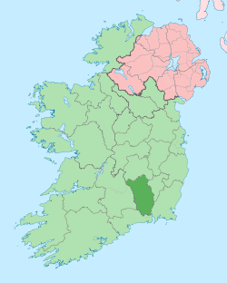 | |
| Villages |
| |
| Townlands | ||
| ||
This article is issued from Wikipedia - version of the 7/19/2016. The text is available under the Creative Commons Attribution/Share Alike but additional terms may apply for the media files.