Fauquier-Strickland
| Fauquier-Strickland | |
|---|---|
| Township (single-tier) | |
| Township of Fauquier-Strickland | |
 | |
| Motto: Ad augusta per angusta (Towards success by effort) | |
 Fauquier-Strickland | |
| Coordinates: 49°18′N 82°02′W / 49.300°N 82.033°WCoordinates: 49°18′N 82°02′W / 49.300°N 82.033°W | |
| Country |
|
| Province |
|
| District | Cochrane |
| Settled | 1909 |
| Incorporated | December 24, 1921 |
| Government | |
| • Type | Township |
| • Reeve | Madeleine Tremblay |
| • Governing Body | Fauquier-Strickland Township Council |
| • Federal riding | Algoma—Manitoulin—Kapuskasing |
| • Prov. riding | Timmins—James Bay |
| Area[1] | |
| • Land | 1,013.90 km2 (391.47 sq mi) |
| Population (2011)[1] | |
| • Total | 530 |
| • Density | 0.5/km2 (1/sq mi) |
| Time zone | EST (UTC-5) |
| • Summer (DST) | EDT (UTC-4) |
| Postal code | P0L 1G0 |
| Area code(s) | 705 |
| Website | fauquierstrickland.com |
Fauquier-Strickland is a township in the Canadian province of Ontario, located in the Cochrane District. The three main communities in the township are Fauquier, Strickland, and Gregoires Mill. All are located along Highway 11 between Departure Lake and Moonbeam.
The township was first incorporated on December 24, 1921, as Shackleton and Machin, the names of the two former geographic townships that comprise its territory. It adopted its current name in 1984, renaming itself for its two largest communities.
Fauquier is located along the Groundhog River. The main community landmark is a roadside statue of a groundhog.
Reeves
- Pierre Guèvremont (1922–1929)
- J. Anaclet Habel (1930–1931)
- Ph. Filion (1932)
- Napoléon Gravel (1933–1945)
- J. Émile Jacques (1946–1948)
- Raoul Tremblay (1949–1955)
- J. Antoine Laferrière (1956–1964, 1969–1972)
- Edmond Gauthier (1965)
- Laurent Dufour (1966–1968)
- Raymond Grzela (1972–2003)
- Jacques Demers (2003–2006)
- Madeleine Tremblay (2006–present)
Demographics
| Canada census – Fauquier-Strickland community profile | |||
|---|---|---|---|
| 2011 | 2006 | 2001 | |
| Population: | 530 (-6.7% from 2006) | 568 (-16.2% from 2001) | 678 (-9.2% from 1996) |
| Land area: | 1,013.90 km2 (391.47 sq mi) | 1,013.54 km2 (391.33 sq mi) | 1,013.55 km2 (391.33 sq mi) |
| Population density: | 0.5/km2 (1.3/sq mi) | 0.6/km2 (1.6/sq mi) | 0.7/km2 (1.8/sq mi) |
| Median age: | 49.4 (M: 48.4, F: 51.0) | 43.8 (M: 43.1, F: 44.4) | |
| Total private dwellings: | 367 | 368 | 431 |
| Median household income: | $64,926 | $48,202 | |
| References: 2011[1] 2006[2] 2001[3] | |||
Population:[4]
- Population in 2011: 530
- Population in 2006: 568
- Population in 2001: 678
- Population in 1996: 684 (or 747 when adjusted to 2001 boundaries)
- Population in 1991: 746
Mother tongue:
- English as first language: 17.5%
- French as first language: 78.1%
- English and French as first language: 0%
- Other as first language: 4.4%
See also
References
- 1 2 3 "Fauquier-Strickland census profile". 2011 Census of Population. Statistics Canada. Retrieved 2012-02-21.
- ↑ "2006 Community Profiles". Canada 2006 Census. Statistics Canada. March 30, 2011. Retrieved 2012-02-21.
- ↑ "2001 Community Profiles". Canada 2001 Census. Statistics Canada. February 17, 2012. Retrieved 2012-02-21.
- ↑ Statistics Canada: 1996, 2001, 2006 census
External links
 |
Unorganized North Cochrane | | ||
| Moonbeam | |
Unorganized North Cochrane | ||
| ||||
| | ||||
| Unorganized North Cochrane |
| City | 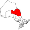 | |
|---|---|---|
| Towns | ||
| Townships | ||
| First Nations | ||
| Indian reserves | ||
| Indian settlements | ||
| Unorganized territories | ||
| Local services boards | ||
| ||
This article is issued from Wikipedia - version of the 7/26/2016. The text is available under the Creative Commons Attribution/Share Alike but additional terms may apply for the media files.