False Pass Airport
| False Pass Airport | |||||||||||
|---|---|---|---|---|---|---|---|---|---|---|---|
| IATA: KFP – ICAO: PAKF – FAA LID: KFP | |||||||||||
| Summary | |||||||||||
| Airport type | Public | ||||||||||
| Owner | Alaska DOT&PF - Central Region | ||||||||||
| Serves | False Pass, Alaska | ||||||||||
| Elevation AMSL | 20 ft / 6 m | ||||||||||
| Coordinates | 54°50′51″N 163°24′37″W / 54.84750°N 163.41028°WCoordinates: 54°50′51″N 163°24′37″W / 54.84750°N 163.41028°W | ||||||||||
| Map | |||||||||||
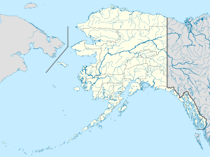
 KFP Location of airport in Alaska | |||||||||||
| Runways | |||||||||||
| |||||||||||
| Statistics (2005) | |||||||||||
| |||||||||||
False Pass Airport (IATA: KFP, ICAO: PAKF, FAA LID: KFP) is a state owned, public use airport in False Pass,[1] a city in the Aleutians East Borough of the U.S. state of Alaska. Scheduled airline service to Cold Bay Airport is provided by Peninsula Airways (PenAir).[2]
As per Federal Aviation Administration records, the airport had 505 passenger boardings (enplanements) in calendar year 2008,[3] 482 enplanements in 2009, and 321 in 2010.[4] It is included in the National Plan of Integrated Airport Systems for 2011–2015, which categorized it as a general aviation airport (the commercial service category requires at least 2,500 enplanements per year).[5]
Facilities and aircraft
False Pass Airport covers 20 acres (8 ha) at an elevation of 20 feet (6 m) above mean sea level. It has one runway designated 13/31 with a gravel surface measuring 2,100 by 75 feet (640 x 23 m). For the 12-month period ending December 31, 2005, the airport had 1,050 aircraft operations, an average of 87 per month: 52% general aviation and 48% air taxi.[1]
Airlines and destinations
The following airlines offer scheduled passenger service at this airport:
| Airlines | Destinations |
|---|---|
| PenAir | Cold Bay [2] |
References
- 1 2 3 FAA Airport Master Record for KFP (Form 5010 PDF). Federal Aviation Administration. Effective April 5, 2012.
- 1 2 "Timetable" (PDF). PenAir. October 21, 2011. Retrieved June 17, 2012.
- ↑ "Enplanements for CY 2008" (PDF, 1.0 MB). CY 2008 Passenger Boarding and All-Cargo Data. Federal Aviation Administration. December 18, 2009. External link in
|work=(help) - ↑ "Enplanements for CY 2010" (PDF, 189 KB). CY 2010 Passenger Boarding and All-Cargo Data. Federal Aviation Administration. October 4, 2011. External link in
|work=(help) - ↑ "2011–2015 NPIAS Report, Appendix A" (PDF, 2.03 MB). National Plan of Integrated Airport Systems. Federal Aviation Administration. October 4, 2010. External link in
|work=(help)
External links
- Airport diagram for False Pass (KFP) (GIF). FAA, Alaska Region. 25 Dec 2003.
- Topographic map from USGS The National Map
- Resources for this airport:
- Airport information for PAKF at AirNav
- Accident history for KFP at Aviation Safety Network
- Aeronautical chart for KFP at SkyVector